Arrow signs at the start of two trails - blue and green
The Czech Hiking Markers Standard is an international system of hiking markers for tourist trails, used in more countries than any competing standard.[citation needed] The signs and markers can be used in both wilderness and cities. They are internationally well understandable as they grow from the same tradition in other Central European countries. Similar signs are in use in Austria, Germany, Poland and Switzerland.
Coloured markers throughout the trail accompany the hiker - this is the blue marked trail
The trail usually starts with arrow signs with names of destinations and number of kilometres marked. Each trail is then colour marked by simple markers and arrows painted between white lines (for better visibility) on fixed objects along the trail (trees, rocks, utility posts or walls) in a colour given to a specific trail. The paint is chosen so that it does not impact on the surrounding environment.
Basic implementation of the system requires only a color paint and a brush (plus a cardboard cut matrix for even size of the signs), with which an entire country can be marked.
Nevertheless, many other also very modern features can be added using GPS and mobile phone applications.
Additional features
Tourist Map Application showing different trails in colors (red, blue, yellow and green) and related information for the hiker
The basic system of trails with markers painted along the trail can be complemented by other features. These additional features are not necessary for the basic functioning of the system though.
Information boards along the trail, giving information about the trail and its difficulty, nature protection, monuments, animals and trees along the trail. Logos of the supervising institution can be shown.
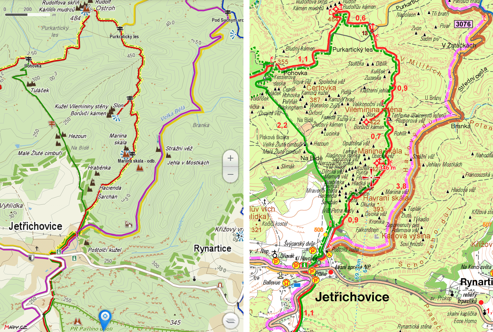
Printed maps with coloured lines showing the trails.
GPS information on each trail, board or sign
Mobile phone application with a map and site descriptions (electronic tourist guide) contains additional information about the trail difficulty, slope inclination, gives the opportunity of hike planning and features that would not be possible on the signs etc.
Left Turn Marker on a blue trail - marker showing the change of direction of the trail
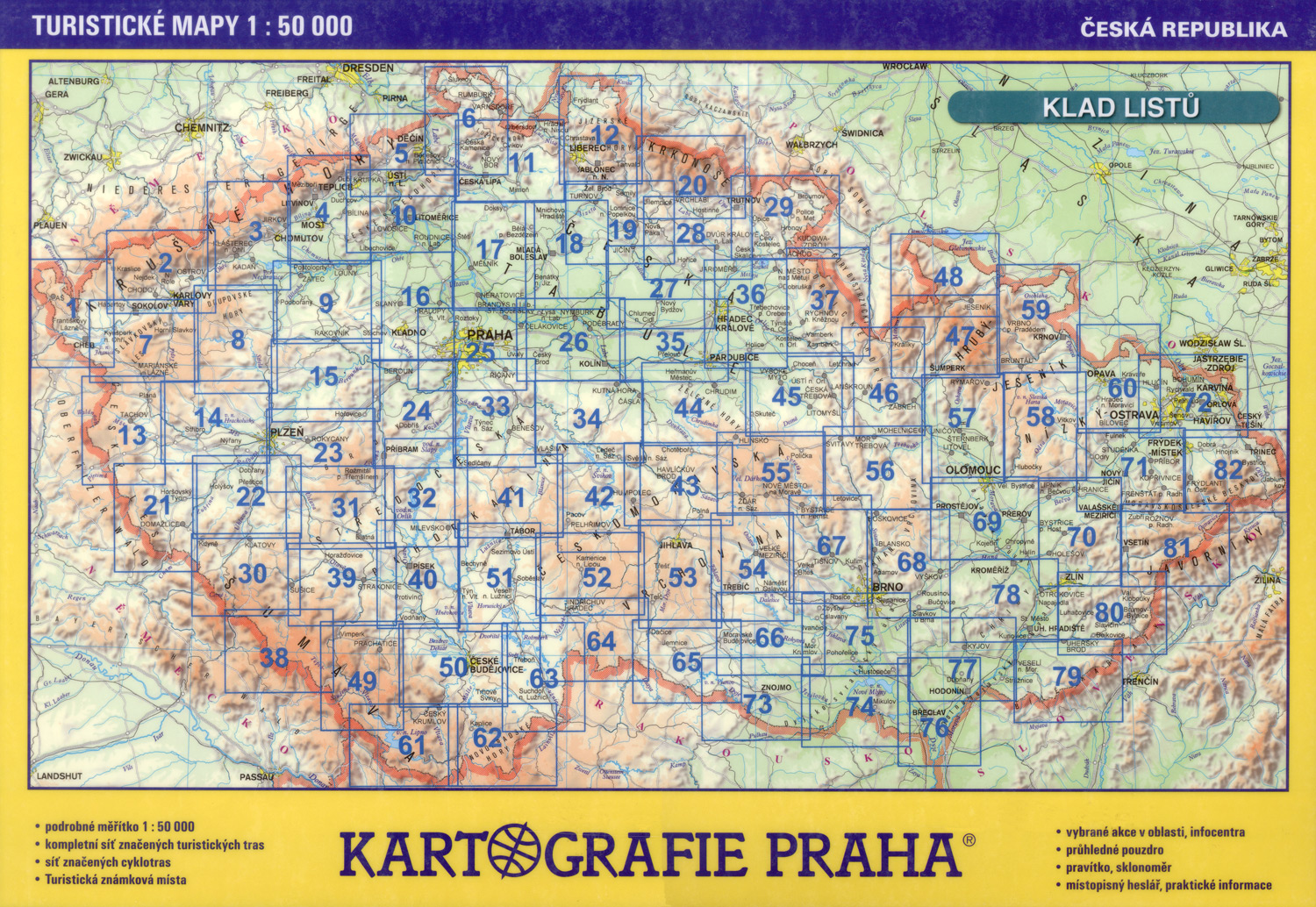
The system has been used by the Czech Hiking Club since 1888.[1] The entire territory of the Czech Republic is covered with marked trails,[2] and detailed maps are published and widely available. In the Czech Republic, over 70,000km of hiking trails have been marked in this way. Of these, 39,816km of hiking trails were marked in 2008. An additional 31,104km of cycling trails, 387km of skiing trails, and 1300km of horse riding trails are also marked. In 1938 it was the longest system in the world,[3] but now it is the densest network according to Czechs, though Switzerland has about twice as dense trail system (see: Swiss hiking trails – unique but under pressure)[3]
Maps of the trails have also been made into a number of digital applications - both Apple and Android for mobile phones, on Google Maps,[4] and on the Czech "Mapy.com".
Czech Markers standard
Printed map with green and blue trail marked. The color coded trails in many mobile applications are used by tourists and hikers. They also enable route planning, information about its difficulty etc.
This system uses three bars - usually one colour in between two white bars,[5] with different meanings attached to different colours:[6]
red indicates the most difficult or summit trails;
blue for significant trails;
green for shorter local trails;
yellow for short interconnecting trails.
These marks may be posted on wooden boards or metallic plates.
Basic Marker - Red colour used for difficult or summit trails
Basic trail markers are square, 10x10 cm in size. The volunteers marking these trails usually prepare sheet metal or cardboard matrices to keep the signs uniform in size.
Any change of direction is marked with arrows of the same colour and similar design. There are also symbols for short side-trails (to peak or lookout, ruin, well or spring, or other point of interest) and for the end of the trail.
The system is usually supplemented by maps,[2] which show the trails as lines in corresponding colours. Nevertheless, maps are not necessary for the system to function, as walkers can simply follow the trail from marker to marker.
Cardboard Matrix for a basic marker of 10x10 cm - used by volunteers painting the markers along the trail
Czech Markers around the world
Several trails marked together before they split in different directions
Due to the relative ease of use and low cost, the system has spread to many other countries, often by Czech people. Originally used in the Czech Republic, the system spread through Central Europe and Eastern Europe and even to countries outside Europe. Nearly identical systems exist in the neighbouring countries of Austria and Poland.
Austria's standard is almost identical, with red-white-red stripes used instead of white-red-white.[7]
Croatia[11] especially on the island of Krk, with a map available in local tourist centers.[12] The Czech Tourist Club marked a network of historical goat trails that can now be used by tourists hiking in the mountains.
Czech Republic - fully covered with marked trails and detailed maps and the densest trail network in the world
Georgia - Caucasus trails marked by Czech volunteers, particularly the mountain border between Georgia, Ingushetia, Chechnya and Dagestan.
Israel - trail markers are larger (approximately 20x15 cm) but based on the same three stripe scheme. Long trails add a purple (regional) or orange (national) dot on the right white stripe.[14][circular reference]
Mongolia A pilot program was launched in July 2023 with some help from experts in Brno
Philippines[15] - Three new trails were marked to showcase the system on Mount Kanlaon Volcano, Negros Island, with the trail marked by Czech volunteers from Mendel University, in cooperation with the Czech Embassy. Additional new and more extensive trails have been marked in 2017;
Poland[16] - these markers are especially common on trails near the Czech and Slovak borders.[17][18] The system is a slight expansion of the Czech model, adding black to the four colours used in the Czech markers.
Romania - 300-400km of trails marked by the Czech Tourist Club in the Banat region,[19][20] as well as a 360km mountain trail leading from Slovakia across Ukraine to Romania.[21]
Slovakia[22] fully covered with marked trails and detailed maps
Switzerland uses a modified form with blue marking Alpine trails, which are more difficult than red trails
This page is based on this Wikipedia article Text is available under the CC BY-SA 4.0 license; additional terms may apply. Images, videos and audio are available under their respective licenses.


