Dakota, Minnesota

Last updated

Dakota
Dakota, Minnesota 9 pano back.jpg
Winona County Minnesota Incorporated and Unincorporated areas Dakota Highlighted.svg
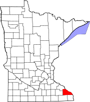
Location of Dakota
within Winona County and state of Minnesota
Coordinates: 43°54′38″N91°21′38″W / 43.91056°N 91.36056°W / 43.91056; -91.36056
CountryUnited States
State Minnesota
County Winona
FoundedMay 23, 1951
Government
  TypeMayor – Council
  MayorMatthew Nelson
Area
[1]
  Total0.55 sq mi (1.43 km2)
  Land0.55 sq mi (1.43 km2)
  Water0.00 sq mi (0.00 km2)
Elevation
[2]
689 ft (210 m)
Population
 (2020) [3]
  Total295
  Estimate 
(2021) [4]
291
  Density532.49/sq mi (205.68/km2)
Time zone UTC-6 (CST)
  Summer (DST) UTC-5 (CDT)
ZIP code
55925
Area code 507
FIPS code 27-14518 [5]
GNIS feature ID2393705 [2]
Website cityofdakotamn.com

Dakota is a city in Winona County, Minnesota, United States. The population was 295 at the 2020 census. [3]

Contents

It is located between Winona and La Crosse along Interstate 90. U.S. Highways 61 and 14 are briefly co-signed with Interstate 90 at this point. Other routes include Winona County Road 12, the Apple Blossom Scenic Drive.

Geography

According to the United States Census Bureau, the city has a total area of 0.98 square miles (2.54 km2); 0.65 square miles (1.68 km2) is land and 0.33 square miles (0.85 km2) is water. [6]

Dakota is located along the Mississippi River. Dakota Creek and the Mississippi River meet at Dakota. Nearby places include Winona, Dresbach, Nodine, La Crescent, La Crosse, Onalaska, and Great River Bluffs State Park.

Dakota is located 18 miles south of the city of Winona, and 11 miles north of the city of La Crosse.

History

Dakota was incorporated on May 23, 1951. It was laid out in 1855 and developed in 1859 by Nathan Brown, who came to Minnesota in 1847, had a stockyard, and ran a ferry service to Wisconsin. Once the center of berry growing, the main industry is now apple growing. [7]

Demographics

Historical population
CensusPop.Note
1880 81
1960 339
1970 3698.8%
1980 350−5.1%
1990 3602.9%
2000 329−8.6%
2010 323−1.8%
2020 295−8.7%
2021 (est.)291 [4] −1.4%
U.S. Decennial Census [8]
2020 Census [3]

2010 census

As of the census of 2010, there were 323 people, 137 households, and 91 families living in the city. The population density was 496.9 inhabitants per square mile (191.9/km2). There were 151 housing units at an average density of 232.3 per square mile (89.7/km2). The racial makeup of the city was 99.4% White and 0.6% from two or more races.

There were 137 households, of which 28.5% had children under the age of 18 living with them, 58.4% were married couples living together, 5.1% had a female householder with no husband present, 2.9% had a male householder with no wife present, and 33.6% were non-families. 29.2% of all households were made up of individuals, and 8% had someone living alone who was 65 years of age or older. The average household size was 2.36 and the average family size was 2.92.

The median age in the city was 42.6 years. 22.6% of residents were under the age of 18; 4.4% were between the ages of 18 and 24; 26.6% were from 25 to 44; 34.1% were from 45 to 64; and 12.4% were 65 years of age or older. The gender makeup of the city was 53.3% male and 46.7% female.

2000 census

As of the census of 2000, there were 329 people, 130 households, and 92 families living in the city. The population density was 493.1 inhabitants per square mile (190.4/km2). There were 145 housing units at an average density of 217.3 per square mile (83.9/km2). The racial makeup of the city was 99.70% White, 0.30% from other races. Hispanic or Latino of any race were 0.30% of the population.

There were 130 households, out of which 31.5% had children under the age of 18 living with them, 63.8% were married couples living together, 5.4% had a female householder with no husband present, and 28.5% were non-families. 27.7% of all households were made up of individuals, and 16.9% had someone living alone who was 65 years of age or older. The average household size was 2.53 and the average family size was 3.13.

In the city, the population was spread out, with 28.9% under the age of 18, 5.5% from 18 to 24, 28.3% from 25 to 44, 19.5% from 45 to 64, and 17.9% who were 65 years of age or older. The median age was 37 years. For every 100 females, there were 93.5 males. For every 100 females age 18 and over, there were 91.8 males.

The median income for a household in the city was $50,156, and the median income for a family was $53,929. Males had a median income of $38,333 versus $24,375 for females. The per capita income for the city was $17,700. About 3.6% of families and 4.7% of the population were below the poverty line, including 2.7% of those under age 18 and 3.3% of those age 65 or over.

Transportation

Amtrak’s Empire Builder , which operates between Seattle/Portland and Chicago, passes through the town on BNSF tracks, but makes no stop. The nearest station is located in La Crosse, 10 miles (16 km) to the southeast.

Related Research Articles

<span class="mw-page-title-main">Ostrander, Minnesota</span> City in Minnesota, United States

Ostrander is a city in Fillmore County, Minnesota, United States. The population was 254 at the 2010 census.

<span class="mw-page-title-main">Wykoff, Minnesota</span> City in Minnesota, United States

Wykoff is a city in Fillmore County, Minnesota, United States. The population was 444 at the 2010 census.

<span class="mw-page-title-main">Caledonia, Minnesota</span> City in Minnesota, United States

Caledonia is a city and the county seat of Houston County, Minnesota, United States and is part of the La Crosse, Wisconsin Metropolitan Statistical Area. The population was 2,847 at the 2020 census.

<span class="mw-page-title-main">Isanti, Minnesota</span> City in the United States

Isanti is a city in Isanti County, Minnesota, United States. The population was 6,804 at the 2020 census. The name Isanti is composed of two Dakota words: isan ("knife") and ati ("camp"), and refers to the Santee Dakota people.

La Crosse Township is a township in Jackson County, Minnesota, United States. The population was 180 at the 2000 census.

<span class="mw-page-title-main">Altura, Minnesota</span> City in Minnesota, United States

Altura is a city in Winona County, Minnesota, United States. The population was 493 at the 2010 census.
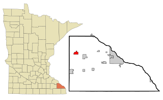
<span class="mw-page-title-main">Elba, Minnesota</span> City in Minnesota, United States

Elba is a city in Winona County, Minnesota, United States. The population was 152 at the 2010 census. It is on Minnesota State Highway 74 just north of Whitewater State Park.

<span class="mw-page-title-main">Goodview, Minnesota</span> City in Minnesota, United States

Goodview is a city in Winona County, Minnesota, United States. The population was 4,158 at the 2020 census.

<span class="mw-page-title-main">Lewiston, Minnesota</span> City in Minnesota, United States

Lewiston is a city in Winona County, Minnesota, United States. The population was 1,620 at the 2010 census.

<span class="mw-page-title-main">Minnesota City, Minnesota</span> City in Minnesota, United States

Minnesota City is a city in Winona County, Minnesota, United States. The population was 202 at the 2020 census.

<span class="mw-page-title-main">Rollingstone, Minnesota</span> City in Minnesota, United States

Rollingstone is a city in Winona County, Minnesota, United States. The population was 678 at the 2020 census.

<span class="mw-page-title-main">Stockton, Minnesota</span> City in Minnesota, United States

Stockton is a city in Winona County, Minnesota, United States. The population was 809 at the 2020 census.

<span class="mw-page-title-main">Winona, Missouri</span> City in Missouri, United States

Winona is a city in southeast Shannon County, Missouri, United States. The population was 950 at the 2020 census.

<span class="mw-page-title-main">St. Charles, Minnesota</span> City in Minnesota, United States

St. Charles is a city in Winona County, Minnesota, United States. The population was 3,990 at the 2020 census, up from 3,735 in 2010. It promotes itself as the gateway to Whitewater State Park, which is located 7 miles (11 km) north of the city on Minnesota State Highway 74.

<span class="mw-page-title-main">Fairmount, North Dakota</span> City in Richland County, North Dakota, United States

Fairmount is a city in Richland County, North Dakota, United States. The population was 343 at the 2020 census. Fairmount was founded in 1884. It is part of the Wahpeton, ND–MN Micropolitan Statistical Area.
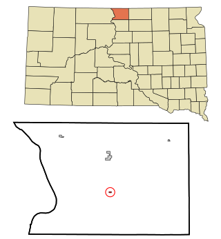
<span class="mw-page-title-main">Mound City, South Dakota</span> Town in South Dakota, United States

Mound City is a town in and the county seat of Campbell County, South Dakota, United States. The population was 69 at the 2020 census.

<span class="mw-page-title-main">Medary, Wisconsin</span> Town in Wisconsin, United States

Medary is a town in La Crosse County, Wisconsin, United States. The population was 1,461 at the 2010 census. It is part of the La Crosse, Wisconsin Metropolitan Statistical Area. The unincorporated community of Medary is located in the town.

<span class="mw-page-title-main">La Crescent, Minnesota</span> City in Minnesota, United States

La Crescent is a city in Houston and Winona counties in the U.S. state of Minnesota. The population was 5,276 at the 2020 census.

<span class="mw-page-title-main">Minneiska, Minnesota</span> City in Minnesota, United States

Minneiska is a city in Wabasha and Winona counties in the U.S. state of Minnesota. The population was 97 at the 2020 census.

<span class="mw-page-title-main">Maiden Rock, Wisconsin</span> Village in Wisconsin, United States

Maiden Rock is a village in Pierce County, Wisconsin, United States. The population was 119 at the 2010 census. The village is located within the Town of Maiden Rock.

References

  1. "2020 U.S. Gazetteer Files". United States Census Bureau. Retrieved July 24, 2022.
  2. 1 2 U.S. Geological Survey Geographic Names Information System: Dakota, Minnesota
  3. 1 2 3 "Explore Census Data". United States Census Bureau . Retrieved June 17, 2022.
  4. 1 2 "City and Town Population Totals: 2020-2021". United States Census Bureau. June 16, 2022. Retrieved June 17, 2022.
  5. "U.S. Census website". United States Census Bureau . Retrieved January 31, 2008.
  6. "US Gazetteer files 2010". United States Census Bureau. Archived from the original on January 12, 2012. Retrieved November 13, 2012.
  7. Minnesota Place Names. Minnesota Historical Society. Accessed August 13, 2014.
  8. "Census of Population and Housing". Census.gov. Retrieved June 4, 2015.