Burns is a town in Allegany County, New York, United States. The population was 1,045 at the 2020 census. The town is named after Scots poet Robert Burns.

Canaseraga is a village in Allegany County, New York, United States. The population was 550 at the 2010 census. The name is derived from a creek that flows past the village, which is reportedly a Seneca term for "lying among milkweeds" or "slippery elms".
West Sparta is a town in Livingston County, New York, United States. The population was 1,255 at the 2010 census. The name is derived from the neighboring town of Sparta.
Nunda is a village in the town of Nunda, Livingston County, New York, United States. The population of the village was 1,377 at the 2010 census, out of 3,064 in the entire town.
Nunda is a town in Livingston County, New York, United States. The population was 3,064 at the 2010 census. Nunda welcomes visitors with signs stating "Welcome to Nunda, a Nice Place to Live." The name is derived from Nunda-wa-ono, the name given to it by a group of the Seneca people who once lived in the hills and valleys along the Genesee River and Keshequa Creek within the present-day town. In the Seneca language, "Nunda" relates to hills, and a popular translation is "Where the valley meets the hills".
Portage is a town in the southwest corner of Livingston County, New York, United States. The town is at the south end of Letchworth State Park. The name of the town stems from the need to portage (carry) canoes around the falls of the Genesee River. The population of Portage was 884 at the 2010 census.
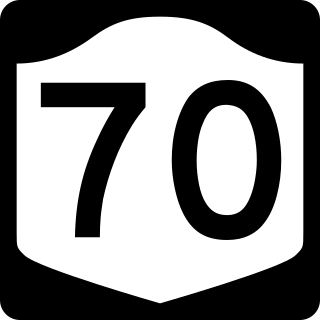
New York State Route 70 (NY 70) is a short state highway in the western portion of New York in the United States. It travels through three different counties in just 18.01 miles (28.98 km) and is the primary road to and from the village of Canaseraga. The western terminus of the route is at an intersection with NY 436 in the Livingston County town of Portage. Its eastern terminus is at a junction with NY 36 in the Steuben County town of Dansville. Although NY 70 is mostly signed north–south, it follows a more southeast–northwest alignment and is considered an east–west route by the New York State Department of Transportation (NYSDOT). The portion of the route between Dalton and Canaseraga parallels both Canaseraga Creek and the Norfolk Southern Railway's Southern Tier Line.

New York State Route 408 (NY 408) is a 15.95-mile-long (25.67 km) state highway located entirely within Livingston County, New York, in the United States. It runs north–south from an intersection with NY 70 near the hamlet of Dalton in the town of Nunda to a junction with NY 63 in the town of Groveland near NY 408's exit with Interstate 390 (I-390). Most of NY 408 is a two-lane rural highway that passes through lightly developed areas; however, the last two miles (3 km) of the highway, where it runs in a due east–west direction, are heavily trafficked as NY 408 becomes a key connector road in both directions.
Lakeville is a hamlet and census-designated place (CDP) in the town of Livonia, Livingston County, New York, United States. Its population was 756 as of the 2010 census.
Hemlock is a hamlet and census-designated place (CDP) in the town of Livonia, Livingston County, New York, United States. The population was 557 as of the 2010 census.
Greigsville is a hamlet and census-designated place (CDP) in the town of York, Livingston County, New York, United States. Its population was 209 as of the 2010 census. The community is located at the intersection of New York State Route 36 and New York State Route 63.
Groveland Station is a census-designated place (CDP) in Livingston County, New York, United States. The CDP consists of the hamlet of Groveland and nearby residential areas. The CDP population was 281 as of the 2010 census. New York State Route 63 passes through the community.
Kysorville is a hamlet and census-designated place (CDP) in the town of West Sparta, Livingston County, New York, United States. Its population was 110 as of the 2010 census.
Wadsworth is a hamlet and census-designated place (CDP) in the town of York, Livingston County, New York, United States. Its population was 190 as of the 2010 census. New York State Route 36 passes through the community.
Websters Crossing is a hamlet and census-designated place (CDP) in the town of Springwater, Livingston County, New York, United States. Its population was 69 as of the 2010 census. New York State Route 15 passes through the community.
Woodsville is a hamlet and census-designated place (CDP) in Livingston County, New York, United States. Its population was 80 as of the 2010 census. New York State Route 36 passes through the community.
York is a hamlet and census-designated place (CDP) in the town of York, Livingston County, New York, United States. Its population was 544 as of the 2010 census. New York State Route 36 passes through the community.
Hunt is a hamlet and census-designated place (CDP) in Livingston County, New York, United States. Its population was 78 as of the 2010 census. Hunt has a post office with ZIP code 14846.
Livonia Center is a hamlet and census-designated place (CDP) in the town of Livonia, Livingston County, New York, United States. Its population was 421 as of the 2010 census. Livonia Center has a post office with ZIP code 14488, which opened on April 9, 1811.
Tuscarora is a hamlet and census-designated place in the town of Mount Morris, Livingston County, New York, United States. Its population was 74 as of the 2010 census.


