Related Research Articles

John Forrest National Park is a national park in the Darling Scarp, 24 km (15 mi) east of Perth, Western Australia. Proclaimed as a national park in November 1900, it was the first national park in Western Australia and the second in Australia after Royal National Park.
The Darling Scarp, also referred to as the Darling Range or Darling Ranges, is a low escarpment running north–south to the east of the Swan Coastal Plain and Perth, Western Australia. The escarpment extends generally north of Bindoon, to the south of Pemberton. The adjacent Darling Plateau goes easterly to include Mount Bakewell near York and Mount Saddleback near Boddington. It was named after the Governor of New South Wales, Lieutenant-General Ralph Darling.

Darlington, Western Australia, is a locality in the Shire of Mundaring on the Darling Scarp, bisected by Nyaania Creek and north of the Helena River.

Bellevue is an eastern suburb of Perth, Western Australia in the local government areas of the City of Swan and the Shire of Mundaring. It is at the foot of the slopes of Greenmount, a landmark on the Darling Scarp that is noted in the earliest of travel journals of the early Swan River Colony.

Greenmount is a locality and a geographical feature in the Shire of Mundaring, Western Australia, on the edge of the Darling Scarp. It is a vital point in the transport routes from the Swan Coastal Plain into the hinterland of Western Australia.

The Helena River is a tributary of the Swan River in Western Australia. The river rises in country east of Mount Dale and flows north-west to Mundaring Weir, where it is dammed. It then flows west until it reaches the Darling Scarp.

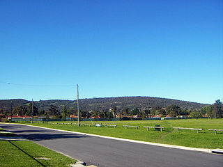
Swan View is an eastern suburb of Perth, Western Australia. Its local government areas are the City of Swan and the Shire of Mundaring. It is 25 kilometres (16 mi) from Perth in the Perth Hills on the edge of the Darling Scarp, just to the west of the John Forrest National Park, east of Roe Highway and north of the Great Eastern Highway.

The Canning River is a major tributary of the Swan River in the South West Land Division of Western Australia. It is home to much wildlife including dolphins, pelicans, swans and many other bird species.

The Swan Coastal Plain in Western Australia is the geographic feature which contains the Swan River as it travels west to the Indian Ocean. The coastal plain continues well beyond the boundaries of the Swan River and its tributaries, as a geological and biological zone, one of Western Australia's Interim Biogeographic Regionalisation for Australia (IBRA) regions. It is also one of the distinct physiographic provinces of the larger West Australian Shield division.

Helena Valley is the name of a river valley and a locality in the foothills of the Darling Scarp in Perth, Western Australia.

Perth Hills is a term used primarily for marketing purposes to identify the part of the Darling Scarp and hinterland east of the scarp that lies within the Shire of Mundaring, City of Swan, and the City of Kalamunda and as part of the constituent bodies belonging to the Eastern Metropolitan Regional Council of Perth, Western Australia.

The Shire of Murray is a local government area of Western Australia. It has an area of 1,710.1 square kilometres (660.3 sq mi) and is located in the Peel Region about 80 kilometres (50 mi) south of the Perth central business district.

Badgingarra is a small town in the Wheatbelt region of Western Australia, about 205 kilometres (127 mi) north of Perth in the Shire of Dandaragan. It lies on the Brand Highway adjacent to the Badgingarra National Park.

The Cumberland Plain, an IBRA biogeographic region, is a relatively flat region lying to the west of Sydney CBD in New South Wales, Australia. Cumberland Basin is the preferred physiographic and geological term for the low-lying plain of the Permian-Triassic Sydney Basin found between Sydney and the Blue Mountains, and it is a structural sub-basin of the Sydney Basin.

The Shire of Dandaragan is a local government area located in the Wheatbelt region of Western Australia, about 200 kilometres (124 mi) north of the state capital, Perth. The Shire covers an area of 6,716 square kilometres (2,593 sq mi) and its seat of government is the town of Jurien Bay.

Statham's Quarry is the site of a quarry on the Darling Scarp on the southern side of the entrance of the Helena River valley on to the Swan Coastal Plain in Perth, Western Australia. It is located in Gooseberry Hill and is within the bounds of the Gooseberry Hill National Park.

Whicher Range, also known as Whicher Scarp, is a range in the South West region of Western Australia.

The Northern Swan Coastal Plain Important Bird Area comprises a 2307 km2 tract of land in south-west Western Australia.
Gingin scarp is a scarp that lies to the west of the Darling Scarp in Western Australia, with the Dandaragan plateau formed between the two scarps. At the southern end of the scarp it lies to the east of the Swan Coastal Plain, to the further north the adjacent sandplain is Eneabba sandplain

Yued is a region inhabited by the Yued people, one of the fourteen groups of Noongar Aboriginal Australians who have lived in the South West corner of Western Australia for approximately 40,000 years.
References
- ↑ McConnell, Margaret (Margaret Joyce.); McGuire, John (John Gerard); Moore, Garrick (Garrick Allan); Dandaragan (W.A. : Shire). Council; McConnell, Margaret; McGuire, John; Moore, Garrick (1993), Plateau, plain and coast : a history of Dandaragan, The Shire, ISBN 978-1-875205-02-8
- ↑ Moore, T.L; Burbidge, A.H; Sonneman, T; Wilson, B.A (2016), Mammal assemblages in Boonanarring Nature Reserve, Dandaragan Plateau, Western Australia from 1986 and 2012, Royal Society of Western Australia, retrieved 23 October 2016
- ↑ Marston, R. J. (Rodney John); Geological Society of Australia. Western Australian Division, Field excursion to the Swan Coastal Plain, Dandaragan and Darling Plateaux north of the Swan River , retrieved 23 October 2016