North Rhine-Westphalia or North-Rhine/Westphalia, commonly shortened to NRW, is a state (Land) in Western Germany. With more than 18 million inhabitants, it is the most populous state in Germany. Apart from the city-states, it is also the most densely populated state in Germany. Covering an area of 34,084 square kilometres (13,160 sq mi), it is the fourth-largest German state by size.

The Ruhr, also referred to as the Ruhr area, sometimes Ruhr district, Ruhr region, or Ruhr valley, is a polycentric urban area in North Rhine-Westphalia, Germany. With a population density of 2,800/km2 and a population of over 5 million (2017), it is the largest urban area in Germany. It consists of several large cities bordered by the rivers Ruhr to the south, Rhine to the west, and Lippe to the north. In the southwest it borders the Bergisches Land. It is considered part of the larger Rhine-Ruhr metropolitan region of more than 10 million people, which is the third largest in Western Europe, behind only London and Paris.

Hamm is a city in North Rhine-Westphalia, Germany. It is located in the northeastern part of the Ruhr area. As of 2016 its population was 179,397. The city is situated between the A1 motorway and A2 motorway. Hamm railway station is an important hub for rail transport and renowned for its distinctive station building.
Soest is a Kreis (district) in the middle of North Rhine-Westphalia, Germany. Neighbouring districts are Warendorf, Gütersloh, Paderborn, Hochsauerland, Märkischer Kreis, Unna and the independent town of Hamm.
The Unna district is a Kreis (district) in central North Rhine-Westphalia, Germany. Neighboring authorities are the district of Coesfeld, the city of Hamm, the districts of Soest and Märkischer Kreis, the cities of Hagen and Dortmund, and the district of Recklinghausen.

The Lippe is a river in North Rhine-Westphalia, Germany. It is a right tributary of the Rhine and 220.3 km (136.9 mi) in length with an elevation difference of 125 metres and a catchment area of 4.890 km². The source is located at the edge of the Teutoburg Forest in Bad Lippspringe close to the city of Paderborn. It runs westward through Paderborn, Lippstadt and then along the northern edge of the Ruhr area, parallel to the river Emscher and river Ruhr. The river finally enters the Rhine at Wesel.

The County of Mark was a county and state of the Holy Roman Empire in the Lower Rhenish–Westphalian Circle. It lay on both sides of the Ruhr River along the Volme and Lenne rivers.

Europoort is an area of the Port of Rotterdam and the adjoining industrial area in the Netherlands. Being situated at Southside of the mouth of the rivers Rhine and Meuse with the hinterland consisting of the Netherlands, Germany, Belgium and partly France, Europoort is one of the world's busiest ports and considered a major entry to Europe. The port handled 12 million containers in 2015.

The Rhine–Main–Danube Canal, is a canal in Bavaria, Germany. Connecting the Main and the Danube rivers across the European Watershed, it runs from Bamberg via Nuremberg to Kelheim. The canal connects the North Sea and Atlantic Ocean to the Black Sea, providing a navigable artery between the Rhine delta, and the Danube Delta in south-eastern Romania and south-western Ukraine. The present canal was completed in 1992 and is 171 kilometres (106 mi) long.

The Albert Canal is a canal located in northeastern Belgium, which was named for King Albert I of Belgium. The Albert Canal connects Antwerp with Liège, and also the Meuse river with the Scheldt river. It also connects with the Dessel–Turnhout–Schoten Canal, and its total length is 129.5 kilometres (80.5 mi).

The Dortmund–Ems Canal is a 269-kilometre (167 mi) long canal in Germany between the inland port of the city of Dortmund and the seaport of Emden. The artificial southern part of the canal ends after 215 kilometres (134 mi) at Herbrum lock near Meppen. The route then takes the river Ems for 45 kilometres (28 mi) to Oldersum lock. From there, the canal continues along a second artificial segment of 9 kilometres (6 mi). This latter section was built because inland ships at the time of the construction of the canal were not built for the open sea, which they would have faced at the Dollart and the entry to the sea port of Emden. It is connected to the Ems-Jade Canal from Emden to Wilhelmshaven.

The Dnieper–Bug Canal, or the Dneprovsko-Bugsky Canal is the longest inland ship canal in Belarus. It connects the Mukhavets River and the Pina River. It is managed by Dneprobugvodput.

The Rhine–Herne Canal is a 45.6-kilometre-long (28.3 mi) transportation canal in the Ruhr area of North Rhine-Westphalia, Germany, with five canal locks. The canal was built over a period of eight years and connects the harbour in Duisburg on the Rhine with the Dortmund-Ems Canal near Henrichenburg, following the valley of the Emscher. It was widened in the 1980s. The Rhein-Herne canal ship was designed specifically for this canal; normally of about 1300–1350 ton capacity, it has a maximum draft of 2.50 metres (8.2 ft), a length of approximately 80 metres (260 ft), and maximum beam of 9.50 metres (31.2 ft).

Bydgoszcz Canal is a canal, 24.7 km long, between the cities of Bydgoszcz and Nakło in Poland, connecting the Vistula river with the river Oder, through the Brda and the Noteć rivers. The level difference along the canal is regulated by 6 locks. The canal was built in 1772–1775, at the order of Frederick II, king of Prussia.

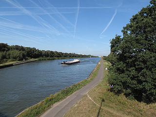
The Wesel–Datteln Canal is a 60-kilometre (37 mi) long canal in North Rhine-Westphalia, Germany. It runs along the northern edge of the Ruhr Area, from the Rhine near Wesel to the Dortmund-Ems Canal near Datteln. It forms an important transport connection between the Lower Rhine and northern and eastern Germany, together with the parallel Rhine-Herne Canal.

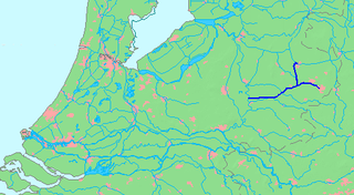
The Twentekanaal is a canal running through the Dutch provinces of Gelderland and Overijssel, connecting the three largest cities of the Twente region, Almelo, Hengelo and Enschede to the national network of rivers and canals. Because the canal forks to reach Almelo, the canal is officially plural, which is Twentekanalen.

The Industrial Heritage Trail links tourist attractions related to the industrial heritage in the Ruhr area in Germany. It is a part of the European Route of Industrial Heritage. The series of routes were developed between 1989 and 1999, however additions are still being made.

The Ludwig Canal, is an abandoned canal in southern Germany.
The Lippeverband is a public German water board (“Wasserwirtschaftsverband”) located in Dortmund and responsible for 3.280 km² of the Lippe catchment from Lippborg down to the river Rhine with 1.4 Mio. citizens. The Lippeverband offers modern, cost-effective water management that covers a broad range of responsibilities. The main tasks are sewage treatment, care and maintenance of waterways, natural remodelling of open waste water canals, flood protection, regulation of water flow and management of groundwater and rainwater.
The Wasserverband Westdeutsche Kanäle (WWK) is a German statutory body for the adjustment of the Lippe water level and service water supply from the West German shipping canals and artificial watercourses in connection with the rivers Rhine, Lippe and Ruhr.


