Daykin, Nebraska

Last updated

Daykin, Nebraska
Daykin, Nebraska Jefferson from Purdy 1.JPG
Downtown Daykin: Jefferson Street
Jefferson County Nebraska Incorporated and Unincorporated areas Daykin Highlighted.svg
Location of Daykin, Nebraska
Coordinates: 40°19′18″N97°17′54″W / 40.32167°N 97.29833°W / 40.32167; -97.29833
Country United States
State Nebraska
County Jefferson
Area
[1]
  Total0.16 sq mi (0.43 km2)
  Land0.16 sq mi (0.43 km2)
  Water0.00 sq mi (0.00 km2)
Elevation
[2]
1,532 ft (467 m)
Population
 (2020) [3]
  Total157
  Estimate 
(2021) [3]
157
  Density980/sq mi (370/km2)
Time zone UTC-6 (Central (CST))
  Summer (DST) UTC-5 (CDT)
ZIP code
68338
Area code 402
FIPS code 31-12455 [4]
GNIS feature ID2398691 [2]

Daykin is a village in Jefferson County, Nebraska, United States. The population was 157 at the 2020 census. [3]

Contents

History

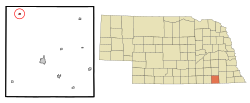
Daykin was founded by John Daykin, a train conductor and stonemason from Illinois. In 1869, John Daykin purchased land in Jefferson County, Nebraska that would later become Daykin. Besides founding the town, he remains most recognized for conducting the train that returned Abraham Lincoln's body to Springfield, Illinois. [5]

Daykin at one point had a population that reached near 300 people. The town held businesses such as a doctor's office, a butcher, laundromat, veterinarian, hotel, blacksmith, furniture store, jewelry store and many more. [6] The Jefferson County Bank was built in 1887, and has been in continuous operation since then, surviving the market crash of the 1930s.

The former Daykin Public School was held in the present day Daykin Community Building after its erection in 1935. The Daykin Schools became a 12 grade system in 1926. Most of the original 1935 building structure remains, with the lower elementary class buildings being moved and the gym being minimized after a restoration. Today students attend Meridian School. Meridian consist of the residents of Daykin, Fairbury, Western, Alexandria, and Tobias, creating the 303 Nebraska School District.

Two churches are located within Daykin, St. John's Lutheran Church, and St. John's United Methodist Church. The Daykin Immanuel Church is a few miles outside of Daykin. Both churches were created in 1888.

Daykin is known as the "Windmill Town". In the 1930s Daykin was featured in Ripley's Believe It or Not, as having more windmills per capita than any other town in Nebraska. In 1949, a water tower was built. It replaced all but one windmill, which now stands on the lawn in front of the Daykin Community Building as reminder of Daykin's history. [7]

Geography

According to the United States Census Bureau, the village has a total area of 0.16 square miles (0.41 km2), all land. [8]

Demographics

Historical population
CensusPop.Note
1900 189
1910 22016.4%
1920 204−7.3%
1930 187−8.3%
1940 165−11.8%
1950 157−4.8%
1960 144−8.3%
1970 19233.3%
1980 2077.8%
1990 188−9.2%
2000 177−5.9%
2010 166−6.2%
2020 157−5.4%
2021 (est.)157 [3] 0.0%
U.S. Decennial Census [9]

2010 census

As of the census [10] of 2010, there were 166 people, 75 households, and 49 families residing in the village. The population density was 1,037.5 inhabitants per square mile (400.6/km2). There were 84 housing units at an average density of 525.0 per square mile (202.7/km2). The racial makeup of the village was 95.8% White, 3.0% African American, 0.6% from other races, and 0.6% from two or more races. Hispanic or Latino of any race were 4.8% of the population.

There were 75 households, of which 25.3% had children under the age of 18 living with them, 57.3% were married couples living together, 6.7% had a female householder with no husband present, 1.3% had a male householder with no wife present, and 34.7% were non-families. 32.0% of all households were made up of individuals, and 20% had someone living alone who was 65 years of age or older. The average household size was 2.21 and the average family size was 2.80.

The median age in the village was 46 years. 22.3% of residents were under the age of 18; 3.5% were between the ages of 18 and 24; 21% were from 25 to 44; 25.2% were from 45 to 64; and 27.7% were 65 years of age or older. The gender makeup of the village was 49.4% male and 50.6% female.

2000 census

As of the census [4] of 2000, there were 177 people, 81 households, and 48 families residing in the village. The population density was 1,050.7 inhabitants per square mile (405.7/km2). There were 90 housing units at an average density of 534.3 per square mile (206.3/km2). The racial makeup of the village was 100% White.

There were 81 households, out of which 23.5% had children under the age of 18 living with them, 55.6% were married couples living together, 3.7% had a female householder with no husband present, and 40.7% were non-families. 40.7% of all households were made up of individuals, and 25.9% had someone living alone who was 65 years of age or older. The average household size was 2.19 and the average family size was 2.98.

In the village, the population was spread out, with 24.3% under the age of 18, 3.4% from 18 to 24, 19.8% from 25 to 44, 24.9% from 45 to 64, and 27.7% who were 65 years of age or older. The median age was 47 years. For every 100 females, there were 75.2 males. For every 100 females age 18 and over, there were 74.0 males.

As of 2000 the median income for a household in the village was $23,333, and the median income for a family was $33,750. Males had a median income of $22,386 versus $19,167 for females. The per capita income for the village was $15,843. About 8.3% of families and 11.3% of the population were below the poverty line, including none of those under the age of eighteen and 16.4% of those 65 or over.

Related Research Articles

<span class="mw-page-title-main">Jefferson County, Nebraska</span> County in Nebraska, United States

Jefferson County is a county in the U.S. state of Nebraska. As of the 2020 United States Census, the population was 7,240. Its county seat is Fairbury. The county was named for Thomas Jefferson, third President of the United States of America.

<span class="mw-page-title-main">Elmwood, Nebraska</span> Village in Nebraska, United States

Elmwood is a village in southeast Cass County, Nebraska, United States. The population was 654 at the 2020 census.

<span class="mw-page-title-main">Boys Town, Nebraska</span> Village in Douglas County, Nebraska, United States

Boys Town is a village in Douglas County, Nebraska, United States. The population was 410 at the 2020 census. Boys Town is an enclave and a suburb of Omaha.

<span class="mw-page-title-main">Waterloo, Nebraska</span> Village in Douglas County, Nebraska, United States

Waterloo is a village in Douglas County, Nebraska, United States. The population was 935 at the 2020 census.

<span class="mw-page-title-main">Strang, Nebraska</span> Village in Nebraska, United States

Strang is a village in Fillmore County, Nebraska, United States. The population was 34 at the 2020 census.

<span class="mw-page-title-main">Diller, Nebraska</span> Village in Nebraska, United States

Diller is a village in Jefferson County, Nebraska, United States. The population was 248 at the 2020 census.

<span class="mw-page-title-main">Endicott, Nebraska</span> Village in Nebraska, United States

Endicott is a village in Jefferson County, Nebraska, United States. The population was 114 at the 2020 census.

<span class="mw-page-title-main">Harbine, Nebraska</span> Village in Nebraska, United States

Harbine is a village in Jefferson County, Nebraska, United States. The population was 54 at the 2020 census.

<span class="mw-page-title-main">Jansen, Nebraska</span> Village in Nebraska, United States

Jansen is a village in Jefferson County, Nebraska, United States. The population was 100 at the 2020 census.

<span class="mw-page-title-main">Plymouth, Nebraska</span> Village in Nebraska, United States

Plymouth is a village in Jefferson County, Nebraska, United States. The population was 363 at the 2020 census.

<span class="mw-page-title-main">Reynolds, Nebraska</span> Village in Jefferson County, Nebraska, United States

Reynolds is a village in Jefferson County, Nebraska, United States. The population was 59 at the 2020 census.

<span class="mw-page-title-main">Steele City, Nebraska</span> Village in Nebraska, United States

Steele City is a village in Jefferson County, Nebraska, United States. The population was 47 at the 2020 census.

<span class="mw-page-title-main">Axtell, Nebraska</span> Village in Nebraska, United States

Axtell is a village in western Kearney County, Nebraska, United States. It is part of the Kearney, Nebraska Micropolitan Statistical Area. The population was 732 at the 2020 census.

<span class="mw-page-title-main">Stapleton, Nebraska</span> Village in and county seat of Logan County, Nebraska, United States

Stapleton is a village in and the county seat of Logan County, Nebraska, United States. The population was 267 at the 2020 census.

<span class="mw-page-title-main">Taylor, Nebraska</span> Village in Nebraska, United States

Taylor is a village in, and the county seat of, Loup County, Nebraska, United States. The population was 190 at the 2010 census.

<span class="mw-page-title-main">Dorchester, Nebraska</span> Village in Nebraska, United States

Dorchester is a village in Saline County, Nebraska, United States. It is thirty-eight miles southwest from the Lincoln, Nebraska metropolitan area. The population was 596 at the 2020 census.

<span class="mw-page-title-main">Morse Bluff, Nebraska</span> Village in Saunders County, Nebraska, United States

Morse Bluff is a village in Saunders County, Nebraska, United States. The population was 117 at the 2020 census.

<span class="mw-page-title-main">Weston, Nebraska</span> Village in Saunder County, Nebraska, United States

Weston is a village in Saunders County, Nebraska, United States. The population was 250 at the 2020 census.

<span class="mw-page-title-main">Alexandria, Nebraska</span> Village in Thayer County, Nebraska, United States

Alexandria is a village in Thayer County, Nebraska, United States. The population was 146 at the 2020 census.

<span class="mw-page-title-main">Bartlett, Nebraska</span> Village in and county seat of Wheeler County, Nebraska, United States

Bartlett is a village in, and the county seat of, Wheeler County, Nebraska, United States. The population was 117 at the 2010 census.

References

  1. "ArcGIS REST Services Directory". United States Census Bureau. Retrieved September 18, 2022.
  2. 1 2 U.S. Geological Survey Geographic Names Information System: Daykin, Nebraska
  3. 1 2 3 4 Bureau, US Census. "City and Town Population Totals: 2020—2021". Census.gov. US Census Bureau. Retrieved October 18, 2022.
  4. 1 2 "U.S. Census website". United States Census Bureau . Retrieved January 31, 2008.
  5. "Prominent Residents at Riverside Cemetery in Cleveland".
  6. "Daykin Nebraska, Read, Investigate, and Learn About This Live Town" . Retrieved August 4, 2023.[ user-generated source ]
  7. "Daykin -- Jefferson County". Archived from the original on February 5, 2016. Retrieved August 4, 2023.
  8. "US Gazetteer files 2010". United States Census Bureau. Archived from the original on January 25, 2012. Retrieved June 24, 2012.
  9. "Census of Population and Housing". Census.gov. Retrieved June 4, 2015.
  10. "U.S. Census website". United States Census Bureau . Retrieved June 24, 2012.