Decommissioned highway

Last updated

A decommissioned highway is a highway that has been removed from service by being shut down, or has had its authorization as a national, provincial or state highway removed, the latter also referred to as downloading. Decommissioning can include the complete or partial demolition or abandonment of an old highway structure because the old roadway has lost its utility, but such is not always the norm. Where the old highway has continuing value, it likely remains as a local road offering access to properties denied access to the new road or for use by slow vehicles such as farm equipment and horse-drawn vehicles denied use of the newer highway.

Contents

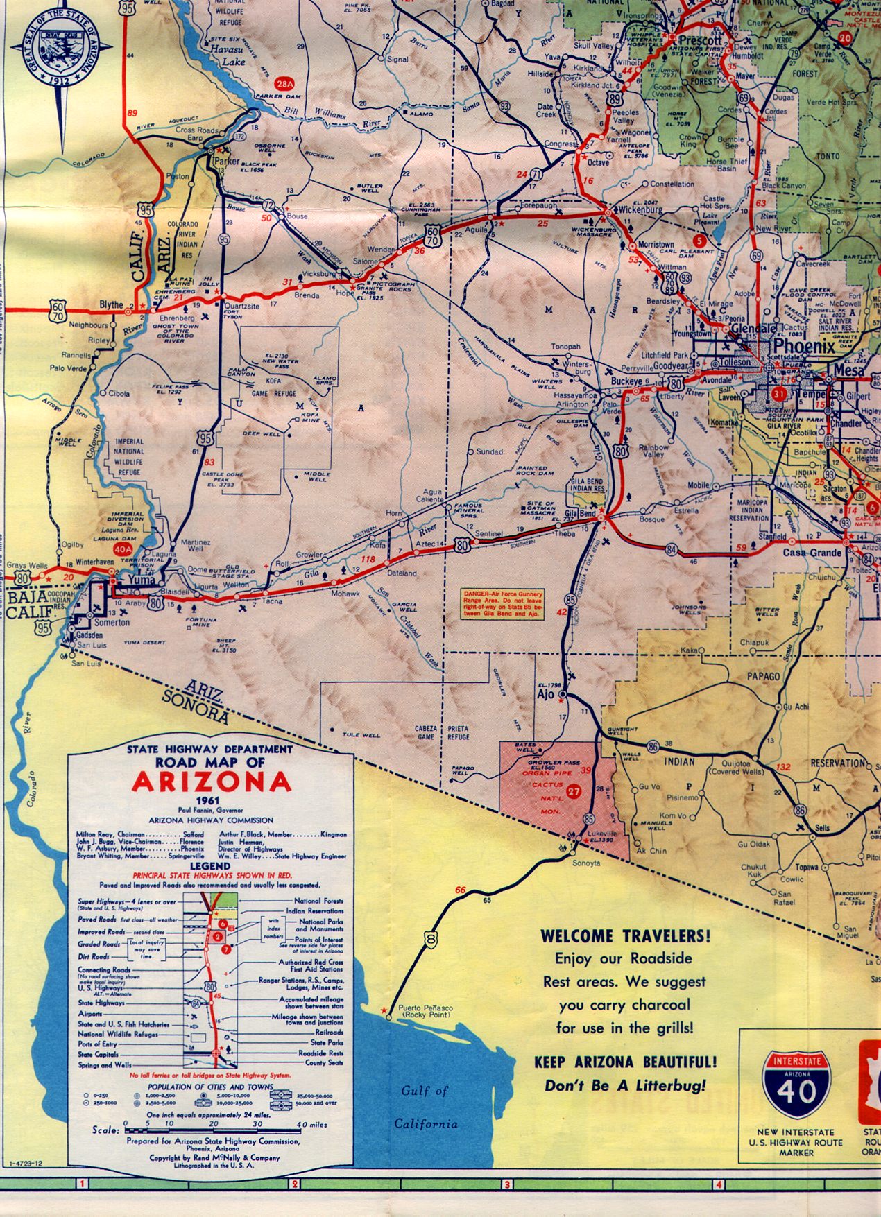
Decommissioning can also include the removal of one or more of the multiple designations of a single segment of highway. As an example, what remains as U.S. Route 60 (US 60) between Wickenburg, Arizona, and Phoenix, Arizona, carried the routes of three US Highways (US 60, US 70, US 89) and one state highway (Arizona State Route 93). [1] Since then, US 60 was diverted to other routes.

United States

Pennsylvania Route 611 was known as US 611, but was downgraded to a state route as it was entirely in Pennsylvania. This old US 611 sign, along the ramp from Cheltenham Avenue to PA 611 on the border of Philadelphia and Cheltenham, was still present in 2014, but has been removed as of 2022. US611.JPG
Pennsylvania Route 611 was known as US 611, but was downgraded to a state route as it was entirely in Pennsylvania. This old US 611 sign, along the ramp from Cheltenham Avenue to PA 611 on the border of Philadelphia and Cheltenham, was still present in 2014, but has been removed as of 2022.

Decommissioned highways are common in the United States. Even in the early years of the United States Numbered Highway System, some highways had short lives as US Highways especially if they were themselves short routes, such as the early US 110 in Wisconsin. Indeed, the fourteen shortest U.S. Numbered Highways that have ever existed were stripped of "US" status in 1982 or earlier. Extensions of US Routes have implied the elimination of earlier designations; for example, US 6, which originally went no farther west than the Hudson River in New York, was extended to Long Beach, California over routes that included an old Indiana State Road 6, most of an old US 32 between Chicago and Omaha, all of US 38 between Omaha and Denver, and an old California State Route 7 mostly in the Mojave Desert. US 6 was itself pared back to Bishop, California, in the Great Renumbering of California in 1964.

As the states build freeways as a new classification of highways, the state may strip the old highway of its old designation as a numbered highway or downgrade it to a lesser status. For example, US 66, which connected Los Angeles and Chicago from 1926 until 1985, lost its designation as a U.S. Highway in favor of faster, more direct Interstate Highways which had supplanted it. Some highways may be partly decommissioned, such as two segments of M-21 in Michigan from Holland to Grand Rapids as Interstate 196 and between Flint and the Canadian border at the Blue Water Bridge as Interstate 69 (I-69) supplanted much of it and M-21 remained in existence between Grand Rapids and Flint. [2] US 33 in Lancaster, Ohio, was signed as US 33 Business following relocation of US 33 and construction to Interstate Highway standards. Other highways have been wholly decommissioned in favor of newer Interstates, as was the case with Texas State Highway 9. [3] However, the reverse can also be done, such as I-170 in Baltimore being removed in favor of US 40 (which was previously routed on parallel-running one-way streets) because its parent route (I-70) had been cancelled due to longstanding opposition.[ citation needed ]

Some state routes built on freeway alignments may be upgraded to Interstate Highway standards (or already built to Interstate standards) and receive Interstate designation, such as the case with Pennsylvania Route 60 being largely replaced by I-376. [4] On the other hand, some routes are downgraded, as with US 61 in Minnesota, which became Minnesota State Highway 61 from Duluth to the Canadian border. At times, a state can abandon a number as the reason for state maintenance of the entire route no longer exists; Arizona transferred the short Arizona State Route 62 to the Mohave County government after a mine in Chloride closed and so did the economic purpose of the town. [5] At the extreme a decommissioned route may be demolished, as was done with California State Route 480. Once part of the Interstate Highway System, it required retrofitting to remain in service after the 1989 Loma Prieta earthquake to remain in use; instead the highway was demolished.

"Alternate", "Bypass" and suffixed routes (such as US 6A in Connecticut, the old US 71 bypass around Kansas City that disappeared in favor of Interstate 435 and Missouri Route 291, and the former US 30S in Ohio) have often been redesignated as lesser routes, in accordance with a policy of the AASHTO that now deprecates such highways, especially if short and confined to one state.

Some states have decommissioned state highways which were within a state-numbered system because significant parts of those highways were not up to state standards, such as being unpaved and unlikely to ever be paved, as with Nevada State Route 49.

Indiana removed all state and US Highway designations within the Interstate 465 beltway, either truncating the highway at the beltway (U.S. Highway 136), deleting the highway altogether (Indiana State Road 100), or diverting the routes onto the beltway.

A decommissioned route may also find other use besides automobile use. The Abandoned Pennsylvania Turnpike, a bypassed section of the Pennsylvania Turnpike that features two vehicle tunnels that were overcapacity after the Turnpike saw a surge in usage after World War II, is perhaps the most notable example of this, as it has since become a bike and pedestrian trail and, due to using the alignment for the stillborn South Pennsylvania Railroad, is also unofficially a rail trail.

Even as superhighways supplant older surface routes, some historical highways get attention from those with antiquarian (and commercial) interests in the continued recognition of such routes. US 66 in the midwestern and southwestern United States is a prime example of such efforts; "Historic Route US 66" markers, completely unofficial, designate most of the old surface road, some of which has literary significance (as in John Steinbeck's novel The Grapes of Wrath ).

Canada

Many of Quebec's Autoroutes supplant old through routes.

In New Brunswick, when a bypass road or freeway is constructed, it normally takes the number of the road it replaced, often removing portions of the old road from the provincial highway system entirely. Most become local or county roads; in some cases (such as the Moncton-Fredericton Highway 2, bypassed as freeway in 2001) a section of the old road would be retained as part of some other provincial highway because it reaches a major town the new road had bypassed.

In 1997 and 1998, the province of Ontario undertook a major highway decommissioning project, dropping over 5,000 kilometres (3,100 mi) of road from the provincially maintained highway system. Most of the former highways are now numbered as county roads. See also List of former provincial highways in Ontario.

The Thousand Islands Parkway in Ontario was originally four lanes and part of Ontario Highway 401, Canada's busiest highway, before 401 traffic was bypassed inland on completion of that freeway in 1968. Two of the lanes are provincially maintained for automobile traffic by the St. Lawrence Parks Commission but the other pair have been replaced with footpaths and a bicycle trail.

Europe

In Germany,[ citation needed ] many Autobahns supplant an older through route, as in Bundesstraße 60 (best translated as Federal Highway 60), which disappeared as the A40 Autobahn supplanted it.

In the Republic of Ireland, National Primary Routes are often realigned after the construction of new motorway sections, dual carriageways or bypasses. The old route thus loses its national route status and is usually redesignated as a Regional Road.

New South Wales

Most (old system) state and national routes in New South Wales are decommissioned routes. Among those was state route 30 between Ryde and Kellyville that existed between 1974 and 1993. [6]

Related Research Articles

<span class="mw-page-title-main">United States Numbered Highway System</span> Highway system of the United States of America

The United States Numbered Highway System is an integrated network of roads and highways numbered within a nationwide grid in the contiguous United States. As the designation and numbering of these highways were coordinated among the states, they are sometimes called Federal Highways, but the roadways were built and have always been maintained by state or local governments since their initial designation in 1926.

<span class="mw-page-title-main">Ring road</span> Type of road encircling a settlement

A ring road is a road or a series of connected roads encircling a town, city or country. The most common purpose of a ring road is to assist in reducing traffic volumes in the urban centre, such as by offering an alternate route around the city for drivers who do not need to stop in the city core. Ring roads can also serve to connect suburbs to each other, allowing efficient travel between them.

<span class="mw-page-title-main">U.S. Route 66</span> Former US Highway between Chicago and Santa Monica

U.S. Route 66 or U.S. Highway 66 was one of the original highways in the United States Numbered Highway System. It was established on November 11, 1926, with road signs erected the following year. The highway, which became one of the most famous roads in the United States, ran from Chicago, Illinois, through Missouri, Kansas, Oklahoma, Texas, New Mexico, and Arizona before terminating in Santa Monica in Los Angeles County, California, covering a total of 2,448 miles (3,940 km).

<span class="mw-page-title-main">Interstate 44</span> Interstate Highway mostly in Oklahoma and Missouri

Interstate 44 (I-44) is an Interstate Highway in the central United States. Although it is nominally an east–west road as it is even-numbered, it follows a more southwest–northeast alignment. Its western terminus is in Wichita Falls, Texas, at a concurrency with U.S. Route 277 (US 277), US 281, and US 287; its eastern terminus is at I-70 in St. Louis, Missouri. I-44 is one of five Interstates built to bypass US 66; this highway covers the section between Oklahoma City and St. Louis. Virtually the entire length of I-44 east of Springfield, Missouri, was once US 66, which was upgraded from two to four lanes from 1949 to 1955. The section of I-44 west of Springfield was built farther south than US 66 in order to connect Missouri's section with the already completed Will Rogers Turnpike, which Oklahoma wished to carry their part of I-44.

<span class="mw-page-title-main">U.S. Route 80</span> Numbered Highway in the United States

U.S. Route 80 or U.S. Highway 80 (US 80) is a major east–west United States Numbered Highway in the Southern United States, much of which was once part of the early auto trail known as the Dixie Overland Highway. As the "0" in the route number indicates, it was originally a cross-country route, from the Pacific Ocean to the Atlantic Ocean. Its original western terminus was at Historic US 101 in San Diego, California. However, the entire segment west of Dallas, Texas, has been decommissioned in favor of various Interstate Highways and state highways. Currently, the highway's western terminus is at an interchange with Interstate 30 (I-30) on the Dallas–Mesquite city line. Its eastern terminus is in Tybee Island, Georgia near the Atlantic Ocean. Between Jonesville, Texas and Kewanee, Mississippi, US 80 runs parallel to or concurrently with Interstate 20. It also currently runs through Dallas, Texas; Shreveport, Louisiana; Jackson, Mississippi; Montgomery, Alabama; Columbus, Georgia; Macon, Georgia; and Savannah, Georgia.

<span class="mw-page-title-main">U.S. Route 75</span> Highway in the United States

U.S. Route 75 is a north–south U.S. Highway that runs 1,239 miles (1,994 km) in the central United States. The highway's northern terminus is located at the Canadian border near Noyes, Minnesota, at a now-closed border crossing. From this point, the highway once continued farther north as Manitoba Highway 75. Its southern terminus is located at Interstate 30 (I-30) and I-45 in Dallas, Texas, where US 75 is known as North Central Expressway.

<span class="mw-page-title-main">State highways in California</span>

The state highway system of the U.S. state of California is a network of highways that are owned and maintained by the California Department of Transportation (Caltrans).

<span class="mw-page-title-main">Interstate 376</span> Highway in Pennsylvania

Interstate 376 (I-376) is a major auxiliary route of the Interstate Highway System in the US state of Pennsylvania, located within the Allegheny Plateau. It runs from I-80 near Sharon south and east to a junction with the Pennsylvania Turnpike in Monroeville, after having crossed the Pennsylvania Turnpike at an interchange in Big Beaver. The route serves Pittsburgh and its surrounding areas and is the main access road to Pittsburgh International Airport (PIT). Portions of the route are known as the Beaver Valley Expressway, Southern Expressway, and Airport Parkway. Within Allegheny County, the route runs along the majority of the Penn-Lincoln Parkway, known locally as Parkway West and Parkway East. It is currently the ninth-longest auxiliary Interstate route in the system and second only to I-476 within Pennsylvania.

<span class="mw-page-title-main">Concurrency (road)</span> Road bearing more than one route number

A concurrency in a road network is an instance of one physical roadway bearing two or more different route numbers. When two roadways share the same right-of-way, it is sometimes called a common section or commons. Other terminology for a concurrency includes overlap, coincidence, duplex, triplex, multiplex, dual routing or triple routing.

<span class="mw-page-title-main">Texas state highway system</span> Highway system of Texas in the United States

Texas state highways are a network of highways owned and maintained by the U.S. state of Texas. The Texas Department of Transportation (TxDOT) is the state agency responsible for the day-to-day operations and maintenance of the system. Texas has the largest state highway system, followed closely by North Carolina's state highway system. In addition to the nationally numbered Interstate Highways and U.S. Highways, the highway system consists of a main network of state highways, loops, spurs, and beltways that provide local access to the other highways. The system also includes a large network of farm to market roads that connect rural areas of the state with urban areas and the rest of the state highway system. The state also owns and maintains some park and recreational roads located near and within state and national parks, as well as recreational areas. All state highways, regardless of classification, are paved roads. The Old San Antonio Road, also known as the El Camino Real, is the oldest highway in the United States, first being blazed in 1691. The length of the highways varies from US 83's 893.4 miles (1,437.8 km) inside the state borders to Spur 200 at just 0.05 miles long.

<span class="mw-page-title-main">Bypass (road)</span> Road that bypasses a built-up area

A bypass is a road or highway that avoids or "bypasses" a built-up area, town, or village, to let through traffic flow without interference from local traffic, to reduce congestion in the built-up area, and to improve road safety. A bypass specifically designated for trucks may be called a truck route.

<span class="mw-page-title-main">Interstate 40 in Texas</span> Highway in Texas

In the US state of Texas, Interstate 40 (I-40) runs west–east through the panhandle in the northwest part of the state. The only large city it passes through is Amarillo, where it meets the north end of I-27. The entire section of I-40 in Texas is designated as a Purple Heart Trail route.

<span class="mw-page-title-main">Pennsylvania Route 283</span> State highway in Pennsylvania, US

Pennsylvania Route 283 (PA 283), officially State Route 0300 or SR 0300 due to the presence of Interstate 283 (I-283), is a 29-mile-long (47 km) freeway in the U.S. state of Pennsylvania. It connects Harrisburg to Lancaster, paralleling the old U.S. Route 230. The route follows a generally northwest–southeast direction but is signed east–west. The number was assigned based on the function the route serves as a southeastern extension of I-283, but I-283 and PA 283 are not the same roadway; the two intersect at a partial cloverleaf interchange.

<span class="mw-page-title-main">Special route</span> Type of United States road

In road transportation in the United States, a special route is a road in a numbered highway system that diverts a specific segment of related traffic away from another road. They are featured in many highway systems; most are found in the Interstate Highway System, U.S. highway system, and several state highway systems. Each type of special route possesses generally defined characteristics and has a defined relationship with its parent route. Typically, special routes share a route number with a dominant route, often referred as the "parent" or "mainline", and are given either a descriptor which may be used either before or after the route name, such as Alternate or Business, or a letter suffix that is attached to the route number. For example, an alternate route of U.S. Route 1 may be called "Alternate U.S. Route 1", "U.S. Route 1 Alternate", or "U.S. Route 1A". Occasionally, a special route will have both a descriptor and a suffix, such as U.S. Route 1A Business.

<span class="mw-page-title-main">Exit numbers in the United States</span> Conventions on assigning numbers to highway exits in the United States

Exit numbers in the United States are assigned to freeway junctions, and are usually numbered as exits from freeways. Exit numbers generally are found above the destinations and route number(s) at the exit, as well as a sign in the gore. Exit numbers typically reset at political borders such as state lines. Some major streets also use exit numbers. Freeway exits in the United States are usually numbered in two formats: distance-based and sequential.

<span class="mw-page-title-main">Special routes of U.S. Route 30</span> Highway system

Several special routes of U.S. Route 30 exist. In order from west to east they are as follows.

Highway revolts have occurred in cities and regions across the United States. In many cities, there remain unused highways, abruptly terminating freeway alignments, and short stretches of freeway in the middle of nowhere, all of which are evidence of larger projects which were never completed. In some instances, freeway revolts have led to the eventual removal or relocation of freeways that had been built.

References

  1. http://www.arizonaroads.com/maps/1961-3.jpg
  2. "Michigan Highways: Route Listings: M-21".
  3. Transportation Planning and Programming Division (n.d.). "State Highway No. 9". Highway Designation Files. Texas Department of Transportation.
  4. "Some local roads to get I-376 designation". Pittsburgh Business Times . October 17, 2005. Retrieved 2010-04-14.
  5. http://www.arizonaroads.com/arizona/az62.html
  6. "Ozroads: NSW State Route 30". www.ozroads.com.au. Retrieved 2023-01-12.