Related Research Articles

Howards Ridge is an unincorporated community in southeastern Ozark County in the southern Missouri Ozarks, United States. It is located seven miles southeast of Gainesville and 2.15 miles north of the Arkansas border, at the intersection of Ozark County routes J and T. The community is at an elevation of 880 feet and lies two and a half miles west of Norfork Lake.

Upton is an unincorporated community in western Texas County, Missouri, United States. The community is located on a ridge top approximately one mile east of the West Fork Roubidoux Creek. It is located about ten miles west of Houston on Missouri Route FF.
Grayridge is a census-designated place in eastern Stoddard County, Missouri, United States. It is located approximately ten miles southwest of Sikeston, just south of U.S. Route 60.
Hickory Ridge is an unincorporated community in Cape Girardeau County, in the U.S. state of Missouri.
Corkery is an extinct town in Dallas and Laclede counties, in the U.S. state of Missouri. The GNIS classifies it as a populated place. The community area is located on a ridge surrounded on three sides by an entrenched meander of the Niangua River which is about 300 feet below the ridgetop. The location is only accessible by road from Laclede County.
Filer is an unincorporated community in northern Douglas County, in the Ozarks of southern Missouri. The community is located on Tick Ridge along Missouri Route C, approximately 3 mi (4.8 km) south of the Douglas - Wright county line.
Prior is an unincorporated community in Douglas County, Missouri, United States. The community is located on Missouri Route 95, just north of the intersection with Missouri Route 76 and 2.5 miles north of Vanzant. The community sits on a ridge between Fox Creek to the west and Clifty Creek to the east, at an elevation of 1,243 ft (379 m).
Bee Ridge Township is an inactive township in Knox County, in the U.S. state of Missouri.
Drew is an unincorporated community in southern Laclede County, Missouri, United States. Drew is located on State Route B on a ridge east of Cobb Creek. The townsite is at an elevation of 1,109 ft (338 m).
Talmage is an unincorporated community in Wright County, in the U.S. state of Missouri. The community was located just west of Missouri Route E, approximately five miles due east of Hartville and two miles north of the community of Owens. It is on a ridge between Clark and Whetstone creeks at an elevation of 1266 feet.
Bear Ridge is a ridge in Pulaski County in the U.S. state of Missouri. The Geographic Names Information System marks its location as unknown.
Chestnut Ridge is an unincorporated community in Ste. Genevieve County, in the U.S. state of Missouri.
Lime Kiln Mountain is a long ridge in Taney County in the Ozarks of southern Missouri. The ridge reaches an elevation of 1,330 feet (410 m) at 36°36′13″N92°53′22″W. US Route 160 traverses the ridgeline from Rueter in the southeast to Hilda in the northwest for a distance of approximately 7.5 mi (12.1 km). Cane Creek runs roughly parallel to the ridge along the northeast.
Alice is an unincorporated community in southwest Texas County, in the U.S. state of Missouri.
Ellsworth is an unincorporated community in Texas County, in the U.S. state of Missouri.
Mitchells Corner is an unincorporated community in Texas County, in the U.S. state of Missouri. The community is approximately eight miles northwest of Houston on Missouri Route 17. Success is about two miles north on Route 17.
Pleasant Ridge is an unincorporated community in Texas County, in the U.S. state of Missouri. The community is located on Pleasant Ridge Road, approximately three-quarters of a mile southwest of Upton and about ten miles west of Houston.
Roubidoux Township is a township in Texas County, in the U.S. state of Missouri.
Upton Township is a township in Texas County, in the U.S. state of Missouri.
Olathia is a community in north-central Douglas County, Missouri United States. It is located approximately six miles southeast of Mansfield along Missouri Route U and is nine miles northeast of Ava. It is on a ridge between Puncheon Camp Creek one-half mile to the northeast and Bryant Creek one and a quarter mile to the southwest.
References
- ↑ U.S. Geological Survey Geographic Names Information System: Democrat Ridge
- ↑ "Phelps County Place Names, 1928–1945". The State Historical Society of Missouri. Archived from the original on June 24, 2016. Retrieved December 5, 2016.
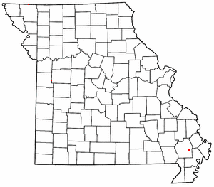
Coordinates: 37°42′12″N92°01′24″W / 37.7034683°N 92.0232514°W
| This Phelps County, Missouri state location article is a stub. You can help Wikipedia by expanding it. |
| This Pulaski County, Missouri state location article is a stub. You can help Wikipedia by expanding it. |