Related Research Articles

India is the most populous country in the world with one-sixth of the world's population. According to UN estimates, India overtook China in having the largest population in the world with a population of 1,425,775,850 at the end of April 2023.

Louis XVIII, known as the Desired, was King of France from 1814 to 1824, except for a brief interruption during the Hundred Days in 1815. He spent 23 years in exile from 1791: during the French Revolution and the First French Empire (1804–1814), and during the Hundred Days.

Camrose is a city in central Alberta, Canada that is surrounded by Camrose County. Located along Highway 13 it had its beginnings as a railroad hub.

Frederick John Dealtry Lugard, 1st Baron Lugard, known as Sir Frederick Lugard between 1901 and 1928, was a British soldier, mercenary, explorer of Africa and a colonial administrator. He was Governor of Hong Kong (1907–1912), the last Governor of Southern Nigeria Protectorate (1912–1914), the first High Commissioner (1900–1906) and last Governor (1912–1914) of Northern Nigeria Protectorate and the first Governor-General of Nigeria (1914–1919).

Leduc is a city in the province of Alberta, Canada. It is 33 km (21 mi) south of the provincial capital of Edmonton and is part of the Edmonton Metropolitan Region.

Wetaskiwin is a city in the province of Alberta, Canada. The city is located 70 kilometres (43 mi) south of the provincial capital of Edmonton. The city name comes from the Cree word wītaskiwinihk, meaning "the hills where peace was made".

Okotoks is a town in the Calgary Region of Alberta, Canada. It is on the Sheep River, approximately 38 km (24 mi) south of Downtown Calgary. Okotoks has emerged as a bedroom community of Calgary. According to the 2021 Federal Census, the town has a population of 30,214 making it the largest town in Alberta.
Airdrie is a city in Alberta, Canada, within the Calgary Region. It is located north of Calgary within the Calgary–Edmonton Corridor at the intersection of Queen Elizabeth II Highway and Highway 567.

Northern Nigeria was a British protectorate which lasted from 1900 until 1914 and covered the northern part of what is now Nigeria.

Stony Plain is a town in the Edmonton Metropolitan Region of Alberta, Canada that is surrounded by Parkland County. It is west of Edmonton adjacent to the City of Spruce Grove and sits on Treaty 6 land.

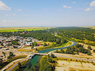
Lacombe is a city in central Alberta, Canada. It is located approximately 25 kilometres (16 mi) north of Red Deer, the nearest major city, and 125 kilometres (78 mi) south of Edmonton, the nearest metropolitan area. The city is set in the rolling parkland of central Alberta, between the Rocky Mountains foothills to the west and the flatter Alberta prairie to the east.

East Africa Protectorate was an area in the African Great Lakes occupying roughly the same terrain as present-day Kenya from the Indian Ocean inland to the border with Uganda in the west. Controlled by Britain in the late 19th century, it grew out of British commercial interests in the area in the 1880s and remained a protectorate until 1920 when it became the Colony of Kenya, save for an independent 16-kilometre-wide (10 mi) coastal strip that became the Kenya Protectorate.
High River is a town within the Calgary Metropolitan Region of Alberta, Canada. It is approximately 68 kilometres (42 mi) south of Calgary, at the junction of Alberta Highways 2 and 23. High River had a population of 14,324 in 2021.

Blairmore is a community in the Rocky Mountains within the Municipality of Crowsnest Pass in southwest Alberta, Canada. It was formerly incorporated as a town prior to 1979 when it amalgamated with four other municipalities to form Crowsnest Pass. Blairmore is the principal commercial centre of Crowsnest Pass.

Colonial Nigeria was ruled by the British Empire from the mid-nineteenth century until 1960 when Nigeria achieved independence. The revolt and resistance of the enslaved Africans all over Europe and America led to the prohibition of slave trade in Nigeria. Britain annexed Lagos in 1861 and established the Oil River Protectorate in 1884. British influence in the Niger area increased gradually over the 19th century, but Britain did not effectively occupy the area until 1885. Other European powers acknowledged Britain's dominance over the area in the 1885 Berlin Conference.
Nigerians or the Nigerian people are citizens of Nigeria or people with ancestry from Nigeria. The name Nigeria was derived from the Niger River running through the country. This name was allegedly coined in the late 19th century by British journalist Flora Shaw, who later married Baron Frederick Lugard, a British colonial administrator. Nigeria is composed of various ethnic groups and cultures and the term Nigerian refers to a citizenship-based civic nationality. Nigerians derive from over 250 ethno-linguistic groups. Though there are multiple ethnic groups in Nigeria, economic factors result in significant mobility of Nigerians of multiple ethnic and religious backgrounds to reside in territories in Nigeria that are outside their ethnic or religious background, resulting in the mixing of the various ethnic and religious groups, especially in Nigeria's cities. The English language is the lingua franca of Nigerians. Nigeria is divided roughly in half between Muslims, who live mostly in the north, and Christians, who live mostly in the south; indigenous religions, such as those native to the Igbo and Yoruba ethnicities, are in the minority.
According to the 2021 census, the City of Edmonton had a population of 1,010,899 residents, compared to 4,262,635 for all of Alberta, Canada. The total population of the Edmonton census metropolitan area (CMA) was 1,418,118, making it the sixth-largest CMA in Canada.

Vologda Governorate, also known as the Government of Vologda, was an administrative division of the Russian Empire and the Russian SFSR, which existed from 1796 until 1929. Its administrative center was in the city of Vologda. The governorate was located in the north of Russian Empire.

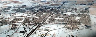
In the 2021 Census, the City of Calgary had a population of 1,306,784 residents, representing 30.7% of the 4,262,635 residents in all of Alberta, and 3.5% compared to a population of 36,991,981 in all of Canada. The total population of the Calgary census metropolitan area (CMA) was 1,481,806. Calgary is the largest city in Alberta, and the third-largest municipality and fifth-largest metropolitan area in Canada, as of 2021.
References
- ↑ Maddison 2001, pp. 97 "The total population of the Empire was 412 million [in 1913]", 241 "[World population in 1913 (in thousands):] 1 791 020".
- 1 2 "Area and Population of the British Empire". Historical Atlas of the British Empire. 1925.[ dead link ]
- 1 2 3 Patrick Colquhoun (1814). A Treatise on the Wealth, Power and Resources of the British Empire in Every Quarter of the World, Including the East-Indies: The Rise and Progress of the Funding System Explained. National Library of the Netherlands. p. 7.
- ↑ Census of the British empire: 1901. Great Britain Census Office. 1906. p. xviii.
- ↑ Census of the British empire: 1901. Great Britain Census Office. 1906. pp. xvi & xviii.
- ↑ Lugard, Flora Louise (1911). . In Chisholm, Hugh (ed.). Encyclopædia Britannica . Vol. 4 (11th ed.). Cambridge University Press. p. 606. notes that "the census returns for 1901 from the various parts of the empire were condensed for the first time in 1906 into a blue-book under the title of Census of the British Empire, Report with Summary".
- ↑ Maddison 2001, pp. 97 & 241
- ↑ Smith, George (1882). The Geography of British India, Political & Physical. Oxford University. J. Murray. pp. 3.
- ↑ Census of the British empire: 1901. Great Britain Census Office. 1906. p. xvi.
- ↑ Lugard 1911, p. 607.
- ↑ Lugard 1911, p. 606.
- ↑ Lugard 1911, pp. 606–607.
- ↑ Porter, Andrew (1992). "Religion and empire: British expansion in the long nineteenth century, 1780–1914". The Journal of Imperial and Commonwealth History. 20 (3): 370–390. doi:10.1080/03086539208582877.
- ↑ "War, Religion and the British Empire, 1757-1872". 23 April 2010.
- ↑ Ballantyne, Tony (2005). "Religion, Difference, and the Limits of British Imperial History". Victorian Studies. 47 (3): 427–455. doi:10.2979/VIC.2005.47.3.427. JSTOR 3830222. S2CID 144368015.
- ↑ Pestana, Carla Gardina (June 2011). Protestant Empire: Religion and the Making of the British Atlantic World. University of Pennsylvania Press. ISBN 978-0812203493.
- ↑ Strong, Rowan (26 July 2007). Anglicanism and the British Empire, C.1700-1850. OUP Oxford. ISBN 978-0-19-921804-2.
- 1 2 Lugard 1911, pp. 614.