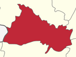
Pennagaram is a Taluk Town Panchayat in Dharmapuri district in the Indian state of Tamil Nadu.
Kumbakonam taluk is a taluk of Thanjavur district of the Indian state of Tamil Nadu. The headquarters of the taluk is the town of Kumbakonam.
Dharmapuri is a state assembly constituency in Dharmapuri district in Tamil Nadu, India. It comprises a portion of Dharmapuri taluk and is a part of the similarly-named constituency which is used for national elections to the Parliament of India.
Mayiladuthurai taluk is a taluk of Nagapattinam district of the Indian state of Tamil Nadu. The headquarters of the taluk is the town of Mayiladuthurai. Mozhaiyur is 1 of 113 villages in the taluk of Mayiladuthurai.
Omalur taluk is a taluk of Salem district of the Indian state of Tamil Nadu. The headquarters of the taluk is the town of.
Yercaud taluk is a taluk of Salem district of the Indian state of Tamil Nadu. The headquarters of the taluk is the town of Yercaud.
Manapparai taluk is a taluk of Tiruchirapalli district of the Indian state of Tamil Nadu. The headquarters of the taluk is the town of Manapparai.
Kallakkurichi taluk is a taluk of Kallakurichi district of the Indian state of Tamil Nadu. The headquarters of the taluk is the town of Kallakurichi.
Vaniyambadi taluk is a taluk in Tirupattur district of the Indian state of Tamil Nadu. The headquarters of the taluk is the town of Vaniyambadi.
Palacode taluk is a taluk in the Dharmapuri district of the Indian state of Tamil Nadu. The headquarters of the taluk is the town of Palacode.
Pennagaram taluk is a taluk in the Dharmapuri district of the Indian state of Tamil Nadu. The headquarters of the taluk is the town of Pennagaram.
Harur taluk is a taluk in the Dharmapuri district of the Indian state of Tamil Nadu. The headquarters of the taluk is the town of Harur.
Pappireddipatti taluk is a taluk in the Dharmapuri district of the Indian state of Tamil Nadu. The headquarters of the taluk is the town of Pappireddipatti.
Krishnagiri Taluk is a taluk of Krishnagiri district of the Indian state of Tamil Nadu. The headquarters is the municipal town of Krishnagiri which is about 255 km from Chennai, state capital. Taluk office is located on the Bengaluru road-Dharmaraja Temple road junction.
Chengam taluk is a taluk of Tiruvannamalai district of the Indian state of Tamil Nadu. The headquarters is the town of Chengam.
Rasipuram taluk is a taluk of Namakkal district of the Indian state of Tamil Nadu. The headquarters of the taluk is the town of Rasipuram
Alangudi taluk is a taluk of Pudukkottai district of the Indian state of Tamil Nadu. The headquarters of the taluk is the town of Alangudi. Keeramangalam is also in the area.senthangudi is also one of the villages under Alangudi. Renowned Athlete Santhi Soundarajan was born in this taluk.
Ara(m)nthangi taluk is a taluk of Pudukkottai district of the Indian state of Tamil Nadu. The headquarters of the taluk is the town of Aranthangi
Ambur taluk is an administrative division in the Tirupattur district of Tamil Nadu, India. The headquarters of the taluk is the town of Ambur. There are 78 revenue villages under this taluk namely Oomerabad etc..


