Related Research Articles

The town of Clare is located in South Australia in the Mid North region, 136 km north of Adelaide. It gives its name to the Clare Valley wine and tourist region.

The Australian monastic town of Sevenhill is in the Clare Valley of South Australia, approximately 130 km north of Adelaide. The town was founded by members of the Jesuit order in 1850. The name, bestowed by Austrian Jesuit priest Aloysius Kranewitter, is in homage to the seven hills of Rome.
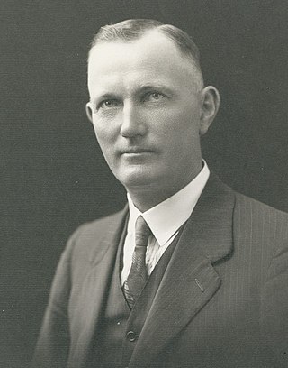
Sir Alexander Lyell McEwin, KBE, always known as "Lyell McEwin" was a politician in South Australia.

Andrews is a rural locality in the Northern Areas Council of South Australia, located on the Hill River. Its boundaries were formalised in April 2001 for the long established name for the area. The district, which is primarily dedicated to primary production, mainly grain farming, is in the Spalding Ward of the council. The township has bulk grain handling and storage facilities as well as limited sporting and community facilities. The Hill River Road and the Hill River run north–south through the locality, while Andrews Road runs east–west, connecting the Goyder Highway with RM Williams Way. In the 2011 census, the population of Andrews was too low to separately report; it was included in that of adjacent Spalding.

Hilltown is a locality in the District Council of Clare and Gilbert Valleys of South Australia. The former town centre is located on Hilltown Road, which runs north-south between Andrews and Hill River, while the unsealed Harvey Highway connects the former town centre to RM Williams Way. It is about 4 km east of RM Williams Way, on the former Spalding railway line.

The District Council of Coglin was a local government area in South Australia. It came into operation on 5 January 1888 under the provisions of the District Councils Act 1887. At its inception, it comprised the Hundreds of Cavenagh, Coglin, Gumbowie, Parnaroo, Hardy, Nackara, and Paratoo. It was divided into four wards: Coglin, Gumbowie, East and North. Meetings were held alternately at Dawson and Lancelot until 1899, and thereafter at Penn.

The District Council of Spalding was a local government area in South Australia, centred on the town of Spalding. It was proclaimed on 30 July 1885 by Governor William C. F. Robinson, comprising the Hundreds of Reynolds and Andrews as far south as the northern boundary of Euromina. It followed significant agitation by residents for a local municipality, with the boundaries having been the subject of some dispute.
The District Council of Yongala was a local government area in South Australia from 1883 to 1935, seated at Yongala.
The District Council of Jamestown was a local government area in South Australia, centred on the region surrounding the town of Jamestown. The District Council came into existence on 21 March 1935 following the amalgamation of 95% of the District Council of Belalie with the District Council of Caltowie and the Hundred of Mannanarie, which had been in the abolished District Council of Yongala. For almost all of its history, it surrounded but did not include the town of Jamestown itself; the Jamestown township had separated from Belalie as the Corporate Town of Jamestown in 1878, and would not merge back into the broader municipality until 1991.

The District Council of Belalie was a local government area in South Australia. It was proclaimed on 11 November 1875, and initially comprised most of the cadastral Hundred of Belalie, including its central town of Jamestown. Jamestown itself had originally been planned to be named Belalie when surveyed; while the town had been renamed, the Belalie name was retained for the council. It was divided into five wards at its inception with one councillor each, the first councillors for each being appointed by proclamation. The South-East and South-West wards had been replaced by the Yarcowie and Yongala wards by 1893.
The District Councils Act 1887 was an act of the Parliament of South Australia. It received assent on 9 December 1887, and its provisions came into effect when proclaimed by Governor William C. F. Robinson on 5 January 1888.
The District Council of Highercombe was a local government area in South Australia from 1853 to 1935.
The District Council of Redhill was a local government area in South Australia from 1888 to 1988.
The District Council of Port Broughton was a local government area in South Australia from 1892 to 1997 seated at the town of Port Broughton.

The District Council of Terowie was a local government area in South Australia from 1888 to 1935, centring on the town of Terowie.
The District Council of Hanson was a local government area in South Australia from 1878 to 1935.
Mannanarie is a rural locality in the Mid North region of South Australia, situated in the Northern Areas Council. It was established in April 2001, when boundaries were formalised for the "long established local name". It comprises most of the cadastral Hundred of Mannanarie, apart from a northern section which lies in Tarcowie and Yatina. The name stems from an Aboriginal word, "manangari", meaning "good string or cord", stemming from a local native plant useful for string making.
The District Council of Snowtown was a local government area in South Australia from 1888 to 1987.
The District Council of Blyth was a local government area in South Australia from 1872 to 1987 seated at Blyth in the Mid North.

The Corporation and District Council of Clare were twin local government areas in South Australia centred on the town of Clare. The district council existed from 1853 until 1997, while the town corporation existed from 1868 until 1969.
References
- 1 2 Marsden, Susan (2012). "A History of South Australian Councils to 1936" (PDF). Local Government Association of South Australia. p. 41. Retrieved 30 October 2015.
- ↑ "Proclamations—New distriot councils and councillors appointed—Hutt and Hill Rivers distriot council" (PDF). South Australian Government Gazette . 1885 (33 ed.): 306. 30 July 1885. Retrieved 23 June 2017.
- ↑ "The District Councils Act 1887 No. 419". Flinders University. Retrieved 14 November 2015.
- ↑ "Council Chambers". Bungaree Station. Retrieved 17 March 2016.
- ↑ "Hutt and Hill Rivers, June 18". The Northern Argus . Vol. XX, no. 1, 749. South Australia. 22 June 1888. p. 3. Retrieved 18 March 2016– via National Library of Australia.
- ↑ "Alteration Of Council Boundaries". Laura Standard and Crystal Brook Courier . Vol. XLVI, no. 2, 251. South Australia. 8 February 1935. p. 3. Retrieved 17 March 2016– via National Library of Australia.
- ↑ Hosking, P. (1936). The Official civic record of South Australia : centenary year, 1936. Adelaide: Universal Publicity Company. p. 203.
- 1 2 "The District Council of Hutt and Hill Rivers". The Northern Argus . Vol. LXVI, no. 3, 549. South Australia. 12 April 1935. p. 6. Retrieved 18 March 2016– via National Library of Australia.
- ↑ "Hutt and Hill Rivers, Sept. 4". The Northern Argus . Vol. XXIX, no. 2, 408. South Australia. 10 September 1897. p. 3. Retrieved 18 March 2016– via National Library of Australia.
- ↑ "District Councils". The Northern Argus . Vol. XXX, no. 2, 451. South Australia. 8 July 1898. p. 3. Retrieved 18 March 2016– via National Library of Australia.
- ↑ "Hutt and Hill Rivers, March 8". The Northern Argus . Vol. XXXI, no. 2, 486. South Australia. 10 March 1899. p. 3. Retrieved 18 March 2016– via National Library of Australia.
- ↑ "District Councils". The Chronicle . Vol. 44, no. 2, 243. South Australia. 17 August 1901. p. 33. Retrieved 18 March 2016– via National Library of Australia.
- ↑ "Hutt and Hill Rivers, September". The Northern Argus . Vol. XXXVI, no. 2, 774. South Australia. 16 September 1904. p. 4. Retrieved 18 March 2016– via National Library of Australia.
- ↑ "Hutt and Hill Rivers, July 5". The Northern Argus . Vol. XXXVII, no. 2, 816. South Australia. 7 July 1905. p. 3. Retrieved 18 March 2016– via National Library of Australia.
- ↑ "Hutt and Hill Rivers. June 6". The Northern Argus . Vol. XXXVIII, no. 2, 864. South Australia. 8 June 1906. p. 3. Retrieved 18 March 2016– via National Library of Australia.
- ↑ "Hutt and Hill Rivers, Sept. 4". The Northern Argus . Vol. XXXIX, no. 2, 929. South Australia. 6 September 1907. p. 3. Retrieved 18 March 2016– via National Library of Australia.
- ↑ "Hutt and Hill Rivers, July 1". The Northern Argus . Vol. XL, no. 2, 973. South Australia. 10 July 1908. p. 3. Retrieved 18 March 2016– via National Library of Australia.
- ↑ "Hutt and Hill Rivers, Dec. 7". The Northern Argus . Vol. XLII, no. 3, 100. South Australia. 16 December 1910. p. 3. Retrieved 18 March 2016– via National Library of Australia.
- ↑ "Hutt and Hill Rivers, Jan. 7". Blyth Agriculturist . Vol. IX, no. 469. South Australia. 18 January 1918. p. 2. Retrieved 18 March 2016– via National Library of Australia.