Districts of Vienna

Last updated

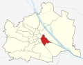
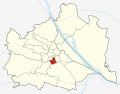
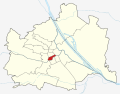
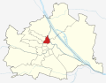
The districts of Vienna (German: Wiener Gemeindebezirke) are the 23 named city sections of Vienna, Austria, which are numbered for easy reference. They were created from 1850 onwards, when the city area was enlarged by the inclusion of surrounding communities. Although they fill a similar role, Vienna's municipal districts are not administrative districts (Bezirke) as defined by the federal constitution; Vienna is a statutory city and as such is a single administrative district in its entirety.

Contents

Districts

No.DistrictCoat of
arms
Area
(km2)
Population
(2023)
Density
per km2
Map
1 Innere Stadt Wien - Bezirk Innere Stadt, Wappen.svg 2.86916,6205,791 Vienna subdivisions (1).svg
2 Leopoldstadt Wien - Bezirk Leopoldstadt, Wappen.svg 19.242108,2695,627 Vienna subdivisions (2).svg
3 Landstraße Wien - Bezirk Landstrasse, Wappen.svg 7.40396,75613,075 Vienna subdivisions (3).svg
4 Wieden Wien - Bezirk Wieden, Wappen.svg 1.77633,63318,895 Vienna subdivisions (4).svg
5 Margareten Wien - Bezirk Margareten, Wappen.svg 2.01255,01827,372 Vienna subdivisions (5).svg
6 Mariahilf Wien - Bezirk Mariahilf, Wappen.svg 1.45531,42321,523 Vienna subdivisions (6).svg
7 Neubau Wien - Bezirk Neubau, Wappen.svg 1.60831,58119,616 Vienna subdivisions (7).svg
8 Josefstadt Wien - Bezirk Josefstadt, Wappen.svg 1.0924,67422,637 Vienna subdivisions (8).svg
9 Alsergrund Wien - Bezirk Alsergrund, Wappen.svg 2.97642,20614,211 Vienna subdivisions (9).svg
10 Favoriten Wien - Bezirk Favoriten, Wappen.svg 31.823218,4156,862 Vienna subdivisions (10).svg
11 Simmering Wien - Bezirk Simmering, Wappen.svg 23.256109,0384,688 Vienna subdivisions (11).svg
12 Meidling Wien - Bezirk Meidling, Wappen.svg 8.103100,28112,380 Vienna subdivisions (12).svg
13 Hietzing Wien - Bezirk Hietzing, Wappen.svg 37.71355,5681,473 Vienna subdivisions (13).svg
14 Penzing Wien - Bezirk Penzing, Wappen.svg 33.7696,8282,868 Vienna subdivisions (14).svg
15 Rudolfsheim-Fünfhaus Wien - Bezirk Rudolfsheim-Funfhaus, Wappen.svg 3.91876,10919,416 Vienna subdivisions (15).svg
16 Ottakring Wien - Bezirk Ottakring, Wappen.svg 8.673102,44411,816 Vienna subdivisions (16).svg
17 Hernals Wien - Bezirk Hernals, Wappen.svg 11.39656,0334,919 Vienna subdivisions (17).svg
18 Währing Wien - Bezirk Wahring, Wappen.svg 6.34751,5598,120 Vienna subdivisions (18).svg
19 Döbling Wien - Bezirk Dobling, Wappen.svg 24.94475,5173,028 Vienna subdivisions (19).svg
20 Brigittenau Wien - Bezirk Brigittenau, Wappen.svg 5.7185,69015,007 Vienna subdivisions (20).svg
21 Floridsdorf Wien - Bezirk Floridsdorf, Wappen.svg 44.443183,8954,138 Vienna subdivisions (21).svg
22 Donaustadt Wien - Bezirk Donaustadt, Wappen.svg 102.299212,6582.079 Vienna subdivisions (22).svg
23 Liesing Wien - Bezirk Liesing, Wappen.svg 32.061117,8823,677 Vienna subdivisions (23).svg

District locations

District locations Vienna, administrative divisions - Nmbrs.svg
District locations

The boundaries of each district have been shown as a layer on this map. The following are locations of the 23 districts:

  1. Innere Stadt is the city centre, with numerous historical sites and few residents.
  2. Leopoldstadt is the island between the Danube and the Donaukanal, with Praterstern, Vienna's most frequented traffic spot, and the Prater with Vienna's iconic Giant Wheel.
  3. Landstraße is on the right bank of the Donaukanal, and includes the Belvedere.
  4. Wieden is a small district south of the city centre, and includes the Vienna University of Technology.
  5. Margareten was separated from Wieden in 1861. The Museum for Social and Economic Affairs (Gesellschafts- und Wirtschaftsmuseum) is located in Margareten. The museum was the base for the development of the Vienna Method.
  6. Mariahilf is a small district on the main shopping lane leading to Westbahnhof.
  7. Neubau is a small district on main shopping lane leading to Westbahnhof, and includes the Museumsquartier, a large cultural complex.
  8. Josefstadt is a small district close to the Rathaus, Parlament, and the University of Vienna.
  9. Alsergrund is the General Hospital district, and includes Sigmund Freud's residence.
  10. Favoriten is in the southern part of Vienna, and has the largest population, the new main train station, and the city's thermal spa.
  11. Simmering is on the right bank of the Donaukanal, and includes the Zentralfriedhof which is the main cemetery.
  12. Meidling is on the southern bank of the Wien river.
  13. Hietzing is on the southern bank of the Wien river, and includes Schönbrunn Palace.
  14. Penzing is on the northern bank of the Wien river, and was separated from Hietzing in 1938. It includes Otto Wagner's Church Am Steinhof.
  15. Rudolfsheim-Fünfhaus is on the northern bank of the Wien river.
  16. Ottakring is on the western outskirts and includes Vienna's traditional brewery.
  17. Hernals is on the northwestern outskirts of Vienna.
  18. Währing is on the northwestern outskirts of Vienna, and includes the Türkenschanzpark around which was founded the University of Natural Resources and Life Sciences, Vienna.
  19. Döbling is on the northern outskirts of Vienna, and includes the classical Heurigen district.
  20. Brigittenau is on the same island as Leopoldstadt, and was separated in 1900.
  21. Floridsdorf is on the left bank of the Danube, and includes industry areas. It is the northernmost part of Vienna.
  22. Donaustadt is on the left bank of the Danube, and is the largest district in size. It includes the Vienna International Centre, a campus and building complex hosting the United Nations Office at Vienna as well as Vienna's largest conference center.
  23. Liesing is the southernmost least population dense district, and includes the Wotruba Church.

By looking at the postal code it can be determined in which district a given address is located: 1XXA - 1 denotes Vienna, XX the district number (if it is a single digit then with a leading zero), A is the number of the post office (irrelevant in this case, usually zero). Example: 1070 for Neubau. Exceptions of that are 1300 for the Vienna International Airport located in Lower Austria near Schwechat, 1400 for the UN Complex, 1450 for the Austria Center Vienna, and 1500 for the Austrian UN-Forces.

The numbering of the districts reflects to some degree when they were incorporated into Vienna.

Politics

The seats of Bezirksvorsteher (political district head) and Bezirksvertretung (district assembly) are located in the respective districts, with the exception of the 14th district, whose political representatives reside in the 13th district (to which much of the 14th had belonged until 1938). The Magistratisches Bezirksamt (district office of the city administration, not headed by the political district head) in four locations combines services for two districts:

  • for the 1st and 8th district in the 1st,
  • for the 4th and 5th district in the 5th,
  • for the 6th and 7th district in the 7th,
  • for the 13th and 14th district in the 13th.

Hence Vienna has 19 district offices.

Since 2002, in Austria, instead of the police the mayors are responsible for objects found in public places. In Vienna, the mayor has ordered the district offices to perform the functions police stations have performed concerning found objects until then. Since 2005, by federal law the districts in all of Austria are responsible for issuing passports and registering residents, tasks until then covered in Vienna by the Federal Police. The mayor of Vienna again has ordered the district offices of the Magistrat to perform these functions.

Optimizing overhead costs has gone farther with the Federal Police in Vienna. The 23 District Police Commands in 2002 have been reduced to 14 City Police Commands. Reducing the number of small districts by mergers, as happened in Berlin after the 1990 reunification of Germany, has not even been discussed in Vienna, since the district assemblies function as breeding factories for the political parties' representatives.

See also

For the creation and administration of the districts, see Vienna § Districts and enlargement.

Related Research Articles

<span class="mw-page-title-main">Vienna</span> Capital and largest city of Austria

Vienna is the capital, largest city, and one of nine federal states of Austria. Vienna is Austria's most populous city and its primate city, with about two million inhabitants, and its cultural, economic, and political center. It is the fifth-largest city proper by population in the European Union and the largest of all cities on the Danube river by population.

<span class="mw-page-title-main">Leopoldstadt</span> 2nd District of Vienna in Austria

Leopoldstadt is the 2nd municipal district of Vienna in Austria. As of 1 January 2016, there are 103,233 inhabitants over 19.27 km2 (7 sq mi). It is situated in the heart of the city and, together with Brigittenau, forms a large island surrounded by the Danube Canal and, to the north, the Danube. It is named after Leopold I, Holy Roman Emperor. Due to its relatively high percentage of Jewish inhabitants before the Holocaust, Leopoldstadt gained the nickname Mazzesinsel. This context was a significant aspect for the district twinning with the New York City borough Brooklyn in 2007.

<span class="mw-page-title-main">Hietzing</span> 13th District of Vienna in Austria

Hietzing is the 13th municipal District of Vienna. It is located west of the central districts, west of Meidling. Hietzing is a heavily populated urban area with many residential buildings, but also contains large areas of the Vienna Woods, along with Schönbrunn Palace.

<span class="mw-page-title-main">Innere Stadt</span> 1st District of Vienna in Austria

The Innere Stadt is the 1st municipal district of Vienna located in the center of the Austrian capital. The Innere Stadt is the old town of Vienna. Until the city boundaries were expanded in 1850, the Innere Stadt was congruent with the city of Vienna. Traditionally it was divided into four quarters, which were designated after important town gates: Stubenviertel (northeast), Kärntner Viertel (southeast), Widmerviertel (southwest), Schottenviertel (northwest).

<span class="mw-page-title-main">Gürtel, Vienna</span> Main thoroughfare in Vienna

The Gürtel is a substantial beltway of Vienna. Running 13.1 km (8.1 mi) parallel to the famous Vienna Ring Road, it encompasses the inner city districts (Innenbezirke) and follows the route of the former Linienwall outer fortification. The city's red-light district is situated around the Gürtel.

<span class="mw-page-title-main">Döbling</span> 19th District of Vienna in Austria

Döbling is the 19th district in the city of Vienna, Austria. It is located in the north of Vienna, north of the districts Alsergrund and Währing. Döbling has some heavily populated urban areas with many residential buildings, and borders the Vienna Woods. It includes some of the most expensive residential areas such as Grinzing, Sievering, and Neustift am Walde, and is home to many Heurigen taverns. There are some large Gemeindebauten, including Vienna's most famous, the Karl-Marx-Hof.

<span class="mw-page-title-main">Donaustadt</span> 22nd District of Vienna in Austria

Donaustadt is the 22nd district of Vienna, Austria . Donaustadt is the eastern district of Vienna.

<span class="mw-page-title-main">Brigittenau</span> 20th District of Vienna in Austria

Brigittenau is the 20th district of Vienna. It is located north of the central districts, north of Leopoldstadt on the same island area between the Danube and the Danube Canal. Brigittenau is a heavily populated urban area with many residential buildings.

<span class="mw-page-title-main">Wieden</span> 4th District of Vienna in Austria

Wieden is the 4th municipal district of Vienna, Austria. It is near the centre of Vienna and was established as a district in 1850, but its borders were changed later. Wieden is a small region near the city centre. After World War II, Wieden was part of the Soviet sector of Vienna for 10 years.

<span class="mw-page-title-main">Margareten</span> 5th District of Vienna in Austria

Margareten is the fifth district of Vienna. It is near the old town of Vienna and was established as a district in 1850, but borders changed later. Margareten is a residential urban area, with over 25,000 inhabitants per km2, one of the most densely populated districts in Vienna. The district is named after Margaret of Antioch.

<span class="mw-page-title-main">Favoriten</span> 10th District of Vienna in Austria

Favoriten, the 10th district of Vienna, Austria, is located south of the central districts. It is south of Innere Stadt, Wieden and Margareten. Favoriten is a heavily populated urban area with many residential buildings, but also large recreational areas and parks.

<span class="mw-page-title-main">Rudolfsheim-Fünfhaus</span> 15th District of Vienna in Austria

Rudolfsheim-Fünfhaus is the 15th municipal District of Vienna, Austria. It is in central Vienna, west of Innere Stadt.

<span class="mw-page-title-main">Donaukanal</span> Waterway in Vienna

The Donaukanal is a former arm of the river Danube, now regulated as a water channel, within the city of Vienna, Austria. It is 17.3 kilometres (10.7 mi) long and, unlike the Danube itself, it borders Vienna's city centre, Innere Stadt, where the Wien River (Wienfluss) flows into it.

<span class="mw-page-title-main">Vienna Stadtbahn</span> Public transportation system

The Vienna Stadtbahn was a rail-based public transportation system operated under this name from 1898 until 1989. Today, the Vienna U-Bahn lines U4 and U6 and the Vienna S-Bahn run on its former lines.

The Wienzeile is a street in Vienna, which originated in the course of the regulation of the Vienna River between 1899 and 1905 along the river's banks.

The history of the Jews in Vienna, Austria, goes back over eight hundred years. There is evidence of a Jewish presence in Vienna from the 12th century onwards.

<i>Linienwall</i> Viennas outer fortification (1704-1894)

The Linienwall was the outer line of the fortifications for the city of Vienna, Austria, that lay between the city’s suburbs and outlying villages. Constructed in 1704, it was razed in 1894 to make way for the Vienna Beltway.

<span class="mw-page-title-main">Suburban line (Vienna)</span> Railway line in Vienna, Austria

The Suburban line is a railway line in the city of Vienna. It runs approximately 14 kilometres (8.7 mi) from Wien Hütteldorf to Wien Heiligenstadt, running around the northwest side of the city. It hosts the S45 service of the Vienna S-Bahn.

<span class="mw-page-title-main">Augartenbrücke</span> Bridge in Vienna

The Augartenbrücke is a bridge that crosses the Donaukanal in Vienna, which connects the 9th district (Alsergrund) and the 1st district on the southwest side of the canal with the 2nd district, Leopoldstadt, on the northeast side. There has been a bridge on the site since 1782.

References

    Districts of Vienna Interactive Map

    Commons-logo.svg Media related to Districts of Vienna at Wikimedia Commons