Ditchling Common

Last updated

Ditchling Common
Site of Special Scientific Interest
Ditchling Common.JPG
Location East Sussex
Grid reference TQ 334 185 [1]
InterestBiological
Area66.5 hectares (164 acres) [1]
Notification 1986 [1]
Location map Magic Map

Ditchling Common is a 66.5-hectare (164-acre) biological Site of Special Scientific Interest south-west of Wivelsfield in East Sussex. It is a country park. which is owned and managed by East Sussex County Council. [1] [2] In many respects, it is a biologically important site of the Low Weald supporting a rich array of biodiversity not found anywhere else in the area.

Contents

Areas

Ditchling Common Country Park - geograph.org.uk - 1446467 Ditchling Common Country Park - geograph.org.uk - 1446467.jpg
Ditchling Common Country Park - geograph.org.uk - 1446467
Track at the SE corner of Ditchling Common Country Park - geograph.org.uk - 1313963 Track at the SE corner of Ditchling Common Country Park - geograph.org.uk - 1313963.jpg
Track at the SE corner of Ditchling Common Country Park - geograph.org.uk - 1313963

There are two areas of Ditchling Common: the northern area, which is owned by East Sussex County Council and has become Ditchling Country Park, and is itself split in two by the fast traffic of the Ditchling Road (B2112); and the southern area south of Folders Lane, which is owned by Commoner's Association.

Despite the publicised Country Park walks concentrating on the area east of the Ditchling Road, the area to the west is as rich in biodiversity with rare plants such as the tiny adder's tongue fern and big swarms of petty whin. [3]

History

Entrance to Ditchling Common - geograph.org.uk - 1471834 Entrance to Ditchling Common - geograph.org.uk - 1471834.jpg
Entrance to Ditchling Common - geograph.org.uk - 1471834
Ditchling Common Country Park - geograph.org.uk - 1463048 Ditchling Common Country Park - geograph.org.uk - 1463048.jpg
Ditchling Common Country Park - geograph.org.uk - 1463048

The extent of the present Ditchling Common (including the Country Park) has changed little since 1300. The manor of Ditchling, held in modern times by the Marquess of Abergavenny, owned the Commons since in the medieval ages and only sold the land in 1950. [4] [3] During the following twenty-five years the richness of the Common's biodiversity was damaged. [5] The northern park became overgrown with scrub following a cessation of grazing the area. On the commoners' Common, where three-quarters was ploughed up and fertilised. There was a public outcry from local people and other commoners, who pursued a campaign to stop the destruction of the area's rich biodiversity. Ultimately legal action was brought on the farmers and the archaic biodiversity was partially saved. [3]

The northern half of the Common was bought by East Sussex County Council in 1974 and the area was designated a Country Park. Since then they have started partial grazing of the area. The southern half is now managed by the Commoners Association who in recent years have done excellent work to save the southern area's biodiversity.

Jacob's Post - geograph.org.uk - 2365313 Jacob's Post - geograph.org.uk - 2365313.jpg
Jacob's Post - geograph.org.uk - 2365313

At the very north of the Common one can find Jacob's Post ( TQ 337 197 ), which has the date 1734 on the bird at its top. It remembers the pedlar, Jacob Harris, who in that year committed murder in the Kings Head pub and as a reminder of his crime had his dead body suspended on a gibbet outside the pub for many months. The post itself took on a life of its own as people believed infertility and other ailments could be cured by touching the post. This continued into the 19th century despite the original post being replaced. [6]

Biodiversity

Fish Pond, Ditchling Common - geograph.org.uk - 1446462 Fish Pond, Ditchling Common - geograph.org.uk - 1446462.jpg
Fish Pond, Ditchling Common - geograph.org.uk - 1446462
Trail, Ditchling Common - geograph.org.uk - 1446464 Trail, Ditchling Common - geograph.org.uk - 1446464.jpg
Trail, Ditchling Common - geograph.org.uk - 1446464
Bluebells at Ditchling Common - geograph.org.uk - 1588811 Bluebells at Ditchling Common - geograph.org.uk - 1588811.jpg
Bluebells at Ditchling Common - geograph.org.uk - 1588811

The common has several different types of acidic heath grassland, together with areas of bracken, scrub, woodland, streams and a pond. The rich butterfly and moth fauna includes several uncommon species. [7] It is in this area of the middle Sussex Low Weald that the old clay land community of herbs and sub-shrubs, grasses and sedges, on the spectrum from marsh to dry slope, is at its most complete.

The Country Park is well known for its spring time display of bluebells, but unlike most bluebell displays that are usually protected by a leafy tree canopy, here the bluebell are sheltered by bracken. There is still petty whin, meadow thistle, bitter vetch, saw wort, dyer's greenweed, heath bedstraw, tormentil, betony and devil's bit scabious. There are also many orchids including heath spotted and common spotted orchid and a kaleidoscope of hybrids. It is one of the few truly native sites for wild columbine flowers and ling heather clings on. There are still rarities too including narrow buckler and adders tongue ferns, pignut, and the little heath milkwort. [3] In springtime there are emperor moths, in summer, there are green and purple hairstreak butterfly and in 2017 a well established colony of the rare and elusive black hairstreak butterfly was discovered that is thought to have existed undetected for some time. [8]

The commoners' Common is the only part where the character of the original common is maintained and there is still a sense of landscape-scale openness. The biodiversity of the western part survived the farmers intent on ploughing and fertilising the grassland in the decades following the second world war. Now the Commoners Association do important work to save the area's biodiversity. Cattle grazing and scrub control are systematic and regular and as a result the old vegetation is still intact. There is a mosaic of tufted hair grass and purple moor grass, tormentil and dyer's greenweed, with low clumps of dwarf and European gorses, some thorn scrub, and a few super-special 'lawns' of rare marsh plume meadow thistle, with accompanying least willow, spring, carnation and glaucous sedges and quaking grass. On the marshy winter grassland, snipe are still visitors. In late summer large serotine bats forage and the forest specialist's Bechstein's and Barbastrelle bats are also present across both parts of the Common. [9] [3]

Despite the richness of today's Common, much has been lost. NIghtingales used to breed here, but no longer. [10] On both the commoners' Common and the Country Park, the closely related sub-shrubs Dyer's greenweed and petty whin were host to dependant populations of at least seven rare micro-moths, which were the chief fame of the Common to lepidopterists. Most, if not all of the micromoths, are now gone, but their evocative names, such as large gold case bearer, the greenweed leaf miner, the greenweed flat body, and the petty whin case bearer, are remembered. Also gone are the rare tawny and flea sedges, starfruit at the pond, and silver studded blue and small pearl-bordered fritillary butterflies. The marsh fritillary is also gone despite many reintroductions attempts between 1960 and 1991. [3]

Related Research Articles

Henfield Human settlement in England

Henfield is a large village and civil parish in the Horsham District of West Sussex, England. It lies 41 miles (66 km) south of London, 12 miles (19 km) northwest of Brighton, and 30 miles (48 km) east northeast of the county town of Chichester at the road junction of the A281 and A2037. The parish has a land area of 4,285 acres (1,734.1 ha). In the 2001 census 5,012 people lived in 2,153 households, of whom 2,361 were economically active. Other nearby towns include Burgess Hill to the east and Shoreham-by-Sea to the south. The population at the 2011 Census was 5,349.

Ditchling Village in East Sussex, England

Ditchling is a village and civil parish in the Lewes District of East Sussex, England. The village is contained within the boundaries of the South Downs National Park; the order confirming the establishment of the park was signed in Ditchling.

Pearl-bordered fritillary Species of butterfly

The pearl-bordered fritillary is a butterfly of the family Nymphalidae found in Europe and through Russia across the Palearctic to the north of Kazakhstan.

Chailey Village in East Sussex, England

Chailey is a village and civil parish in the Lewes District of East Sussex, England. It is located 7 miles north of Lewes, on the A272 road from Winchester to Canterbury. The Prime Meridian passes just to the east of Chailey.

East Chiltington Village in East Sussex, England

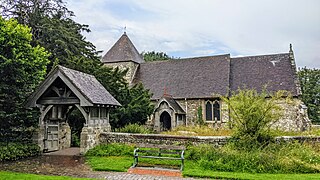
East Chiltington is a village and civil parish in the Lewes District of East Sussex, England. It is centred four miles (5.9 km) south-east of Burgess Hill and five miles (8 km) north-west of Lewes. It is a strip parish of 3.76 square miles (9.7 km2), stretching northward from the crest of the South Downs. The village church is 13th century in origin; the vicar also has charge of two churches in Plumpton. Near the church there is a pub called The Jolly Sportsman. The Sussex Greensand Way, a Roman road, runs from east to west through the centre of the parish.

Westmeston Village in East Sussex, England

Westmeston is a village and civil parish in the Lewes District of East Sussex, England heavily dependent in amenities on larger Ditchling to the near-immediate northwest. It is four miles (6 km) south-southeast of Burgess Hill and (10 km) west of Lewes, on the northern slopes of the South Downs.

Sayers Common Human settlement in England

Sayers Common is a village in the Mid Sussex District of West Sussex, England. With Hurstpierpoint it forms one of the Mid Sussex parishes. It is located two miles (1.6 km) north-west of Hurstpierpoint. Situated until the 1990s on the main London to Brighton A23 road it has become a more popular residential village since being partially bypassed by the new A23 road. It has some very old cottages at its heart, and also contains the Priory of Our Lady, previously a residential retreat, now a specialist school for children with autism. The parish has an area of 2,029.88 square kilometres and a population of 6264 persons. The village has become well known in recent years as the location for one of the south easts largest car boot sales open most Sundays from March to October. It is in the civil parish of Hurstpierpoint and Sayers Common.

Pyecombe Human settlement in England

Pyecombe is a village and civil parish in the Mid Sussex District of West Sussex, England. The name 'Pyecombe' may derive from the Saxon "pic" meaning point or pike, in which case it may mean "valley marked by a projecting hill".

Lamberts Castle Historic hill fort in Dorset, England

Lambert's Castle is an Iron Age hillfort in the county of Dorset in southwest England. Since 1981 it has been designated as a Site of Special Scientific Interest (SSSI) on account of its geology, archaeology and ecology. The hillfort is designated a scheduled monument together with a bowl barrow, the sites of a post-medieval fair and a telegraph station. The site was on the Heritage at Risk Register but was removed in 2022 as a result of the Hillforts and Habitats Project.

Strawberry Banks Biological Site of Special Scientific Interest in Gloucestershire, England

Strawberry Banks is a 5.06-hectare (12.5-acre) biological Site of Special Scientific Interest in Gloucestershire, notified in 1993.

Ditchling Beacon Hill in East Sussex, England

Ditchling Beacon is the highest point in East Sussex, England, with an elevation of 248 m (814 ft). It is south of Ditchling and to the north-east of Brighton. It is a large chalk hill with a particularly steep northern face, covered with open grassland and sheep-grazing areas. It is the third-highest point on the South Downs, behind Butser Hill and Crown Tegleaze.

Clayton to Offham Escarpment Landform in Sussex, England

Clayton to Offham Escarpment is a 422.5-hectare (1,044-acre) linear biological Site of Special Scientific Interest (SSSI) which runs from Clayton in West Sussex to Lewes in East Sussex. Its ownership and management is divided between over fifteen landowners and farmers. Parts of Ditchling's Downs, e.g. TQ 323 133, and the scarp between Blackcap and Mount Harry, e.g. TQ 378 124, are owned by the National Trust. What remains of Ditchling Tenantry Down common at Ditchling Beacon is leased to the Sussex Wildlife Trust.

Park Corner Heath

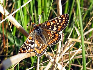
Park Corner Heath is a 2.9-hectare (7.2-acre) biological Site of Special Scientific Interest about 1.2 miles (2 km) south of East Hoathly, adjacent to the A22 main road between Uckfield and Eastbourne in East Sussex. It is managed by Butterfly Conservation.

Purple moor grass and rush pastures One of UKs natural habitats

Purple moor grass and rush pastures is a type of Biodiversity Action Plan habitat in the UK. It occurs on poorly drained neutral and acidic soils of the lowlands and upland fringe. It is found in the South West of England, especially in Devon.

Waldridge Fell

Waldridge Fell is a Site of Special Scientific Interest located immediately south-west of Chester-le-Street in the northern part of County Durham, England. It is one of the largest areas of lowland heath in County Durham and contains the only lowland valley-mire in the county. The fell is home to a number of plants and insects that are scarce to rare elsewhere in the county.

Cefn Blaenau

Cefn Blaenau is a 23-hectare Site of Special Scientific Interest in a small upland valley in Carmarthen and Dinefwr, Wales. It was designated an SSSI in 1989, primarily for its flush and spring vegetation as well as the diverse mosaic of unimproved pasture, ‘ffridd’ land, marshy grassland, wet heath, acid grassland, broadleaved woodland, streams, and small rock outcrops. These habitats, which are well represented at this site, have been greatly reduced in north Carmarthenshire due to land improvement, agricultural intensification, and afforestation. Only about 140 hectares of flush and spring vegetation remain in the county.

Daneway Banks SSSI Biological Site of Special Scientific Interest in Gloucestershire, England

Daneway Banks is a 17-hectare (42-acre) biological Site of Special Scientific Interest in Gloucestershire, notified in 1954 and renotified in 1983. It lies half a mile west of Sapperton and is part of a group of wildlife sites in the Frome Valley that includes Siccaridge Wood and Sapperton Canal reserves. The site is in the Cotswold Area of Outstanding Natural Beauty.

Arcot Hall Grasslands and Ponds is the name given to a Site of Special Scientific Interest (SSSI) near Cramlington in Northumberland, England, notable as the largest lowland species-rich grassland in North East England. The site is composed of grassland, heath, ponds, and associated damp habitats now rare in Northumberland.

Bevendean Down

Bevendean Down is a 64.6-hectare (160-acre) Local Nature Reserve in the Bevendean district in Brighton, East Sussex. It is owned by Brighton and Hove Council and managed by tenant farmers and others. It is mainly chalk grassland and there are also areas of woodland and scrub. This site is in five separate blocks.

Beeding Hill to Newtimber Hill

Beeding Hill to Newtimber Hill is a 321-hectare (790-acre) biological and geological Downland Site of Special Scientific Interest (SSSI) north of Shoreham-by-Sea in West Sussex. It is a Nature Conservation Review site, Grade 2, and it includes Devil's Dyke Geological Conservation Review site.

References

  1. 1 2 3 4 "Designated Sites View: Ditchling Common". Sites of Special Scientific Interest. Natural England. Retrieved 12 January 2019.
  2. "Map of Ditchling Common". Sites of Special Scientific Interest. Natural England. Retrieved 12 January 2019.
  3. 1 2 3 4 5 6 Bangs, David (2018). THE LAND OF THE BRIGHTON LINE: A Field Guide to the Middle Sussex and Southeast Surrey Weald. Farlington, Portsmouth: Bishops Printers. ISBN 9780954863821.
  4. "Ditchling". The Keep. Retrieved 27 August 2021.
  5. "Ditchling Common - Thursday 17 October 1968 - Hansard - UK Parliament". hansard.parliament.uk. Retrieved 27 August 2021.
  6. Spector, D (1968). "The Jews of Brighton, 1770—1900". Transactions & Miscellanies (Jewish Historical Society of England. No. 22. pp. 42–52. Retrieved 27 August 2021.
  7. "Ditchling Common citation" (PDF). Sites of Special Scientific Interest. Natural England. Retrieved 12 January 2019.
  8. Hulme, Neil (11 June 2017). "Black Hairstreak discovered in Sussex". Butterfly Conservation - Sussex Branch. Archived from the original on 26 September 2020. Retrieved 25 August 2021.
  9. J., Feltwell (2012). "Desktop Biodiversity Report" (PDF). Sussex Biodiversity Record Centre.
  10. Thomas, R.J., 2002. The costs of singing in nightingales. Animal Behaviour, 63(5), pp.959-966.

Coordinates: 50°57′04″N0°06′07″W / 50.951°N 0.102°W / 50.951; -0.102