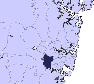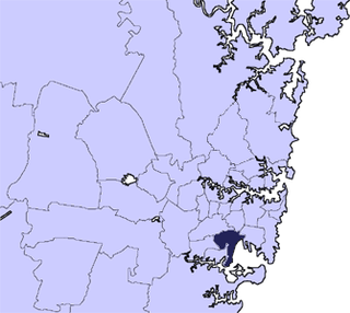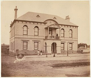
The Municipality of Ashfield was a local government area in the Inner West of Sydney, New South Wales, Australia. It is about 10 kilometres (6.2 mi) west of the Sydney central business district. The municipality was proclaimed on 28 December 1871 as the "Borough of Ashfield", which changed to the "Municipality of Ashfield" in 1906. On 12 May 2016, Ashfield merged with Marrickville Council and the Municipality of Leichhardt to form the Inner West Council.
The Division of West Sydney was an Australian electoral division in the state of New South Wales. It was located in the inner western suburbs of Sydney, and at various times included the suburbs of Pyrmont, Darling Harbour, Surry Hills, Balmain, Glebe, and from 1955 to 1969, Lord Howe Island.

The Division of Sydney is an Australian electoral division in the state of New South Wales.

The City of Bankstown was a local government area in the south-west region of Sydney, Australia, centred on the suburb of Bankstown, from 1895 to 2016. The last mayor of the City of Bankstown Council was Clr Khal Asfour, a member of the Labor Party.

Marrickville Council was a local government area located in the Inner West region of Sydney, Australia. It was originally created on 1 November 1861 as the "Municipality of Marrickville". On 12 May 2016, Marrickville Council was forcibly merged with Ashfield and Leichhardt councils into the newly formed Inner West Council.

The City of Rockdale was a local government area in southern and St George regions of Sydney, in the state of New South Wales, Australia. The city centre was located 12 kilometres (7.5 mi) south-west of the Sydney central business district, on the western shores of Botany Bay. First proclaimed on 13 January 1871, Rockdale was formerly known as the Municipality of West Botany until 1887 and the Municipality of Rockdale before being proclaimed as a City in 1995. Rockdale was amalgamated with the neighbouring City of Botany Bay on 9 September 2016 to form the new municipality of Bayside Council.

Waverley Council is a Local government area in the eastern suburbs of Sydney, in the state of New South Wales, Australia. First incorporated on 16 June 1859 as the Municipality of Waverley, it is one of the oldest-surviving local government areas in New South Wales. Waverley is bounded by the Tasman Sea to the east, the Municipality of Woollahra to the north, and the City of Randwick in the south and west. The administrative centre of Waverley Council is located on Bondi Road in Bondi Junction in the Council Chambers on the corner of Waverley Park.

The Shire of Banana is a local government area located in the Capricorn region of Queensland, Australia, inland from the regional city of Gladstone. The shire was named after the first township in the region (Banana), which in turn was named for the burial site of a huge dun coloured bullock named 'Banana'. The council sits in the town of Biloela, which is the largest town in the Shire.
Sydney-Pyrmont was an electoral district of the Legislative Assembly in the Australian state of New South Wales, created in 1894, partly replacing the multi-member electorate of West Sydney. It was named after and included the Sydney suburb of Pyrmont, consisting of the entire peninsula north of Fig Street and east of Wattle Street. In 1904, it was largely replaced by Pyrmont, which also absorbed part of the abolished district of Sydney-Denison.
Sydney-King was an electoral district of the Legislative Assembly in the Australian state of New South Wales, created in 1894 in central Sydney from part of the electoral district of East Sydney and named after Governor King. It was initially east of George Street, north of Liverpool Street and Oxford Street and west of Riley Street. It also included Lord Howe Island. In 1904, its name was changed to King.
Sydney-Lang was an electoral district of the Legislative Assembly in the Australian state of New South Wales, created in 1894 from part of the electoral district of West Sydney in inner Sydney and named after Presbyterian clergyman, writer, politician and activist John Dunmore Lang. It was west of George Street, generally south of Margaret Street, north of Hay Street and east of Darling Harbour. It was abolished in 1904 and absorbed into Darling Harbour.
The New South Wales Premier's Department, a department of the New South Wales Government, is responsible for leading the New South Wales public sector to deliver on the Government's commitments and priorities. The department provides administrative support that enables the cabinet to identify, design and implement a coordinated policy, project and reform agenda that boosts the efficiency, productivity and effectiveness across the State. The department consults and work closely with other New South Wales government departments, the Commonwealth Government, local government, business and the community to ensure responses to community needs are effective.

The Municipality of Redfern was a local government area of Sydney, New South Wales, Australia. The small municipality was proclaimed in 1859 as one of the first municipalities proclaimed under the new provisions of the Municipalities Act, 1858, and was centred on the suburbs of Redfern, Eveleigh, Darlington and Surry Hills. The council was amalgamated, along with most of its neighbours, with the City of Sydney to the north with the passing of the Local Government (Areas) Act 1948. From 1968 to 1982 and from 1989 to 2004, the area was part of the South Sydney councils.

The Central Coast Council is a local government area in the Central Coast region of New South Wales, Australia. It is adjacent to the Pacific Highway, Central Coast Highway, the Northern railway line and the Pacific Ocean. The council was formed on 12 May 2016 following the merger of the Gosford City and Wyong Shire Councils.

Bayside Council is a local government area in Sydney, New South Wales, Australia. It is located around part of Botany Bay, 7 kilometres (4.3 mi) to 12 kilometres (7.5 mi) south of the Sydney CBD. It includes suburbs of Southern Sydney as well as a small portion in the Eastern suburbs, south-east of the Sydney CBD. It comprises an area of 50 square kilometres (19 sq mi) and as at the 2016 census had a population of 156,058.

The Municipality of Erskineville was a local government area of Sydney, New South Wales, Australia. The municipality was proclaimed as the "Municipal District of Macdonald Town" on 23 May 1872 and, with an area of 0.8 square kilometres, was one of the smallest local government areas in Sydney and included the modern suburb of Erskineville, part of Eveleigh and the locality of Macdonaldtown. The council was amalgamated, along with most of its neighbours, with the City of Sydney to the north with the passing of the Local Government (Areas) Act 1948. From 1968 to 1982 and from 1989 to 2004, the area was part of the South Sydney councils, with the former Town Hall serving as its council chambers.

The Municipality of Mascot was a local government area in the inner south of Sydney, New South Wales, Australia. The municipality was proclaimed as the Borough of North Botany on 29 March 1888 and was renamed to the Municipality of Mascot, in order to differentiate itself from their southern neighbour, from 31 October 1911. It included the modern suburbs of Eastlakes and Daceyville, with parts of Mascot and Pagewood. From 1 January 1949, the council was amalgamated into the Municipality of Botany, with the passing of the Local Government (Areas) Act 1948.

The next Australian federal election will be held on or before 27 September 2025 to elect members of the 48th Parliament of Australia. All 150 seats in the House of Representatives and likely 40 of the 76 seats in the Senate will be contested. It is expected that at this election, the Labor government of Prime Minister Anthony Albanese will be seeking re-election to a second term in office, opposed by the Liberal/National Coalition under Leader of the Opposition Peter Dutton.

Foreign relations exist between Australia and Latvia. Australia first recognised Latvia on 22 September 1921 and was among the first countries to re-recognise Latvia's independence on 27 August 1991. Both countries re-established diplomatic relations on 21 November 1991. Australia is represented in Latvia through its embassy in Stockholm, Sweden and an honorary consulate in Riga. Latvia has had an embassy in Canberra since October 2021, and also has honorary consulates in Sydney, Brisbane, Adelaide, Melbourne and Perth.


