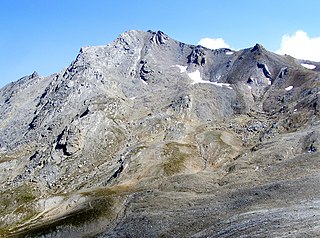
The Cottian Alps are a mountain range in the southwestern part of the Alps. They form the border between France and Italy (Piedmont). The Fréjus Road Tunnel and Fréjus Rail Tunnel between Modane and Susa are important transportation arteries between France and Italy (Turin).

Avigliana is a town and comune (municipality) in the Metropolitan City of Turin in the Piedmont region or Italy, with 12,480 inhabitants as of January 1, 2017. It lies about 25 kilometres (16 mi) west of Turin in the Susa valley, on the highway going from Turin to Frejus, France.

Dora Baltea or Doire Baltée is a river in northwestern Italy. It is a left-hand tributary of the Po and is about 170 kilometres (110 mi) long.

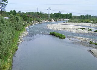
The Dora Riparia is an alpine river, a left-hand tributary of the Po. It is 125 kilometres (78 mi) long, with a 1,231 square kilometres (475 sq mi) drainage basin. It originates in the Cottian Alps, close to the Col de Montgenèvre in France, where it is called the Piccola Dora. Its name becomes the Dora Riparia after the confluence with the Ripa in the Argentera Valley and the Thuras de Bousson close to Cesana.

The Fréjus Road Tunnel is a tunnel that connects France and Italy. It runs under Col du Fréjus in the Cottian Alps between Modane in France and Bardonecchia in Italy. It is one of the major trans-Alpine transport routes between France and Italy being used for 80% of the commercial road traffic.

Mont Cenis is a massif and a pass in Savoie (France), which forms the limit between the Cottian and Graian Alps.

The Susa Valley is a valley in the Metropolitan City of Turin, Piedmont region of northern Italy, located between the Graian Alps in the north and the Cottian Alps in the south. It is one of the longest valleys of the Italian Alps. It extends over 50 kilometres (31 mi) in an east-west direction from the French border to the outskirts of Turin. The valley takes its name from the city of Susa which lies in the valley. The Dora Riparia river, a tributary of the Po, flows through the valley.

Bardonecchia is an Italian town and comune located in the Metropolitan City of Turin, in the Piedmont region, in the western part of Susa Valley. It grew out of a small village with the works for the Frejus Rail Tunnel, the first crossing the Alps.

Bruzolo ) is a comune of the Metropolitan City of Turin in the Italian region Piedmont. Located some 43 kilometres (27 mi) west of Turin, in the lower Susa Valley, it is a member of the Comunità Montana Bassa Valle di Susa e Val Cenischia. Bruzolo borders the following municipalities: Usseglio, Condove, Chianocco, San Didero, and San Giorio di Susa.

Sant'Ambrogio di Torino is a comune (municipality) in the Metropolitan City of Turin in the Italian region Piedmont, located about 25 km west of Turin in the Susa Valley.

The Cenischia is a mountain torrent which straddles the south-west French department of Savoie and the north-west Italian Metropolitan City of Turin, in Piedmont. Part of the Po basin, it is a left tributary of the Dora Riparia and forms the valley called the Val Cenischia which marks the boundary between the Graian Alps to the north and the Cottian Alps to the south.

Turin is a city and an important business and cultural centre in northern Italy. It is the capital city of Piedmont and of the Metropolitan City of Turin, and was the first Italian capital from 1861 to 1865. The city is mainly on the western bank of the Po River, below its Susa Valley, and is surrounded by the western Alpine arch and Superga Hill. The population of the city proper is 852,223 while the population of the urban area is estimated by Eurostat to be 1.7 million inhabitants. The Turin metropolitan area is estimated by the OECD to have a population of 2.2 million.

Col de l'Échelle is a mountain pass in the Alps in the department of Hautes-Alpes in France. It is the lower mountain pass between France and Italy and connects Vallée de la Clarée and Vallée Étroite. The highest point between both valleys is actually at 1779 meter, some kilometers north of the official Col de l'Échelle at the Mauvais Pas. Between both cols, a small dry valley exists.

Punta Sommeiller or Pointe Sommeiller is a mountain of the Province of Turin, Italy and of Savoie, France. It lies in the Cottian Alps range. It has an elevation of 3,333 metres (10,935 ft) above sea level.

Col d'Étache in French,, is a pedestrian pass across the Cottian Alps. It connects Susa Valley and Maurienne.

The Ambin group is a sub-range of the Cottian Alps located on the French-Italian border.

The Punta Nera is a mountain of Savoie (France) and of the Province of Turin (Italy). It lies in the Cottian Alps range. It has an elevation of 3,047 metres above sea level.

Le Grand Argentier is a mountain of Savoie (France). It lies in the Cottian Alps range at an elevation of 3,042 metres (9,980 ft) above sea level.
The Belaci were a small Gallic tribe dwelling in the Alpes Cottiae, around present-day Oulx, during the Iron Age.


