
Kidderminster is a market town and civil parish in Worcestershire, England, 20 miles (32 km) south-west of Birmingham and 12 miles (19 km) north of Worcester. Located north of the River Stour and east of the River Severn, in the 2021 census, it had a population of 57,400. The town is twinned with Husum, Germany.

The River Severn, at 220 miles (354 km) long, is the longest river in Great Britain. It is also the river with the most voluminous flow of water by far in all of England and Wales, with an average flow rate of 107 m3/s (3,800 cu ft/s) at Apperley, Gloucestershire. It rises in the Cambrian Mountains in mid Wales, at an altitude of 2,001 feet (610 m), on the Plynlimon massif, which lies close to the Ceredigion/Powys border near Llanidloes. The river then flows through Shropshire, Worcestershire and Gloucestershire. The county towns of Shrewsbury, Worcester and Gloucester lie on its course.

Bewdley is a town and civil parish in the Wyre Forest District in Worcestershire, England, on the banks of the River Severn. It is in the Severn Valley, and is 3 miles (4.8 km) west of Kidderminster, 10 miles (16 km) north of Worcester and 25 miles (40 km) southwest of Birmingham. It lies on the River Severn, at the gateway of the Wyre Forest national nature reserve, and at the time of the 2021 census had a population of 9,267. Bewdley is a popular tourist destination and is known for the Bewdley Bridge, designed by Thomas Telford, and the well-preserved Georgian riverside.

Stourport-on-Severn, often shortened to Stourport, is a town and civil parish in the Wyre Forest District of North Worcestershire, England, a few miles to the south of Kidderminster and downstream on the River Severn from Bewdley. At the 2021 census, it had a population of 20,653.
Wyre Forest is a large, semi-natural woodland and forest measuring 26.34 square kilometres (10.17 sq mi) which straddles the borders of Worcestershire and Shropshire, England. Knowles Mill, a former corn mill owned by the National Trust lies within the forest.

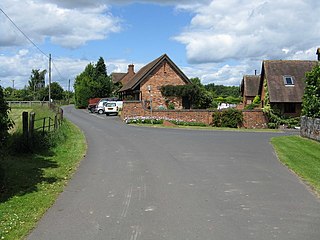
Areley Kings is a village on the River Severn, in the civil parish of Stourport-on-Severn, in the Wyre Forest of Worcestershire, England. It is 10 miles north of Worcester and south of Stourport on Severn. It is in the Wyre Forest. The village is featured in the Domesday Book and is home to many historical places of interest such as Areley Hall and St Bartholomew's Church.

Known as the Hagley Road in Birmingham, the A456 is a main road in England running between Central Birmingham and Woofferton, Shropshire, south of Ludlow. Some sections of the route, for example Edgbaston near Bearwood, are also the route of the Elan Aqueduct which carries Birmingham's water supply from the Elan Valley.

Wyre Forest is a local government district in Worcestershire, England. It is named after the ancient woodland of Wyre Forest. The largest town is Kidderminster, where the council is based. The district also includes the towns of Stourport-on-Severn and Bewdley, along with several villages and surrounding rural areas.
Holt is a village and civil parish in the Malvern Hills District of the county of Worcestershire, England. The church is dedicated to St. Martin, and dates from about the 12th century. Holt Bridge, over the River Severn, was designed by Thomas Telford, and opened in 1830.
Little Witley is a village and civil parish in the Malvern Hills District in the county of Worcestershire, England.

Ombersley is a village and civil parish in Wychavon district, in the county of Worcestershire, England. The parish includes the hamlet of Holt Fleet, where Telford's 1828 Holt Fleet Bridge crosses the River Severn. The 2011 census recorded a population of 2,360 for the parish.
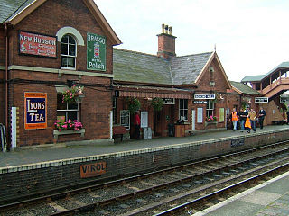
Bewdley railway station serves the town of Bewdley in Worcestershire, England. Until 2014, it was the administrative headquarters of the Severn Valley Railway, after which they were moved to Comberton Hill, Kidderminster. Bewdley is the principal intermediate station on the line.

The English Lowlands beech forests is a terrestrial ecoregion in the United Kingdom, as defined by the World Wide Fund for Nature (WWF) and the European Environment Agency (EEA). It covers 45,600 km2 (17,600 sq mi) of Southern England, approximately as far as the border with Devon and South Wales in the west, into the Severn valley in the north-west, into the East Midlands in the north, and up to the border of Norfolk in the north-east. The WWF code for this ecoregion is PA0421.
Dick Brook is small tributary stream of the River Severn that flows through Worcestershire, England.
Jannion Steele Elliott, his surname sometimes hyphenated to Steele-Elliott, was a British ornithologist and naturalist who, in particular, accumulated large amounts of information on the mammals and birds of Bedfordshire.

Spennells Valley is a local nature reserve in south-east Kidderminster, in Worcestershire, England.

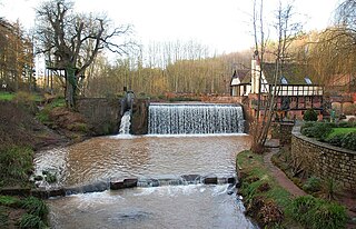
Wilden Marsh is a nature reserve of the Worcestershire Wildlife Trust. It is situated between Kidderminster and Stourport-on-Severn, in Worcestershire, England, immediately east of the Staffordshire and Worcestershire Canal, and alongside the River Stour. The reserve is a Site of Special Scientific Interest.
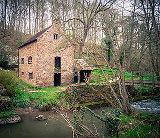
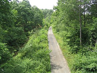
Knowles Mill is the remains of an eighteenth-century water-powered grain mill, located in the Wyre Forest in Worcestershire, England. The mill has been owned by the National Trust since 1938. The mill and its surroundings feature extant machinery, as well as notable populations of adders and wood cranesbill.

Dowles is a hamlet in the civil parish of Upper Arley, in the Wyre Forest district, in the county of Worcestershire, England. It is about 3 miles from the town of Kidderminster. The parish was divided into two parts by the Severn.

Stourport Civic Centre is a municipal building in New Street in Stourport-on-Severn, a town in Worcestershire, in England. The building, which is currently used as a public events venue, is owned by a community group.

