Downey, Idaho

Last updated

Downey, Idaho
Bannock County Idaho Incorporated and Unincorporated areas Downey Highlighted 1622600.svg
Location of Downey in Bannock County, Idaho.
Coordinates: 42°25′46″N112°7′21″W / 42.42944°N 112.12250°W / 42.42944; -112.12250
Country United States
State Idaho
County Bannock
Government
  MayorRex Nielsen
Area
[1]
  Total0.98 sq mi (2.53 km2)
  Land0.98 sq mi (2.53 km2)
  Water0.00 sq mi (0.00 km2)
Elevation
4,865 ft (1,483 m)
Population
 (2010) [2]
  Total625
  Estimate 
(2019) [3]
633
  Density647.24/sq mi (249.80/km2)
Time zone UTC-7 (Mountain (MST))
  Summer (DST) UTC-6 (MDT)
ZIP code
83234
Area code(s) 208, 986
FIPS code 16-22600
GNIS feature ID2410353
Website www.downeyidaho.us

Downey is a city in the Marsh Valley in southern Bannock County, Idaho, United States. [4] It is part of the Pocatello Metropolitan Statistical Area. The population was 625 at the 2010 census.

Contents

The community was reportedly named after one Mr. Downey, a director of the Union Pacific Railroad. However, researchers have been unable verify existence of said Mr. Downey. Notwithstanding, some have asserted he was a track worker, not a director. [5] [6]

Geography

Downey is located at 42°25′46″N112°7′21″W / 42.42944°N 112.12250°W / 42.42944; -112.12250 (42.429312, -112.122397), [7] at 4,860 feet (1,480 m) in Marsh Valley. It lies on the route of U.S. Highway 91.

According to the United States Census Bureau, the city has a total area of 0.99 square miles (2.56 km2), all of it land. [8]

Demographics

Historical population
CensusPop.Note
1920 522
1930 5535.9%
1940 67321.7%
1950 74811.1%
1960 726−2.9%
1970 586−19.3%
1980 64510.1%
1990 626−2.9%
2000 613−2.1%
2010 6252.0%
2019 (est.)633 [3] 1.3%
U.S. Decennial Census [9]

2010 census

As of the census [2] of 2010, there were 625 people, 255 households, and 168 families residing in the city. The population density was 631.3 inhabitants per square mile (243.7/km2). There were 290 housing units at an average density of 292.9 per square mile (113.1/km2). The racial makeup of the city was 98.1% White, 0.2% Native American, 0.8% Pacific Islander, 0.5% from other races, and 0.5% from two or more races. Hispanic or Latino of any race were 1.6% of the population.

There were 255 households, of which 27.1% had children under the age of 18 living with them, 55.3% were married couples living together, 5.1% had a female householder with no husband present, 5.5% had a male householder with no wife present, and 34.1% were non-families. 30.6% of all households were made up of individuals, and 19.6% had someone living alone who was 65 years of age or older. The average household size was 2.45 and the average family size was 3.13.

The median age in the city was 47.1 years. 27.2% of residents were under the age of 18; 5% were between the ages of 18 and 24; 16.6% were from 25 to 44; 26.8% were from 45 to 64; and 24.6% were 65 years of age or older. The gender makeup of the city was 49.8% male and 50.2% female.

2000 census

As of the census [10] of 2000, there were 613 people, 233 households, and 165 families residing in the city. The population density was 622.8 inhabitants per square mile (240.5/km2). There were 264 housing units at an average density of 268.2 per square mile (103.6/km2). The racial makeup of the city was 97.39% White, 0.49% Native American, 0.16% Asian, 0.49% Pacific Islander, 1.31% from other races, and 0.16% from two or more races. Hispanic or Latino of any race were 1.63% of the population.

There were 233 households, out of which 32.2% had children under the age of 18 living with them, 61.8% were married couples living together, 6.0% had a female householder with no husband present, and 28.8% were non-families. 27.0% of all households were made up of individuals, and 18.9% had someone living alone who was 65 years of age or older. The average household size was 2.63 and the average family size was 3.23.

In the city, the population was spread out, with 30.5% under the age of 18, 5.9% from 18 to 24, 22.2% from 25 to 44, 17.0% from 45 to 64, and 24.5% who were 65 years of age or older. The median age was 39 years. For every 100 females, there were 97.1 males. For every 100 females age 18 and over, there were 94.5 males.

The median income for a household in the city was $26,667, and the median income for a family was $34,432. Males had a median income of $30,781 versus $20,500 for females. The per capita income for the city was $11,908. About 12.7% of families and 18.6% of the population were below the poverty line, including 25.7% of those under age 18 and 14.6% of those age 65 or over.

Education

Downey is part of the Marsh Valley School Joint District #21 and is served by three schools:

Transportation

Downey is served by one U.S. Highway and one state highway:

See also

Related Research Articles

<span class="mw-page-title-main">Power County, Idaho</span> County in Idaho, United States

Power County is a county located in the U.S. state of Idaho. As of the 2020 Census, the county had a population of 7,878. The county seat and largest city is American Falls. The county was created by the Idaho Legislature on January 30, 1913, by a partition of Cassia County. It is named for an early hydroelectric power plant (1902) at the American Falls.

<span class="mw-page-title-main">Oneida County, Idaho</span> County in Idaho, United States

Oneida County is a county located in the U.S. state of Idaho. As of the 2020 Census the county had a population of 4,564. The county seat and largest city is Malad City. Most of the county's population lives in Malad City and the surrounding Malad Valley.
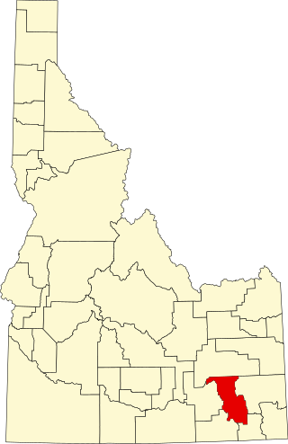
<span class="mw-page-title-main">Bannock County, Idaho</span> County in Idaho, United States

Bannock County is a county in the southeastern part of Idaho. As of the 2020 Census, the population was 87,018, making it the sixth-most populous county in Idaho. The county seat and largest city is Pocatello. The county was established in 1893 and named after the local Bannock tribe. It is one of the counties with territories included in the Fort Hall Indian Reservation of the federally recognized Shoshone-Bannock Tribes.

<span class="mw-page-title-main">Eagle, Idaho</span> City in Idaho, United States

Eagle is a city in the western United States in Ada County, Idaho, ten miles (16 km) northwest of downtown Boise. The population was 30,346 at the time of the 2020 census.

<span class="mw-page-title-main">Arimo, Idaho</span> City in Bannock County, Idaho, United States

Arimo is a city in the Marsh Valley in central Bannock County, Idaho, United States, that is part of the 'Pocatello Metropolitan Statistical Area'. The population was 354 at the 2020 census.
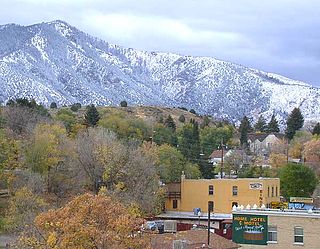
<span class="mw-page-title-main">Lava Hot Springs, Idaho</span> City in Bannock County, Idaho, United States

Lava Hot Springs is a city along the Portneuf River in eastern Bannock County, Idaho, United States. It is part of the Pocatello, Idaho metropolitan area. The population was 407 at the 2010 census, down from 521 in 2000. Located in the mountainous valley of the Portneuf River on the old route of the Oregon Trail and California Trail, the city has become a popular resort location, noted for its numerous hot springs amenable to bathing and a turbulent inner tube run through part of the town.

<span class="mw-page-title-main">St. Charles, Idaho</span> City in Idaho, United States

St. Charles is a city in southern Bear Lake County, Idaho, United States, that is located near the northwestern shore of Bear Lake. Its population was 131 at the 2010 census, down from 156 in 2000.
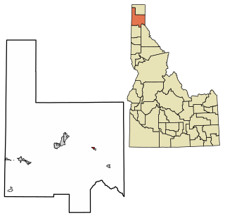
<span class="mw-page-title-main">Hope, Idaho</span> City in Idaho, United States

Hope is a city in Bonner County, Idaho, United States. The population was 86 at the 2010 census.

<span class="mw-page-title-main">Swan Valley, Idaho</span> City in Idaho, United States

Swan Valley is a city in Bonneville County, Idaho, United States. It is part of the Idaho Falls, Idaho Metropolitan Statistical Area. The population was 204 at the 2010 census.

<span class="mw-page-title-main">Oxford, Idaho</span> City in Idaho, United States

Oxford is a city in Franklin County, Idaho, United States. The population was 48 at the 2010 census.
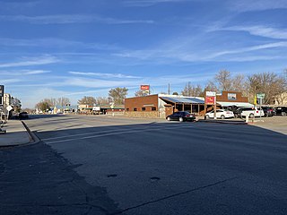
<span class="mw-page-title-main">Hagerman, Idaho</span> City in Idaho, United States

Hagerman is a city in Gooding County, Idaho, United States. The population was 872 at the 2010 census, up from 656 in 2000. The area is noted for its fossil beds and the Thousand Springs of the Eastern Snake Plain Aquifer. Hagerman is home to a national fish hatchery, a university research station, and extensive aquaculture, assisted by an abundance of geothermal water for temperature regulation.

<span class="mw-page-title-main">Jerome, Idaho</span> City in Idaho, United States

Jerome is a city in and county seat of Jerome County, Idaho, United States. The population was 10,890 at the 2010 census, up from 7,780 in 2000. The city is the county seat of Jerome County, and is part of the Twin Falls Micropolitan Statistical Area. It is the second largest city in Idaho's Magic Valley region, second only to Twin Falls which is located 10 miles (16 km) southeast. Jerome's economy is largely agrarian, with dairy farming being one of the main revenue sources for the local economy.

<span class="mw-page-title-main">Leadore, Idaho</span> City in Idaho, United States

Leadore is an incorporated small town in Lemhi County, Idaho, United States. The population was 105 at the 2010 census.

<span class="mw-page-title-main">Rupert, Idaho</span> City in Idaho, United States

Rupert is the county seat and largest city of Minidoka County, Idaho,. It is part of the Burley Micropolitan Statistical Area. The population was 6,082 at the 2020 census, up from 5,554 in 2010.

<span class="mw-page-title-main">Fruitland, Idaho</span> City in Payette County, Idaho, United States

Fruitland is a city along the Snake and Payette rivers in Payette County, Idaho, United States. It lies along U.S. Route 95 in the Treasure Valley of southwest Idaho, about 50 miles (80 km) west of Boise on the border with Oregon. It is part of the Ontario Micropolitan Area. Fruitland is named after apple orchards that surround the community, and its slogan is "The Big Apple of Idaho."

<span class="mw-page-title-main">American Falls, Idaho</span> City in Idaho, United States

American Falls is a city in and the county seat of Power County, Idaho. The population was 4,457 at the time of the 2010 census.

<span class="mw-page-title-main">Rockland, Idaho</span> City in Idaho, United States

Rockland is a city in Power County, Idaho, United States. The population was 295 at the 2010 census.

<span class="mw-page-title-main">Driggs, Idaho</span> City in Idaho, United States

Driggs is a city in the western United States in eastern Idaho, and is the county seat of Teton County. Part of the Jackson, WY-ID Micropolitan Statistical Area, it is located in Teton Valley, the headwaters of the Teton River. The population was 1,660 at the 2010 census, up from 1,100 in 2000.

<span class="mw-page-title-main">Plymouth, Iowa</span> City in Iowa, United States

Plymouth is a city in Cerro Gordo County, Iowa, United States, along the Shell Rock River. The population was 375 at the time of the 2020 census. It is part of the Mason City Micropolitan Statistical Area.

<span class="mw-page-title-main">Cedar Grove, West Virginia</span> Town in West Virginia, United States

Cedar Grove is a town in Kanawha County, West Virginia, United States. The population was 714 at the 2020 census. Cedar Grove was incorporated in 1902. Its name is derived from the time the town was established, when a large juniper forest, misidentified as cedars by early settlers, was growing at that location. Cedar Grove is the site of Fort Kelley and the oldest settlement in the Kanawha Valley, dating from 1773. Landmarks located here include the Tompkins Home (1844) and the Old Brick Church (1853). The current mayor is James Hudnall.

References

  1. "2019 U.S. Gazetteer Files". United States Census Bureau. Retrieved July 9, 2020.
  2. 1 2 "U.S. Census website". United States Census Bureau . Retrieved December 18, 2012.
  3. 1 2 "Population and Housing Unit Estimates". United States Census Bureau. May 24, 2020. Retrieved May 27, 2020.
  4. U.S. Geological Survey Geographic Names Information System: Doweny
  5. "Downey Idaho History". downeyidaho.com. Downey, Idaho: Downey Chamber of Commerce. Retrieved May 1, 2020.
  6. The Utah Genealogical and Historical Magazine, Volumes 9-10. 1918. p. 121.
  7. "US Gazetteer files: 2010, 2000, and 1990". United States Census Bureau. February 12, 2011. Retrieved April 23, 2011.
  8. "US Gazetteer files 2010". United States Census Bureau. Archived from the original on July 2, 2012. Retrieved December 18, 2012.
  9. "Census of Population and Housing". Census.gov. Retrieved June 4, 2015.
  10. "U.S. Census website". United States Census Bureau . Retrieved January 31, 2008.