Highway engineering is a professional engineering discipline branching from the civil engineering subdiscipline of transportation engineering that involves the planning, design, construction, operation, and maintenance of roads, highways, streets, bridges, and tunnels to ensure safe and effective transportation of people and goods. Highway engineering became prominent towards the latter half of the 20th century after World War II. Standards of highway engineering are continuously being improved. Highway engineers must take into account future traffic flows, design of highway intersections/interchanges, geometric alignment and design, highway pavement materials and design, structural design of pavement thickness, and pavement maintenance.

A road surface or pavement is the durable surface material laid down on an area intended to sustain vehicular or foot traffic, such as a road or walkway. In the past, gravel road surfaces, macadam, hoggin, cobblestone and granite setts were extensively used, but these have mostly been replaced by asphalt or concrete laid on a compacted base course. Asphalt mixtures have been used in pavement construction since the beginning of the 20th century and are of two types: metalled (hard-surfaced) and unmetalled roads. Metalled roadways are made to sustain vehicular load and so are usually made on frequently used roads. Unmetalled roads, also known as gravel roads, are rough and can sustain less weight. Road surfaces are frequently marked to guide traffic.

The grade of a physical feature, landform or constructed line refers to the tangent of the angle of that surface to the horizontal. It is a special case of the slope, where zero indicates horizontality. A larger number indicates higher or steeper degree of "tilt". Often slope is calculated as a ratio of "rise" to "run", or as a fraction in which run is the horizontal distance and rise is the vertical distance.

Aquaplaning or hydroplaning by the tires of a road vehicle, aircraft or other wheeled vehicle occurs when a layer of water builds between the wheels of the vehicle and the road surface, leading to a loss of traction that prevents the vehicle from responding to control inputs. If it occurs to all wheels simultaneously, the vehicle becomes, in effect, an uncontrolled sled. Aquaplaning is a different phenomenon from when water on the surface of the roadway merely acts as a lubricant. Traction is diminished on wet pavement even when aquaplaning is not occurring.
Standards for Interstate Highways in the United States are defined by the American Association of State Highway and Transportation Officials (AASHTO) in the publication A Policy on Design Standards: Interstate System. For a certain highway to be considered an Interstate Highway, it must meet these construction requirements or obtain a waiver from the Federal Highway Administration.

The AASHO Road Test was a series of experiments carried out by the American Association of State Highway and Transportation Officials (AASHTO), to determine how traffic contributed to the deterioration of highway pavements.
A banked turn is a turn or change of direction in which the vehicle banks or inclines, usually towards the inside of the turn. For a road or railroad this is usually due to the roadbed having a transverse down-slope towards the inside of the curve. The bank angle is the angle at which the vehicle is inclined about its longitudinal axis with respect to the horizontal.

A curb, or kerb, is the edge where a raised sidewalk or road median/central reservation meets a street or other roadway.

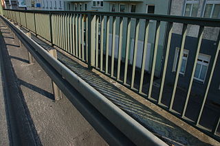
Traffic barriers keep vehicles within their roadway and prevent them from colliding with dangerous obstacles such as boulders, sign supports, trees, bridge abutments, buildings, walls, and large storm drains, or from traversing steep (non-recoverable) slopes or entering deep water. They are also installed within medians of divided highways to prevent errant vehicles from entering the opposing carriageway of traffic and help to reduce head-on collisions. Some of these barriers, designed to be struck from either side, are called median barriers. Traffic barriers can also be used to protect vulnerable areas like school yards, pedestrian zones, and fuel tanks from errant vehicles.

In railway engineering, cant deficiency is defined in the context of travel of a rail vehicle at constant speed on a constant-radius curve. Cant itself refers to the superelevation of the curve, that is, the difference between the elevations of the outside and inside rails. Cant deficiency is present when a rail vehicle's speed on the curve is greater than the speed at which the components of wheel to rail force are normal to the plane of the track. In that case, the resultant force exerts on the outside rail more than the inside rail, in which it creates lateral acceleration toward the outside of the curve. In order to reduce cant deficiency, the speed can be reduced or the superelevation can be increased. The amount of cant deficiency is expressed in terms of required superelevation to be added in order to bring the resultant force into balance between the two rails.
Cross slope, cross fall or camber is a geometric feature of pavement surfaces: the transverse slope with respect to the horizon. It is a very important safety factor. Cross slope is provided to provide a drainage gradient so that water will run off the surface to a drainage system such as a street gutter or ditch. Inadequate cross slope will contribute to aquaplaning. On straight sections of normal two-lane roads, the pavement cross section is usually highest in the center and drains to both sides. In horizontal curves, the cross slope is banked into superelevation to reduce steering effort and lateral force required to go around the curve. All water drains to the inside of the curve. If the cross slope magnitude oscillates within 1–25 metres (3–82 ft), the body and payload of high (heavy) vehicles will experience high roll vibration.

Road slipperiness is a condition of low skid resistance due to insufficient road friction. It is a result of snow, ice, water, loose material and the texture of the road surface on the traction produced by the wheels of a vehicle.
Road surface textures are deviations from a planar and smooth surface, affecting the vehicle/tyre interaction. Pavement texture is divided into: microtexture with wavelengths from 0 mm to 0.5 millimetres (0.020 in), macrotexture with wavelengths from 0.5 millimetres (0.020 in) to 50 millimetres (2.0 in) and megatexture with wavelengths from 50 millimetres (2.0 in) to 500 millimetres (20 in).

The minimum railway curve radius is the shortest allowable design radius for the centerline of railway tracks under a particular set of conditions. It has an important bearing on construction costs and operating costs and, in combination with superelevation in the case of train tracks, determines the maximum safe speed of a curve. The minimum radius of a curve is one parameter in the design of railway vehicles as well as trams; monorails and automated guideways are also subject to a minimum radius.

A roadway departure is a type of incident that occurs when a vehicle leaves the roadway. Such incidents can lead to a single-vehicle collision.

The geometric design of roads is the branch of highway engineering concerned with the positioning of the physical elements of the roadway according to standards and constraints. The basic objectives in geometric design are to optimize efficiency and safety while minimizing cost and environmental damage. Geometric design also affects an emerging fifth objective called "livability," which is defined as designing roads to foster broader community goals, including providing access to employment, schools, businesses and residences, accommodate a range of travel modes such as walking, bicycling, transit, and automobiles, and minimizing fuel use, emissions and environmental damage.
The European Campaign for Safe Road Design aims to influence the European Union to make safe road design a European transport priority and save unnecessary deaths on Europe's roads. The campaign is a partnership between 28 road safety stakeholders from across Europe, claiming that a formal safe road infrastructure initiative could reduce the number of killed and seriously injured by 50,000 per year in less than a decade, saving 0.5% of GDP - €50 billion, saving at least 300 deaths and serious injuries per day. The European campaign builds on the UK Campaign for Safe Road Design which has worked to influence the UK government since 2008.
Diamond grinding is a pavement preservation technique that corrects a variety of surface imperfections on both concrete and asphalt concrete pavements. Most often utilized on concrete pavement, diamond grinding is typically performed in conjunction with other concrete pavement preservation (CPP) techniques such as road slab stabilization, full- and partial-depth repair, dowel bar retrofit, cross stitching longitudinal cracks or joints and joint and crack resealing. Diamond grinding restores rideability by removing surface irregularities caused during construction or through repeated traffic loading over time. The immediate effect of diamond grinding is a significant improvement in the smoothness of a pavement. Another important effect of diamond grinding is the considerable increase in surface macrotexture and consequent improvement in skid resistance, noise reduction and safety.

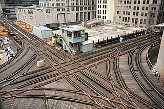
Track geometry is concerned with the properties and relations of points, lines, curves, and surfaces in the three-dimensional positioning of railroad track. The term is also applied to measurements used in design, construction and maintenance of track. Track geometry involves standards, speed limits and other regulations in the areas of track gauge, alignment, elevation, curvature and track surface. Standards are usually separately expressed for horizontal and vertical layouts although track geometry is three-dimensional.

The cant of a railway track or camber of a road is the rate of change in elevation (height) between the two rails or edges of the road. This is normally greater where the railway or road is curved; raising the outer rail or the outer edge of the road creates a banked turn, thus allowing vehicles to travel round the curve at faster speeds which would otherwise not be possible if the surface is flat or level.


