Dronfield Urban District

Last updated

Dronfield
Dronfield Urban District, Derbyshire (1970).svg
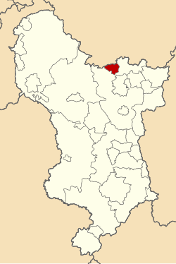
Dronfield Urban District shown within Derbyshire in 1970.
Area
  19111,045 acres (4.23 km2)
  19613,452 acres (13.97 km2)
Population
  19113,943
  196111,303
History
  Created1894
  Abolished1974
  Succeeded by North East Derbyshire
Status Urban District
GovernmentDronfield Urban District Council
   HQ Dronfield

Dronfield was an Urban District in Derbyshire, England from 1894 to 1974. [1] [2] It was created under the Local Government Act 1894.

It was enlarged in 1935 when parts of the civil parishes of Coal Aston, Dronfield Woodhouse and Unstone were transferred to the district.

The district was abolished in 1974 under the Local Government Act 1972 and combined with Chesterfield Rural District (except the civil parish of Brimington) and Clay Cross Urban District to form the new North East Derbyshire district.

Related Research Articles

North East Derbyshire Local government district in England

North East Derbyshire is a local government district in Derbyshire, England. It borders the districts of Chesterfield, Bolsover, Amber Valley and Derbyshire Dales in Derbyshire, and Sheffield and Rotherham in South Yorkshire. The population of the district as taken at the 2011 Census was 99,023. The district council is a non-constituent partner member of the Sheffield City Region Combined Authority. The district is a non-constituent member of the Sheffield City Region and shares a membership along with neighbouring Derbyshire Dales, Borough of Chesterfield, Bolsover District and Bassetlaw District in Nottinghamshire. The district is also part of The Derby, Derbyshire, Nottingham and Nottinghamshire Local Enterprise Partnership.

Holme Valley Civil parish in West Yorkshire, England

Holme Valley is a large civil parish in the Metropolitan Borough of Kirklees in West Yorkshire, England. It has a population of 25,049, increasing to 34,680 for the two wards in the 2011 Census. Its administrative centre is in Holmfirth. Other sizeable settlements in the parish include, Brockholes, Honley and New Mill. It is named from the River Holme that runs through the parish.

Tintwistle Rural District

Tintwistle Rural District was a local government district in north east Cheshire, England from 1894 to 1974.

Bucklow Rural District was, from 1894 to 1974, a local government district in the north of the administrative county of Cheshire, England. Following the Local Government Act 1972, this rural district was split between the new Greater Manchester boroughs of Trafford and Manchester, and Macclesfield, which was retained in Cheshire.

Wigan Rural District was an administrative district in Lancashire, England from 1894 to 1974. The rural district comprised an area to the north, but did not include the town of Wigan.

Clowne Rural District

Clowne was a rural district in Derbyshire, England from 1894 to 1974.

Chesterfield Rural District

Chesterfield was a Rural District in Derbyshire, England from 1894 to 1974. It was created under the Local Government Act 1894.

Alfreton Urban District

Alfreton was an Urban District in Derbyshire, England from 1894 to 1974. It was created under the Local Government Act 1894.

Ashbourne Urban District

Ashbourne was an Urban District in Derbyshire, England from 1894 to 1974. It was created under the Local Government Act 1894.

Bakewell Urban District

Bakewell was an Urban District in Derbyshire, England from 1894 to 1974. It was created under the Local Government Act 1894.

Belper Urban District

Belper was an Urban District in Derbyshire, England from 1894 to 1974. It was created under the Local Government Act 1894.

Bolsover Urban District Historical administrative district in Derbyshire, England

Bolsover was an Urban District in Derbyshire, England from 1894 to 1974. It was created under the Local Government Act 1894.

Municipal Borough of Buxton

Buxton was an Urban District from 1894 to 1917 and a Municipal Borough from 1917 to 1974 in Derbyshire, England.

Municipal Borough of Chesterfield

Chesterfield was a municipal borough in Derbyshire, England from 1835 to 1974. It was formed under the Municipal Corporations Act 1835 from the Ancient borough of Chesterfield.

Clay Cross Urban District

Clay Cross was an Urban District in Derbyshire, England from 1894 to 1974. It was created under the Local Government Act 1894.

Municipal Borough of Glossop

Glossop was a Municipal Borough in Derbyshire, England from 1866 to 1974. It was created under the Municipal Corporations Act 1835.

Heanor was an Urban District in Derbyshire, England from 1894 to 1974. It was created under the Local Government Act 1894.

Long Eaton was an Urban District in Derbyshire, England from 1894 to 1974. It was created under the Local Government Act 1894.

Matlock was an Urban District in Derbyshire, England from 1894 to 1974. It was created under the Local Government Act 1894.

New Mills Urban District

New Mills was an Urban District in Derbyshire, England from 1894 to 1974. It was created under the Local Government Act 1894. The district was abolished in 1974 under the Local Government Act 1972 and combined with the Buxton and Glossop Municipal Boroughs, the Whaley Bridge Urban District and the Chapel en le Frith and Tintwistle Rural Districts to form the new High Peak district.

References

  1. Great Britain Historical GIS / University of Portsmouth, Dronfield Urban District . Retrieved 2016-03-10.
  2. F A Youngs Jr., Guide to the Local Administrative Units of England, Vol II: Northern England, London, 1991

Coordinates: 53°18′09″N1°27′59″W / 53.3024°N 1.4664°W / 53.3024; -1.4664