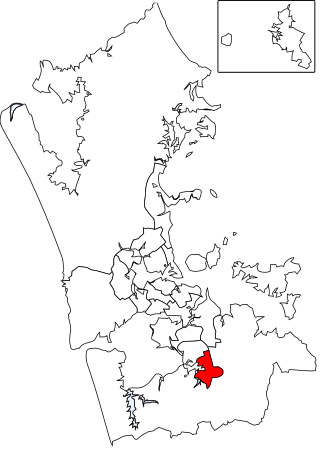
Drury is a rural town near Auckland, in northern New Zealand. Located 36 kilometres to the south of Auckland CBD, under authority of the Auckland Council. Drury lies at the southern border of the Auckland metropolitan area, 12 kilometres to the northeast of Pukekohe, close to the Papakura Channel, an arm of the Manukau Harbour.[4]
Drury is named after Commander Byron Drury, captain of HMS Pandora, who surveyed the Manukau Harbour in 1853.[5]
History
Drury Pottery & Fireclay Works in 1906
Coal mining was a significant early industry established in Drury during the 1850s, and saw the formation of the Waihoihoi Mining and Coal Company in 1859.[6] Continued success with coal mining led to the opening of one of New Zealand's earliest tramways by the company in 1862, consisting of 4ft 8in gauge track with a length of 5.2km, whereby coal was transported to Slippery Creek for shipment to Onehunga.[7] Another early industry seen in Drury was that of an extensive brick and pottery works, linked to a nearby quarry by a tram line at the foot of the Drury Hills.[8] The brick and pottery industry in Drury appears to have operated until at least 1928.[9]
Drury was a significant staging area for British soldiers during the New Zealand Wars, who established a camp in the village under the command of General Duncan Cameron. These soldiers also helped to construct an extension to the Great South Road south to the Mangatawhiri Stream.
During the major reform of local government in 1989, Drury was included in the Auckland Region and made up the southern edge of the Papakura District, along with a certain extent of the eastern surrounding rural areas, previously known as Franklin County. Drury was until recently a relatively small semi-rural area nestling at the foot of the low-lying Bombay Hills. Urban spread of Auckland has rendered it an extreme southern suburb, close to the junction between State Highways 1 and 22, both of which head south towards the Waikato region.
After a review of the Royal Commission on Auckland Governance, the entire Auckland Region was amalgamated into a single city authority, the Auckland Council, in 2010. The Papakura District and Franklin District, and all other territorial authorities in the region were abolished and incorporated into the new council. The town of Drury was included in the Franklin ward, one of the thirteen wards of the council.
Future growth
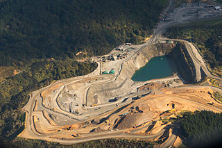
Excavation works at Drury South industrial park, March 2018
Auckland's largest business park, expected to employ 6900 people, is currently under development in the south of Drury. An estimated 2500 homes are also set to be built in the west of Drury, with development already well underway.[10]
In 2020 the size of the developments and of the Auckland Council contribution was under consideration.[11]
Demographics
Drury covers 10.39km2 (4.01sqmi)[1] and had an estimated population of 1,620 as of June 2022,[2] with a population density of 156 people per km2.
Drury had a population of 1,197 at the 2018 New Zealand census, an increase of 93 people (8.4%) since the 2013 census, and a decrease of 51 people (−4.1%) since the 2006 census. There were 360 households, comprising 597 males and 603 females, giving a sex ratio of 0.99 males per female. The median age was 36.0 years (compared with 37.4 years nationally), with 246 people (20.6%) aged under 15 years, 252 (21.1%) aged 15 to 29, 555 (46.4%) aged 30 to 64, and 147 (12.3%) aged 65 or older.
Ethnicities were 73.9% European/Pākehā, 23.3% Māori, 9.8% Pacific peoples, 11.3% Asian, and 1.3% other ethnicities. People may identify with more than one ethnicity.
The percentage of people born overseas was 21.1, compared with 27.1% nationally.
Although some people chose not to answer the census's question about religious affiliation, 49.4% had no religion, 37.6% were Christian, 0.8% had Māori religious beliefs, 1.5% were Hindu, 0.3% were Muslim, 1.0% were Buddhist and 2.8% had other religions.
Of those at least 15 years old, 171 (18.0%) people had a bachelor's or higher degree, and 183 (19.2%) people had no formal qualifications. The median income was $38,500, compared with $31,800 nationally. 201 people (21.1%) earned over $70,000 compared to 17.2% nationally. The employment status of those at least 15 was that 519 (54.6%) people were employed full-time, 135 (14.2%) were part-time, and 36 (3.8%) were unemployed.[3]
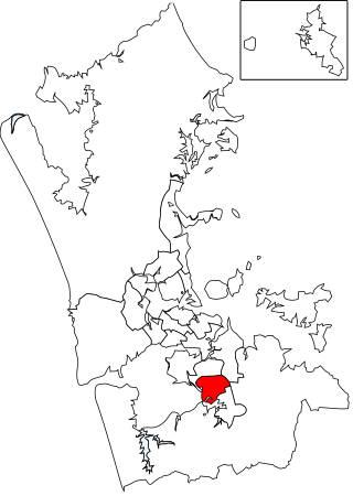
Drury Rural
The area southeast of Drury, called Drury Rural by Statistics New Zealand, covers 36.01km2 (13.90sqmi)[1] and had an estimated population of 2,980 as of June 2022,[2] with a population density of 83 people per km2.
Drury Rural had a population of 2,763 at the 2018 New Zealand census, an increase of 111 people (4.2%) since the 2013 census, and an increase of 279 people (11.2%) since the 2006 census. There were 927 households, comprising 1,416 males and 1,347 females, giving a sex ratio of 1.05 males per female. The median age was 45.4 years (compared with 37.4 years nationally), with 462 people (16.7%) aged under 15 years, 495 (17.9%) aged 15 to 29, 1,377 (49.8%) aged 30 to 64, and 432 (15.6%) aged 65 or older.
Ethnicities were 79.5% European/Pākehā, 13.0% Māori, 4.8% Pacific peoples, 14.2% Asian, and 2.2% other ethnicities. People may identify with more than one ethnicity.
The percentage of people born overseas was 23.7, compared with 27.1% nationally.
Although some people chose not to answer the census's question about religious affiliation, 49.4% had no religion, 37.2% were Christian, 0.4% had Māori religious beliefs, 0.4% were Hindu, 1.1% were Muslim, 1.4% were Buddhist and 3.0% had other religions.
Of those at least 15 years old, 447 (19.4%) people had a bachelor's or higher degree, and 381 (16.6%) people had no formal qualifications. The median income was $42,300, compared with $31,800 nationally. 609 people (26.5%) earned over $70,000 compared to 17.2% nationally. The employment status of those at least 15 was that 1,263 (54.9%) people were employed full-time, 372 (16.2%) were part-time, and 66 (2.9%) were unemployed.[12]
Education
Drury School is a full primary school (years 1–8) with a roll of 401.[13] The school opened in 1857.[14] Drury Christian School is a private composite school (years 1–13) with a roll of 26.[15] Both these schools are coeducational. Rolls are as of April 2023.[16]
St Ignatius of Loyola Catholic College, is a state-integrated secondary school intended to open in 2024 in Drury.[17] It will be the 15th Catholic College in Auckland. A significant housing development will also accompany the construction of the college.
Auckland is one of the 16 regions of New Zealand, which takes its name from the eponymous urban area. The region encompasses the Auckland metropolitan area, smaller towns, rural areas, and the islands of the Hauraki Gulf. Containing 33 percent of the nation's residents, it has by far the largest population and economy of any region of New Zealand, but the second-smallest land area.
Manurewa is a major suburb in South Auckland, New Zealand, located 6 km (3.7 mi) south of Manukau Central, and 26 km (16 mi) southeast of the Auckland City Centre. It is home to the Auckland Botanic Gardens, which receives over a million visitors a year. Manurewa has a high proportion of non-European ethnicities, making it one of the most multi-cultural suburbs in New Zealand. Employment for many is at the many companies of nearby Wiri, Papakura, and at the steel mill at Glenbrook.
Alfriston is a small suburb of Auckland, New Zealand's largest city. Prior to November 2010 it was under the authority of the Papakura District Council and is now part of the enlarged Auckland city. The suburb is in the Manurewa-Papakura ward, one of the thirteen administrative divisions of Auckland Council.
Red Hill is a suburb of Auckland, in northern New Zealand. Located 34 kilometres (21 mi) to the southeast of Auckland CBD, under authority of the Auckland Council. The suburban area of Red Hill makes up the southernmost part of the Auckland metropolitan area, however the majority of the area is rural. The suburb is adjacent to Pukekiwiriki, an ancient volcano and Pā. Red Hill is located in the Manurewa-Papakura ward, one of the thirteen administrative divisions of Auckland city.
Ardmore is a large rural locality of Auckland, New Zealand, located to the south-east of Auckland CBD, just 27 km away. The suburb is in the Franklin Ward, one of the thirteen administrative divisions of Auckland, and is under local governance of Auckland Council.
Ōpaheke is a suburb of Auckland, in northern New Zealand. It is located to the south of Papakura, and 32 kilometres south of the Auckland CBD. The suburb is the southernmost part of the Auckland metropolitan area.
Pahurehure is a suburb of Auckland, in northern New Zealand. It is located on the south-eastern shores of the Manukau Harbour, under the authority of the Auckland Council. The suburb makes up the southernmost part of the Auckland urban area.
Rosehill is a suburb of Auckland, in northern New Zealand. Located to the south of Pahurehure, under authority of the Auckland Council. The suburb makes up the southernmost part of the Auckland metropolitan area, and is located in the Manurewa-Papakura ward, one of the thirteen administrative divisions of Auckland city.
Karaka is a small rural area in the south of Auckland, New Zealand. Formerly part of Franklin District and under the authority of the Franklin District Council, it is now part of Auckland Council following the amalgamation of the Auckland region's councils.
Pōkeno is a small town in the Waikato District of the Waikato region in New Zealand, 53 km (33 mi) southeast of Auckland, 9 km (5.6 mi) from Tuakau and 5 km (3.1 mi) from Mercer. State Highway 1 originally ran through the town, but the upgrading of the highway in 1992 to expressway standards mean that the town has been bypassed.
Papakura North is a suburb of Auckland, in northern New Zealand. Located on the eastern shores of the Pahurehure Inlet, approximately 30 kilometres south of Auckland CBD under authority of the Auckland Council. The suburb makes up the area between the Papakura Town Centre and Takanini, making up the southernmost part of the Auckland metropolitan area.
Brookby is a rural suburb of Auckland, New Zealand. Brookby is approximately 5 kilometres west of Clevedon and 5 km southeast of Whitford. Originally established as a farming community with few people living in the area, Brookby is now a fast-growing community. It has many newly built houses within the area. The suburb is in the Franklin ward, one of the thirteen administrative divisions of Auckland Council. It is situated in the Hunua Electorate.
Papakura is a southern suburb of Auckland, in northern New Zealand. It is located on the shores of the Pahurehure Inlet, approximately 32 kilometres south of the Auckland CBD. It is under the authority of the Auckland Council.
Hingaia is a rural coastal suburb of Auckland, New Zealand. It is located on the shores of the Pahurehure Inlet, to the southwest of the Papakura Town Centre.
Hūnua is a small settlement in the rural outskirts of south Auckland, New Zealand.
Manurewa-Papakura Ward is an Auckland Council ward which elects two councillors and covers the Manurewa and Papakura Local Boards. The two councillors are currently Angela Dalton and Daniel Newman.
The Papakura Local Board is one of the 21 local boards of the Auckland Council. It is overseen by the Manurewa-Papakura ward councillor.
The Manurewa Local Board is one of the 21 local boards of the Auckland Council. It is overseen by the Manurewa-Papakura ward councillor.
Kiripaka is a locality in Northland, New Zealand. The settlement of Glenbervie lies to the southwest, and Ngunguru is to the northeast.
Waiau Pa is a small town of Auckland, New Zealand. It is in the Franklin Ward of Auckland Council. The name means "River of swirling currents" in the Māori language.
This page is based on this Wikipedia article Text is available under the CC BY-SA 4.0 license; additional terms may apply. Images, videos and audio are available under their respective licenses.