Dry Ridge, Kentucky

Last updated

Dry Ridge, Kentucky
Grant County Kentucky Incorporated and Unincorporated areas Dry Ridge Highlighted 2122582.svg
Location of Dry Ridge in Grant County, Kentucky.
Coordinates: 38°40′56″N84°35′47″W / 38.68222°N 84.59639°W / 38.68222; -84.59639
Country United States
State Kentucky
County Grant
Area
[1]
  Total5.08 sq mi (13.16 km2)
  Land5.05 sq mi (13.07 km2)
  Water0.04 sq mi (0.09 km2)
Elevation
[2]
961 ft (293 m)
Population
 (2020)
  Total2,102
  Estimate 
(2022) [3]
2,138
  Density416.49/sq mi (160.81/km2)
Time zone UTC-5 (Eastern (EST))
  Summer (DST) UTC-4 (EDT)
ZIP code
41035
Area code 859
FIPS code 21-22582
GNIS feature ID2403510 [2]
Website cdrky.org

Dry Ridge is a home rule-class city [4] in Grant County, Kentucky, in the United States. The population was 2,191 at the 2010 census, [5] up from 1,995 at the 2000 census. From around 1910 to 1960, the city's economy was dominated by business related to its mineral water wells, purported to have healing properties. [6]

Contents

Geography

Dry Ridge is located north of the center of Grant County. It is bordered to the south by the city of Williamstown, the county seat. Interstate 75 passes through Dry Ridge, with access from Exit 159. I-75 leads north 35 miles (56 km) to Cincinnati and south 49 miles (79 km) to Lexington. U.S. Route 25 (Main Street) runs through the center of Dry Ridge, leading north 7 miles (11 km) to Crittenden and south 4 miles (6 km) to the center of Williamstown.

According to the United States Census Bureau, Dry Ridge has a total area of 4.6 square miles (11.8 km2), of which 0.03 square miles (0.09 km2), or 0.72%, is water. [5]

History

The community now known as Dry Ridge was settled about 1792 as "Campbell's Station" near a spring said to have medicinal qualities. [7]

A post office called "Dry Ridge" was established in 1815 at an inn. Dry Ridge takes its name from a ridge surrounded by inns where travelers stopped for water before proceeding. [8]

In 1909, the city was incorporated, the last incorporated in Grant County. That same year, a creamery company found mineral water which was believed to have medical properties. During the early part of the 20th century, Dry Ridge was the home of Kentucky Carlsbad Mineral Water Bottling Company, and home of the Carlsbad Hotel completed in 1911. [9] [10] People came to Dry Ridge from all over the eastern United States to take the mineral water [11] of what was known as the Kentucky Carlsbad Springs, although it was not a spring, but a well. [6] The hotel was destroyed by fire on February 25, 1927. [12]

In 1937, a water distribution system was created with water from Williamstown, Kentucky's lake. [9]

Demographics

Historical population
CensusPop.Note
1910 143
1920 129−9.8%
1930 97−24.8%
1940 257164.9%
1950 640149.0%
1960 80225.3%
1970 1,10037.2%
1980 1,25013.6%
1990 1,60128.1%
2000 1,99524.6%
2010 2,1919.8%
2020 2,102−4.1%
2022 (est.)2,138 [13] 1.7%
U.S. Decennial Census [14]

As of the census [15] of 2000, there were 1,995 people, 771 households, and 535 families residing in the city. The population density was 428.2 inhabitants per square mile (165.3/km2). There were 861 housing units at an average density of 184.8 per square mile (71.4/km2). The racial makeup of the city was 97.19% White, 0.55% African American, 0.10% Native American, 1.30% Asian, 0.20% from other races, and 0.65% from two or more races. Hispanic or Latino of any race were 0.70% of the population.

There were 771 households, out of which 39.7% had children under the age of 18 living with them, 46.4% were married couples living together, 18.2% had a female householder with no husband present, and 30.5% were non-families. 26.6% of all households were made up of individuals, and 12.1% had someone living alone who was 65 years of age or older. The average household size was 2.51 and the average family size was 3.00.

In the city, the population was spread out, with 28.6% under the age of 18, 11.1% from 18 to 24, 29.3% from 25 to 44, 18.9% from 45 to 64, and 12.1% who were 65 years of age or older. The median age was 31 years. For every 100 females, there were 87.3 males. For every 100 females age 18 and over, there were 83.0 males.

The median income for a household in the city was $30,647, and the median income for a family was $32,202. Males had a median income of $38,000 versus $23,000 for females. The per capita income for the city was $14,568. About 21.0% of families and 23.5% of the population were below the poverty line, including 39.0% of those under age 18 and 14.4% of those age 65 or over.

Education

Grant County students are served by Grant County Middle School and Grant County High School, both located in Dry Ridge.

Notable people

Climate

The climate in this area is characterized by hot, humid summers and generally mild to cool winters. According to the Köppen Climate Classification system, Dry Ridge has a humid subtropical climate, abbreviated "Cfa" on climate maps. [16]

Related Research Articles

<span class="mw-page-title-main">Owen County, Kentucky</span> County in Kentucky, United States

Owen County is a county located in the northern part of the U.S. state of Kentucky. Its county seat is Owenton. The county is named for Colonel Abraham Owen. It is a prohibition or dry county, with the exception of a winery that is authorized to sell its product to the public, and limited sales within the incorporated city limits of Owenton.

<span class="mw-page-title-main">Grant County, Kentucky</span> County in Kentucky, United States

Grant County is a county located in the northern part of the U.S. state of Kentucky. As of the 2020 census, the population was 24,941. Its county seat is Williamstown. The county was formed in 1820 and named for Colonel John Grant, who led a party of settlers in 1779 to establish Grant's Station, in today's Bourbon County, Kentucky. Grant County is included in the Cincinnati-Middletown, OH-KY-IN Metropolitan Statistical Area. Grant County residents voted to allow full alcohol sales in the county by a margin of 56% to 44% in a special election on December 22, 2015. In the 19th century, Grant County had multiple saloons.

<span class="mw-page-title-main">Claypool, Arizona</span> CDP in Gila County, Arizona

Claypool is a census-designated place (CDP) in Gila County, Arizona, United States. The population was 1,538 at the 2010 census, down from 1,794 at the 2000 census. It was named after W. D. Claypool, a member of both the State House of Representatives and State Senate in the 1910s and 1920s.
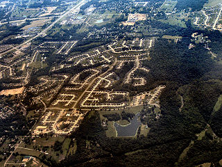
<span class="mw-page-title-main">Burlington, Kentucky</span> Census-designated place in Boone County, Kentucky, United States

Burlington is a census-designated place (CDP) in and the county seat of Boone County, Kentucky, United States. The population was 17,318 at the 2020 census.

<span class="mw-page-title-main">Shepherdsville, Kentucky</span> City in Kentucky, United States

Shepherdsville is a home rule-class city on the Salt River in Bullitt County, Kentucky, in the United States. It is the second largest city and seat of its county, located just south of Louisville. The population was 14,201 during the 2020 U.S. Census.
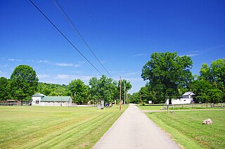
<span class="mw-page-title-main">California, Kentucky</span> City in Kentucky, United States

California is a home rule-class city in Campbell County, Kentucky, United States. The population was 90 at the 2010 census.

<span class="mw-page-title-main">Ghent, Kentucky</span> City in Kentucky, United States

Ghent is a home rule-class city along the south bank of the Ohio River in Carroll County, Kentucky, in the United States. The population was 323 at the 2010 census.
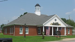
<span class="mw-page-title-main">Liberty, Kentucky</span> City in Kentucky, United States

Liberty is a home rule-class city in Casey County, Kentucky, in the United States. It is the seat of its county. Its population was 2,168 at the 2010 U.S. census.

<span class="mw-page-title-main">Albany, Kentucky</span> City in Kentucky, United States

Albany is a home rule-class city in Clinton County, Kentucky, in the United States. The population was 2,033 at the 2010 census. It is the county seat of Clinton County. It is located on U.S. Route 127, about 6 miles (10 km) north of the Tennessee border.

<span class="mw-page-title-main">Marion, Kentucky</span> City in Kentucky, United States

Marion is a home rule-class city in Crittenden County, Kentucky, in the United States. It is the seat of its county. As of the 2010 census, the city population was 3,039.

<span class="mw-page-title-main">Glencoe, Kentucky</span> City in Kentucky, United States

Glencoe is a home rule-class city in Gallatin County, Kentucky, in the United States. The population was 360 as of the 2010 census, up from 251 at the 2000 census.
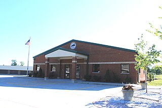
<span class="mw-page-title-main">Crittenden, Kentucky</span> City in Kentucky, United States

Crittenden is a home rule-class city in Grant and Kenton counties, Kentucky, in the United States. The population was 3,815 as of the 2010 census, up from 2,401 at the 2000 census.

<span class="mw-page-title-main">Berry, Kentucky</span> City in Kentucky, United States

Berry is a home rule-class city in Harrison County, Kentucky, in the United States. The city was formally incorporated by the state assembly in 1867 as "Berryville". It was renamed "Berry Station" two years later. The population was 264 at the 2010 census, down from 310 at the 2000 census.

<span class="mw-page-title-main">Erlanger, Kentucky</span> City in Kentucky, United States

Erlanger is a home rule-class city in Kenton County, Kentucky, United States. It had a 2010 census population of 18,368. Erlanger is part of the Cincinnati-Middletown, OH-KY-IN Metropolitan Statistical Area.

<span class="mw-page-title-main">Blaine, Kentucky</span> City in Kentucky, United States

Blaine is a home rule-class city in Lawrence County, Kentucky, United States. The population was 47 at the 2010 census, down from 245 at the 2000 census.

<span class="mw-page-title-main">Kuttawa, Kentucky</span> City in Kentucky, United States

Kuttawa is a home rule-class city in Lyon County, Kentucky, in the United States. The population was 649 as of the 2010 census, up from 596 in 2000.
<span class="mw-page-title-main">Edmonton, Kentucky</span> City in Kentucky, United States

Edmonton is a home rule-class city in and the county seat of Metcalfe County, Kentucky, United States. It is part of the Glasgow Micropolitan Statistical Area. The population was 1,671 at the 2020 census.

<span class="mw-page-title-main">Gamaliel, Kentucky</span> City in Kentucky, United States

Gamaliel is a home rule-class city in Monroe County, Kentucky, in the United States. The population was 391 at the 2020 census.

<span class="mw-page-title-main">Corinth, Kentucky</span> City in Kentucky, United States

Corinth is a home rule-class city mostly in Grant County with a small portion of land in Scott County in the U.S. state of Kentucky. The population was 232 as of the 2010 census, up from 181 at the 2000 census.

<span class="mw-page-title-main">Williamstown, Kentucky</span> City in Kentucky, United States

Williamstown is a home-rule-class city in Grant and Pendleton counties in the U.S. state of Kentucky. The population was 3,925 at the 2010 census, up from 3,227 as of the 2000 census. It is the county seat of Grant County.

References

  1. "2020 U.S. Gazetteer Files". United States Census Bureau. Retrieved March 18, 2022.
  2. 1 2 U.S. Geological Survey Geographic Names Information System: Dry Ridge, Kentucky
  3. "Annual Estimates of the Resident Population for Incorporated Places in Kentucky: April 1, 2020 to July 1, 2022". United States Census Bureau. Retrieved May 26, 2023.
  4. "Summary and Reference Guide to House Bill 331 City Classification Reform" (PDF). Kentucky League of Cities. Retrieved December 30, 2014.
  5. 1 2 "Geographic Identifiers: 2010 Demographic Profile Data (G001): Dry Ridge city, Kentucky". American Factfinder. U.S. Census Bureau. Retrieved December 8, 2016.[ dead link ]
  6. 1 2 Tenkotte, Paul A.; Claypool, James C. (2015). "Carlesbad Springs Hotel". The Encyclopedia of Northern Kentucky. The University Press of Kentucky. p. 154.
  7. Federal Writers' Project (1996). The WPA Guide to Kentucky. University Press of Kentucky. p. 264. ISBN   0813108659 . Retrieved November 24, 2013.
  8. Rennick, Robert M. (1987). Kentucky Place Names. University Press of Kentucky. p. 85. ISBN   0813126312 . Retrieved April 28, 2013.
  9. 1 2 Tenkotte, Paul A.; Claypool, James C. (2015). "Dry Ridge". The Encyclopedia of Northern Kentucky. The University Press of Kentucky. p. 283.
  10. Commission, Kentucky Progress (1931). Kentucky Progress Magazine ...
  11. The Southwestern Reporter. West Publishing Company. 1922.
  12. Tenkotte, Paul A.; Claypool, James C. (2015). "Fire". The Encyclopedia of Northern Kentucky. The University Press of Kentucky. p. 332.
  13. "Annual Estimates of the Resident Population for Incorporated Places in Kentucky: April 1, 2020 to July 1, 2022". United States Census Bureau. Retrieved May 26, 2023.
  14. "Census of Population and Housing". Census.gov. Retrieved June 4, 2015.
  15. "U.S. Census website". United States Census Bureau . Retrieved January 31, 2008.
  16. Climate Summary for Dry Ridge, Kentucky