Dunn Center, North Dakota

Last updated

Dunn Center, North Dakota
Dunn Center, North Dakota.jpg
Dunn Center City Hall
ND Dunn County Dunn Center.svg
Location of Dunn Center, North Dakota
Coordinates: 47°21′10″N102°37′24″W / 47.35278°N 102.62333°W / 47.35278; -102.62333
CountryUnited States
State North Dakota
County Dunn
Founded1914
Area
[1]
  Total0.39 sq mi (1.02 km2)
  Land0.39 sq mi (1.01 km2)
  Water0.00 sq mi (0.00 km2)
Elevation
[2]
2,175 ft (663 m)
Population
 (2020) [3]
  Total227
  Estimate 
(2022) [4]
229
  Density580.56/sq mi (224.21/km2)
Time zone UTC-7 (Mountain (MST))
  Summer (DST) UTC-6 (MDT)
ZIP code
58626
Area code 701
FIPS code 38-20940
GNIS feature ID1035999 [2]
Website cityofdunncenter.com

Dunn Center is a city in Dunn County, North Dakota, United States. The population was 227 at the 2020 census. [3] Dunn Center was founded in 1914.

Contents

History

Dunn Center was laid out in 1914, when the railroad was extended to that point. [5] The city was so named on account of its central location in Dunn County. [6] [7]

Geography

According to the United States Census Bureau, the city has a total area of 0.39 square miles (1.01 km2), all land. [8]

Dunn Center is located on North Dakota Highway 200, east of Lake Ilo.

Demographics

Historical population
CensusPop.Note
1920 247
1930 27611.7%
1940 238−13.8%
1950 2463.4%
1960 2501.6%
1970 107−57.2%
1980 17058.9%
1990 128−24.7%
2000 122−4.7%
2010 14619.7%
2020 22755.5%
2022 (est.)229 [4] 0.9%
U.S. Decennial Census [9]
2020 Census [3]

2010 census

As of the census of 2010, there were 146 people in 66 households, including 38 families, in the city. The population density was 374.4 inhabitants per square mile (144.6/km2). There were 80 housing units at an average density of 205.1 per square mile (79.2/km2). The racial makup of the city was 93.8% White, 1.4% Native American, 0.7% from other races, and 4.1% from two or more races. Hispanic or Latino of any race were 1.4%.

Of the 66 households, 27.3% had children under the age of 18 living with them, 48.5% were married couples living together, 6.1% had a female householder with no husband present, 3.0% had a male householder with no wife present, and 42.4% were non-families. 33.3% of households were one person and 19.7% were one person aged 65 or older. The average household size was 2.21 and the average family size was 2.82.

The median age was 39.2 years. 21.9% of residents were under the age of 18; 8.2% were between the ages of 18 and 24; 27.4% were from 25 to 44; 23.9% were from 45 to 64; and 18.5% were 65 or older. The gender makeup of the city was 51.4% male and 48.6% female.

2000 census

As of the census of 2000, there were 122 people in 58 households, including 33 families, in the city. The population density was 304.5 inhabitants per square mile (117.6/km2). There were 81 housing units at an average density of 202.2 per square mile (78.1/km2). The racial makup of the city was 90.98% White, 6.56% Native American, and 2.46% from two or more races.

Of the 58 households, 15.5% had children under the age of 18 living with them, 50.0% were married couples living together, 3.4% had a female householder with no husband present, and 43.1% were non-families. 36.2% of households were one person and 20.7% were one person aged 65 or older. The average household size was 2.10 and the average family size was 2.67.

The age distribution was 16.4% under the age of 18, 4.9% from 18 to 24, 23.0% from 25 to 44, 32.8% from 45 to 64, and 23.0% 65 or older. The median age was 49 years. For every 100 females, there were 90.6 males. For every 100 females age 18 and over, there were 92.5 males.

The median household income was $23,500 and the median family income was $27,500. Males had a median income of $18,750 versus $16,071 for females. The per capita income for the city was $13,736. There were 8.3% of families and 9.6% of the population living below the poverty line, including no under eighteens and 3.1% of those over 64.

Climate

This climatic region is typified by large seasonal temperature differences, with warm to hot (and often humid) summers and cold (sometimes severely cold) winters. According to the Köppen Climate Classification system, Dunn Center has a humid continental climate, abbreviated "Dfb" on climate maps. [10]

Climate data for Dunn Center 1E, North Dakota (1991–2020 normals, extremes 1919–present)
MonthJanFebMarAprMayJunJulAugSepOctNovDecYear
Record high °F (°C)62
(17)
65
(18)
80
(27)
96
(36)
100
(38)
108
(42)
111
(44)
110
(43)
107
(42)
98
(37)
77
(25)
62
(17)
111
(44)
Average high °F (°C)24.4
(−4.2)
28.6
(−1.9)
41.0
(5.0)
55.1
(12.8)
66.4
(19.1)
75.6
(24.2)
83.5
(28.6)
84.2
(29.0)
73.1
(22.8)
56.4
(13.6)
40.2
(4.6)
27.6
(−2.4)
54.7
(12.6)
Daily mean °F (°C)12.3
(−10.9)
16.2
(−8.8)
28.2
(−2.1)
41.5
(5.3)
53.1
(11.7)
62.7
(17.1)
68.6
(20.3)
68.3
(20.2)
58.0
(14.4)
43.0
(6.1)
27.9
(−2.3)
16.6
(−8.6)
41.4
(5.2)
Average low °F (°C)0.2
(−17.7)
3.8
(−15.7)
15.4
(−9.2)
28.0
(−2.2)
39.8
(4.3)
49.7
(9.8)
53.7
(12.1)
52.3
(11.3)
42.9
(6.1)
29.5
(−1.4)
15.7
(−9.1)
5.7
(−14.6)
28.1
(−2.2)
Record low °F (°C)−46
(−43)
−52
(−47)
−35
(−37)
−14
(−26)
12
(−11)
22
(−6)
20
(−7)
29
(−2)
14
(−10)
−14
(−26)
−23
(−31)
−38
(−39)
−52
(−47)
Average precipitation inches (mm)0.36
(9.1)
0.36
(9.1)
0.73
(19)
1.36
(35)
2.62
(67)
3.25
(83)
2.46
(62)
1.84
(47)
1.72
(44)
1.17
(30)
0.55
(14)
0.41
(10)
16.83
(427)
Source: NOAA [11] [12]

Education

It is zoned to the Killdeer School District. [13]

Related Research Articles

<span class="mw-page-title-main">Richfield, Idaho</span> City in Idaho, United States

Richfield is a city in Lincoln County, Idaho, in the United States. The population was 482 at the 2010 census.

<span class="mw-page-title-main">Grundy Center, Iowa</span> City in Iowa, United States

Grundy Center is a city in Grundy County, Iowa. The population was 2,796 at the time of the 2020 census, a 7.7% increase from 2,596 at the 2000 census. Grundy Center is also the county seat of Grundy County. Grundy Center is part of the Waterloo–Cedar Falls Metropolitan Statistical Area.

<span class="mw-page-title-main">Valley City, North Dakota</span> City in North Dakota, United States

Valley City is a city in Barnes County, North Dakota, United States. It is the county seat of Barnes County. The population was 6,575 during the 2020 census, making it the 12th most populous city in North Dakota. Valley City was founded in 1874.

<span class="mw-page-title-main">Gascoyne, North Dakota</span> City in North Dakota, United States

Gascoyne is a village in Bowman County, North Dakota, United States. The population was 21 at the 2020 census.

<span class="mw-page-title-main">Regan, North Dakota</span> City in North Dakota, United States

Regan is a city in Burleigh County, North Dakota, United States. Its population was 35 at the 2020 census. Regan was founded in 1912.

<span class="mw-page-title-main">Wing, North Dakota</span> City in North Dakota, United States

Wing is a rural small town in Burleigh County, North Dakota, United States. It is part of the "Bismarck, ND Metropolitan Statistical Area" or "Bismarck-Mandan". The population was 132 at the 2020 census. As of 2010, the town has a post office, a full service station, a bar, a restaurant, a small (10-unit) apartment complex, a senior's center, a hotel, several churches, and a complete (K-12) public school system.

<span class="mw-page-title-main">Fullerton, North Dakota</span> City in North Dakota, United States

Fullerton is a town in Dickey County, North Dakota, United States. The population was 62 at the 2020 census.

<span class="mw-page-title-main">Killdeer, North Dakota</span> City in North Dakota, United States

Killdeer is a city in Dunn County, North Dakota, United States. The population was 939 at the 2020 census.

<span class="mw-page-title-main">Dwight, North Dakota</span> City in North Dakota, United States

Dwight is a city in Richland County, North Dakota, United States. The population was 80 at the 2020 census. Dwight was founded in 1881. It is part of the Wahpeton, ND–MN Micropolitan Statistical Area.

<span class="mw-page-title-main">Rolette, North Dakota</span> City in North Dakota, United States

Rolette is a city in Rolette County, North Dakota, United States. The population was 484 at the 2020 census.

<span class="mw-page-title-main">Finley, North Dakota</span> City in North Dakota, United States

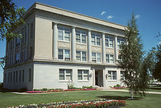
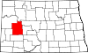
Finley is a city in Steele County, North Dakota. It is the county seat of Steele County. The population was 401 at the 2020 census. Finley was founded in 1897.

<span class="mw-page-title-main">Cleveland, North Dakota</span> City in North Dakota, United States

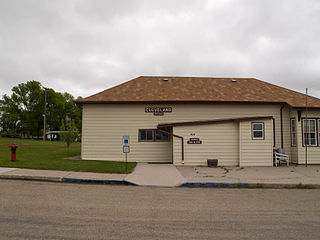
Cleveland is a city in Stutsman County, North Dakota, United States. The population was 57 at the 2020 census.

<span class="mw-page-title-main">Berthold, North Dakota</span> City in North Dakota, United States

Berthold is a town in Ward County, North Dakota, United States. The population was 490 at the 2020 census.

<span class="mw-page-title-main">Bryant, South Dakota</span> City in South Dakota, United States

Bryant is a city in Hamlin County, South Dakota, United States. It is part of the Watertown, South Dakota Micropolitan Statistical Area. The population was 471 at the 2020 census.

<span class="mw-page-title-main">Estelline, South Dakota</span> City in South Dakota, United States

Estelline is a city in Hamlin County, South Dakota, United States. It is part of the Watertown, South Dakota Micropolitan Statistical Area. The population was 749 at the 2020 census.

<span class="mw-page-title-main">Whitewood, South Dakota</span> City in South Dakota, United States

Whitewood is a city in Lawrence County, South Dakota, United States. The population was 879 at the 2020 census.

<span class="mw-page-title-main">Veblen, South Dakota</span> City in South Dakota, United States

Veblen is a city in Marshall County, South Dakota, United States. The population was 317 at the 2020 census.

<span class="mw-page-title-main">Hurley, South Dakota</span> City in South Dakota, United States

Hurley is a city in Turner County, South Dakota, United States. The population was 379 at the 2020 census.

<span class="mw-page-title-main">Selby, South Dakota</span> City in South Dakota, United States

Selby is a city in Walworth County, South Dakota, United States. The population was 610 at the 2020 census. It is the county seat of Walworth County.

<span class="mw-page-title-main">Enderlin, North Dakota</span> City in North Dakota, United States

Enderlin is a city in Cass and Ransom counties in the State of North Dakota. The population was 881 at the 2020 census.

References

  1. "ArcGIS REST Services Directory". United States Census Bureau. Retrieved September 20, 2022.
  2. 1 2 U.S. Geological Survey Geographic Names Information System: Dunn Center, North Dakota
  3. 1 2 3 "Explore Census Data". United States Census Bureau . Retrieved December 2, 2023.
  4. 1 2 "City and Town Population Totals: 2020-2022". United States Census Bureau. December 2, 2023. Retrieved December 2, 2023.
  5. Geneva Roth Olstad (2000). Main Street, North Dakota in Vintage Postcards. Arcadia Publishing. p. 29. ISBN   978-0-7385-0726-2.
  6. Federal Writers' Project (1938). North Dakota, a Guide to the Northern Prairie State. WPA. p. 321. ISBN   978-1-62376-033-5.
  7. Williams, Mary Ann Barnes (1966). Origins of North Dakota Place Names. Bismarck, ND: Bismarck Tribune. p. 97. Retrieved January 4, 2022.
  8. "US Gazetteer files 2010". United States Census Bureau. Archived from the original on July 2, 2012. Retrieved June 14, 2012.
  9. United States Census Bureau. "Census of Population and Housing" . Retrieved July 29, 2013.
  10. Climate Summary for Dunn Center, North Dakota
  11. "NowData - NOAA Online Weather Data". National Oceanic and Atmospheric Administration. Retrieved September 18, 2021.
  12. "Station: Dunn CTR 1E, ND". U.S. Climate Normals 2020: U.S. Monthly Climate Normals (1991-2020). National Oceanic and Atmospheric Administration. Retrieved September 18, 2021.
  13. "2020 CENSUS - SCHOOL DISTRICT REFERENCE MAP: Dunn County, ND" (PDF). United States Census Bureau . Retrieved August 14, 2021.