
The East Riding of Yorkshire, often shortened to the East Riding and alternatively known as East Yorkshire, is a ceremonial county in the Yorkshire and the Humber region of England. It borders North Yorkshire to the north and west, South Yorkshire to the south-west, and Lincolnshire to the south across the Humber Estuary. The city of Kingston upon Hull is the largest settlement.

The River Hull is a navigable river in the East Riding of Yorkshire in Northern England. It rises from a series of springs to the west of Driffield, and enters the Humber Estuary at Kingston upon Hull. Following a period when the Archbishops of York charged tolls for its use, it became a free navigation. The upper reaches became part of the Driffield Navigation from 1770, after which they were again subject to tolls, and the section within the city of Hull came under the jurisdiction of the Port of Hull, with the same result.

Arram Beck is a small stream in the East Riding of Yorkshire, England, running through high embankments and flowing eastwards from the village of Arram to join the River Hull. Depths are variable due to the tidal nature of the Hull. It provides habitat for a variety of fish species and chub have also been stocked here too.

Cottingham is a large village and civil parish in the East Riding of Yorkshire, England. It lies 4 miles (6.4 km) north-west of the centre of Kingston upon Hull, and 6 miles (9.7 km) south-east of Beverley on the eastern edge of the Yorkshire Wolds. It forms part of Hull's Urban Area. It has two main shopping streets, Hallgate and King Street, which cross each other near the Church of Saint Mary the Virgin, and a market square called Market Green. Cottingham had a population of 17,164 residents in 2011, making it larger by area and population than many towns. As a result, it is one of the villages claiming to be the largest village in England.
Aike is a hamlet and former civil parish, now in the parish of Lockington, in the East Riding of Yorkshire, England. The hamlet is centred around a single developed street, which lies to the east of the Yorkshire Wolds. Aike is approximately 4 miles (6 km) north of Beverley and approximately 0.4 miles (1 km) from the west bank of the River Hull. It is approached by a 2.5-mile (4 km) lane which is a no-through road that does not continue beyond the village, although a farm track continues as far as a bridge across the Beverley and Barmston Drain. In 1931 the parish had a population of 48.

Swanland is a village and civil parish in the East Riding of Yorkshire in England. The village is about seven miles (11 km) to the west of Kingston upon Hull city centre and two miles (3.2 km) north of the Humber Estuary in the foothills of the Yorkshire Wolds on the B1231 road.

Aike Beck or the Lockington Navigation was a stream in the East Riding of Yorkshire, England, which was constructed as a navigation in the late 18th century, and ceased to function as such in the 1850s. The water supply came from Bryan Mills Beck and Scorborough Beck, but in 1988, these were diverted to feed into Arram Beck, and most of the channel was filled in with material from the flood banks.

Wilfholme Landing is located on the Driffield Navigation in the East Riding of Yorkshire, England. The navigation is still tidal at this point, and is often considered to still be the River Hull, although technically the Navigation starts at the point where the Aike Beck used to join the river, a little further downstream. It is 0.9 miles (1.4 km) from the hamlet of Wilfholme, and its main features are boat moorings, a farm and a pumping station. It is a popular spot for fishing, with anglers targeting resident roach, bream and perch.

Kirk Ella is a village and civil parish on the western outskirts of Kingston upon Hull, approximately five miles west of the city centre, situated in the East Riding of Yorkshire, England. The parish includes West Ella.

Woodmansey is a village and civil parish in the East Riding of Yorkshire, England. It is situated approximately 1.5 miles (2.4 km) south-east of Beverley on the A1174 road from Hull to Beverley.

Beverley Road is one of several major roads that run out of the city of Hull in the East Riding of Yorkshire, England. The road is noted for being a major arterial route into, and out of Hull. It also known for its student population and being the location of a shop (Turners), whose slogan was used by the pop band, Everything But the Girl. In 1994, just over 1-mile (1.6 km) of the road was designated as a conservation area.
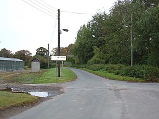
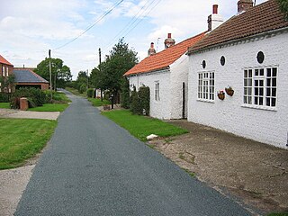
Thearne is a hamlet and former civil parish, now in the parish of Woodmansey, in the East Riding of Yorkshire, England. In 1931 the parish had a population of 183.

Foston on the Wolds is a village and civil parish in the East Riding of Yorkshire, England. It is situated approximately 8 miles (13 km) south-west of Bridlington town centre and 2 miles (3 km) north of the village of North Frodingham.
Stoneferry is a suburb of Kingston upon Hull, East Riding of Yorkshire, England. It was formerly a small hamlet on the east bank of the River Hull, the site of a ferry, and, after 1905, a bridge. The area is primarily industrial, and is situated on the east bank of the river, as well as close by areas on the west bank.

Newland is a suburb of Kingston upon Hull, East Riding of Yorkshire, England, in the north-west of the city, a former village on the Hull to Beverley turnpike.

Stepney is an area of Kingston upon Hull within the larger area of Sculcoates, north of the city centre on the (A1079) Beverley-Hull main road. Before the mid-19th century the place was a small hamlet outside the urban area of Kingston upon Hull.

The Beverley and Barmston Drain is the main feature of a land drainage scheme authorised in 1798 to the west of the River Hull in the East Riding of Yorkshire, England. The area consisted of salt marshes to the south and carrs to the north, fed with water from the higher wolds which lay to the north, and from inundation by tidal water passing up the river from the Humber. Some attempts to reduce the flooding by building embankments had been made by the fourteenth century, and windpumps appeared in the seventeenth century. The Holderness Drainage scheme, which protected the area to the east of the river, was completed in 1772, and attention was then given to resolving flooding of the carrs.
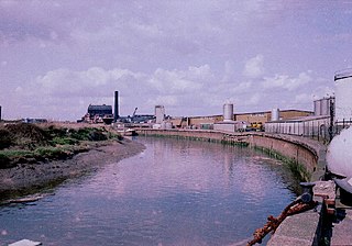
Sculcoates power station supplied electricity to Kingston upon Hull and the wider East Yorkshire area from 1898. An earlier 1893 station in Dagger Lane had operated public lighting in Hull Old Town. Sculcoates power station was built and operated by Kingston upon Hull Corporation on a site in Sculcoates Lane adjacent to the Beverley and Barmston Drain. The power station was increased in size as demand for electricity grew, it was redeveloped several times: including major rebuilds in 1927–29 and in 1938–1952. The power station was closed in 1976 and was subsequently demolished.

Whitefriargate is a pedestrianised street in the Old Town area of Kingston upon Hull, in the East Riding of Yorkshire, England. During the 20th century, it was one of the main shopping streets in the city centre, but some of the major stores have closed down, which has been attributed to out of town shopping centres. However, the Street still provides a useful link to and from the old town of Hull.

 St Faiths Church (2008)
 The Ship Inn (2006)
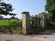 Gates to the enclosed water reservoir (2005)
 Dunswell pumping station exterior (1976) (now demolished)


