
Caernarfonshire, sometimes spelled Caernarvonshire or Carnarvonshire, is one of the thirteen historic counties, a vice-county and a former administrative county of Wales.

The Borough of Arfon was local government district with borough status from 1974 to 1996, being one of five districts in the county of Gwynedd, north-west Wales.


Uxbridge was a local government district in north west Middlesex, England, from 1849 to 1965, seated in the town of Uxbridge.

Carshalton was a local government district in north east Surrey from 1883 to 1965 around the town of Carshalton.
Aethwy was a rural district in the administrative county of Anglesey, Wales, from 1894 to 1974.

The Isle of Anglesey County Council is the local authority for the county of Anglesey, one of the principal areas of Wales. Since 2022 the council has 35 councillors who represent 11 multi-member electoral wards.

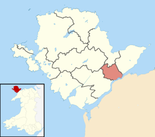
Braint was the name of one of the 40 wards of the Isle of Anglesey County Council, covering part of the area of the community of Llanfairpwllgwyngyll.

Stretford was, from 1868 to 1974, a local government district coterminate with the town of Stretford, Lancashire, England.

The A4080 is a British A road which is located on the Island of Anglesey, Wales. It follows a very roundabout route from the A5 road at Llanfairpwllgwyngyll via Newborough and Rhosneigr back to the A55 and the A5 about 9 miles (14 km) south of Holyhead. In all the road is about 17 miles (27 km) long.
Holywell was a rural district in the administrative county of Flintshire, Wales, from 1894 to 1974.
Twrcelyn was a rural district in the administrative county of Anglesey, Wales, from 1894 to 1974. The district took its name from Twrcelyn, one of the ancient cwmwds or medieval subdivisions of the island.
Valley was a rural district part of the administrative county of Anglesey, Wales from 1894 to 1974.

Nathan Lee Gill is a British politician, who was the Leader of Reform UK Wales from March to May 2021, when he resigned from the party. He previously served as Member of the European Parliament (MEP) for Wales from 2014 to January 2020.

Llanfihangel Ysgeifiog is a community and former ecclesiastical parish in Anglesey, Wales, east of Llangefni.

Afon Braint is a small tidal river on Anglesey, North Wales. There is a series of stepping stones near the village of Dwyran, and a Grade II bridge near Penmynydd. Until recently, there was an electoral ward named after the river.

Church Bay is a settlement on the north-west coast of Anglesey, Wales, United Kingdom, about a mile and a half north-west of the village of Llanfaethlu. The bay shores are rocky but there is also a sandy beach which is popular with visitors. There are a handful of houses near the beach. The Anglesey Coastal Path runs along the cliff tops. There are records of the Swttan settlement going back to the reign of King Henry VIII, but there has probably been a settlement there for many centuries before this. Most of the properties are holiday homes for rent. Amenities include a cafe and a small museum based in a preserved 17th-century thatched cottage. This cottage's position could indicate that there has been a dwelling on this site since Neolithic times. The cottage won the Rural Wales Award from the Campaign for the Protection of Rural Wales (CPRW) in 2003.
Aethwy is the name of an electoral ward in the south of Anglesey, Wales, created in 2012. It contains the population centres of Menai Bridge and Llanfair PG.