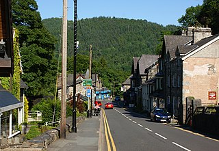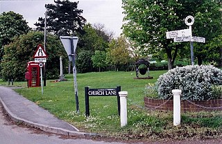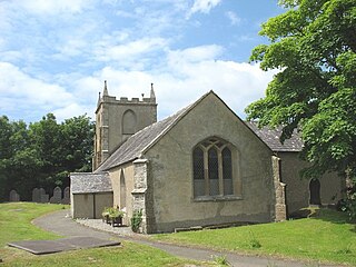
Bunbury is a village in Cheshire, England, south of Tarporley and north west of Nantwich on the Shropshire Union Canal. At the 2011 Census, it had a population of 1,195.

Betws-y-coed is a village and community in the Conwy valley in Conwy County Borough, Wales, located in the historic county of Caernarfonshire, right on the boundary with Denbighshire, in the Gwydir Forest. It is now a very popular visitor destination in the Snowdonia National Park.

Nevern is both a parish and a community in Pembrokeshire, Wales. The community includes the settlements of Felindre Farchog, Monington, Moylgrove and Bayvil. The small village lies in the Nevern valley near the Preseli Hills of the Pembrokeshire Coast National Park 2 miles (3 km) east of Newport on the B4582 road.

Sir Hugh Owen was a pioneer of higher education in Wales. He was the main founder of the University College of Wales at Aberystwyth.

Dunsden Green or Dunsden is a village in the civil parish of Eye & Dunsden in the South Oxfordshire ward of Sonning Common, about 3 miles (5 km) northeast of Reading, Berkshire. Until 1866 it was in the Oxfordshire part of Sonning parish.

Upton Scudamore is a village and civil parish in Wiltshire, England. The village lies about 1.8 miles (3 km) north of the town of Warminster and about the same distance south of Westbury. The parish includes the hamlet of Halfway.

Penmachno is a village in the isolated upland Machno valley, 4 miles (6 km) south of Betws-y-Coed in the county of Conwy, North Wales. The B4406 road runs through part of the village. The village is at the confluence of the Glasgwm and Machno rivers. It has a five-arched, stone bridge dating from 1785. The village has been referred to as Pennant Machno, Llandudclyd and Llan dutchyd in historical sources.

Pulford is a village and former civil parish, now in the parish of Poulton and Pulford, in the unitary authority of Cheshire West and Chester and the ceremonial county of Cheshire, England. It is on the B5445 road, to the south west of Chester and on the border with Wales. The civil parish, which included the hamlet of Cuckoo's Nest, was abolished in 2015 to form Poulton and Pulford.

Haugham is a village and civil parish in the East Lindsey district of Lincolnshire, England. It is situated 3 miles (5 km) south from Louth. The Prime Meridian passes directly through Haugham.

Brinkhill is a village and civil parish in the East Lindsey district of Lincolnshire, England. It is situated approximately 5 miles (8 km) west from the market town of Alford and 7 miles (11 km) north-west from Spilsby, The village lies in the Lincolnshire Wolds, a designated Area of Outstanding Natural Beauty.

Llanfairpwllgwyngyll, or Llanfair Pwllgwyngyll, is a large village and local government community on the island of Anglesey, Wales, on the Menai Strait next to the Britannia Bridge and across the strait from Bangor. Both shortened and lengthened (Llanfairpwllgwyngyllgogerychwyrndrobwllllantysiliogogogoch) forms of the placename are used in various contexts.

Stapleton is a village in the ceremonial English county of Shropshire. It neighbours the villages of Exfords Green and Dorrington, and is closely bypassed by the A49. It is near the town of Shrewsbury and near the Shropshire Hills Area of Outstanding Natural Beauty. In Stapleton is an 18th-century church with a cemetery and First World War war memorial site.

Fordham is a village and civil parish in the Colchester district of the English county of Essex, six miles north-west of the town of Colchester. Its population was recorded as 835 in the 2011 Census and estimated at 823 in 2019. The parish includes the nearby hamlets of Fordham Heath and Hemp's Green.

St Tyfrydog's Church, Llandyfrydog is a small medieval church, in Llandyfrydog, Anglesey, north Wales. The date of establishment of a church on this site is unknown, but one 19th-century Anglesey historian says that it was about 450. The oldest parts of the present building are dated to about 1400, with the chancel dating from the late 15th or early 16th century. It is built from rough, small, squared stones, dressed with limestone. One of the windows on the south side is raised to illuminate the pulpit, a decision that in the eyes of one 19th-century commentator "disfigures the building."

St Ffinan's Church, Llanffinan is a small 19th-century parish church built in the Romanesque revival style, in Anglesey, north Wales. There has been a church in this area, even if not on this precise location, since at least 1254, and 19th-century writers state that St Ffinan established the first church here in the 7th century. The church was rebuilt in 1841, reusing a 12th-century font and 18th-century memorials, as well as the cross at the eastern end of the roof.

St Nidan's Church, Llanidan is a 19th-century parish church near the village of Brynsiencyn, in Anglesey, north Wales. Built between 1839 and 1843, it replaced the Old Church of St Nidan, Llanidan, which needed significant repair, providing a place of Anglican worship nearer to the village than the old church. Some items were moved here from the old church, including the 13th-century font, two bells from the 14th and 15th century, and a reliquary thought to hold the remains of St Nidan. The tower at the west end has been described as "top heavy" and looking like "a water tower".

St Mary's Church, Llanfair-yn-y-Cwmwd is a small medieval parish church near the village of Dwyran, in Anglesey, north Wales. The building probably dates from the 15th century, with some alterations. It contains a 12th-century carved stone font and a 13th-century decorated coffin lid. The bell is inscribed with the year of its casting, 1582. The historian Henry Rowlands was vicar of St Mary's in the late 17th and early 18th centuries. Maurice Wilks, who invented the Land Rover, is buried in the churchyard.

Llanegryn is a village and a community in Gwynedd, north-west Wales. It was formerly part of the historic county of Merionethshire. It is located within Snowdonia National Park south of the Snowdonia (Eryri) mountain range. Travelling by road, it is around 4 miles (6 km) north-east of Tywyn and 17 miles (27 km) south-west of Dolgellau. The nearest railway stations are at Tonfanau and Llwyngwril, both less than 3 miles (5 km) away.

St Ceinwen's Church, Llangeinwen, is a Grade II* listed building in Anglesey, north Wales. It is 1.5 kilometres (0.93 mi) from the neighbouring St Mary's Church, Llanfair-yn-y-Cwmwd.

Llanstinan is a rural parish in the community of Scleddau, north Pembrokeshire, Wales, 3 miles (4.8 km) south of Fishguard.


