Related Research Articles

An earthquake is the shaking of the surface of the Earth resulting from a sudden release of energy in the Earth's lithosphere that creates seismic waves. Earthquakes can range in size from those that are so weak that they cannot be felt to those violent enough to propel objects and people into the air, and wreak destruction across entire cities. The seismicity, or seismic activity, of an area is the frequency, type, and size of earthquakes experienced over a period of time. The word tremor is also used for non-earthquake seismic rumbling.

The term intraplate earthquake refers to a variety of earthquake that occurs within the interior of a tectonic plate; this stands in contrast to an interplate earthquake, which occurs at the boundary of a tectonic plate.

The New Madrid Seismic Zone, sometimes called the New Madrid Fault Line, is a major seismic zone and a prolific source of intraplate earthquakes in the Southern and Midwestern United States, stretching to the southwest from New Madrid, Missouri.

The Newport–Inglewood Fault is a right-lateral strike-slip fault in Southern California. The fault extends for 47 mi (76 km) from Culver City southeast through Inglewood and other coastal communities to Newport Beach at which point the fault extends east-southeast into the Pacific Ocean where it is known as the Rose Canyon Fault. The fault can be inferred on the Earth's surface as passing along and through a line of hills extending from Signal Hill to Culver City. The fault has a slip rate of approximately 0.6 mm (0.024 in)/year and is predicted to be capable of a 6.0–7.4 magnitude earthquake on the moment magnitude scale. A 2017 study concluded that, together, the Newport–Inglewood Fault and Rose Canyon Fault could produce an earthquake of 7.3 or 7.4 magnitude.
Seismic magnitude scales are used to describe the overall strength or "size" of an earthquake. These are distinguished from seismic intensity scales that categorize the intensity or severity of ground shaking (quaking) caused by an earthquake at a given location. Magnitudes are usually determined from measurements of an earthquake's seismic waves as recorded on a seismogram. Magnitude scales vary on what aspect of the seismic waves are measured and how they are measured. Different magnitude scales are necessary because of differences in earthquakes, the information available, and the purposes for which the magnitudes are used.

The San Jacinto Fault Zone (SJFZ) is a major strike-slip fault zone that runs through San Bernardino, Riverside, San Diego, and Imperial Counties in Southern California. The SJFZ is a component of the larger San Andreas transform system and is considered to be the most seismically active fault zone in the area. Together they relieve the majority of the stress between the Pacific and North American tectonic plates.

The 1663 Charlevoix earthquake occurred on February 5 in New France, and was assessed to have a moment magnitude of between 7.3 and 7.9. The earthquake occurred at 5:30 p.m. local time and was estimated to have a maximum perceived intensity of X (Extreme) on the Mercalli intensity scale. The main shock epicentre is suggested to have occurred along the Saint Lawrence River, between the mouth of the Malbaie River on the north and the mouth of the Ouelle River on the south. A large portion of eastern North America felt the effects. Landslides and underwater sediment slumps were a primary characteristic of the event with much of the destruction occurring near the epicentral region of the St. Lawrence estuary and also in the area of the Saguenay Graben.

The 1970 Tonghai earthquake occurred at 01:00:41 local time on January 5 with a moment magnitude of 7.1 and a maximum Mercalli intensity of X (Extreme). The strike-slip rupture originated on the Red River Fault, which had not experienced an earthquake above magnitude 7 since 1700, and affected Tonghai County, Yunnan province, China. At least 10,000 people were killed, making it one of the deadliest in its decade. The tremor caused between US$5 to $25 million in damage, felt over an area of 8,781 km2 (3,390 sq mi). In Hanoi, North Vietnam, almost 483 km (300 mi) from the epicenter, victims left their homes as the rupture rumbled through the city.

The Marianna Fault is a fault located in the Crowley's Ridge area west of Marianna in eastern Arkansas.

The Ramapo Fault zone is a system of faults between the northern Appalachian Mountains and Piedmont areas to the east. Spanning more than 185 miles (298 km) in New York, New Jersey, and Pennsylvania, it is perhaps the best known fault zone in the Mid-Atlantic region, and some small earthquakes have been known to occur in its vicinity. Recently, public knowledge about the fault has increased, especially after the 1970s, when the fault's proximity to the Indian Point nuclear plant in New York was noted.

The 1968 Illinois earthquake was the largest recorded earthquake in the U.S. Midwestern state of Illinois. Striking at 11:02 am on November 9, it measured 5.4 on the Richter scale. Although no fatalities occurred, the event caused considerable structural damage to buildings, including the toppling of chimneys and shaking in Chicago, the region's largest city. The earthquake was one of the most widely felt in U.S. history, largely affecting 23 states over an area of 580,000 sq mi (1,500,000 km2). In studying its cause, scientists discovered the Cottage Grove Fault in the Southern Illinois Basin.

The 1940 New Hampshire earthquakes struck on December 20 and again on December 24. Both shocks had an estimated Ms magnitude of 5.6, and a maximum Mercalli intensity of VII. These doublet earthquakes were the largest to hit the state in several hundred years. Damage included minor fractures or knocked over chimneys in a zone extending through New Hampshire and four other states: Maine, New York, Vermont and Massachusetts.

The 1867 Manhattan earthquake struck Riley County, Kansas, in the United States on April 24, 1867 at 20:22 UTC, or about 14:30 local time. The strongest earthquake to originate in the state, it measured 5.1 on a seismic scale that is based on an isoseismal map or the event's felt area. The earthquake's epicenter was near the town of Manhattan.

The Rose Canyon Fault is a right-lateral strike-slip fault running in a north-south direction through San Diego County, California.

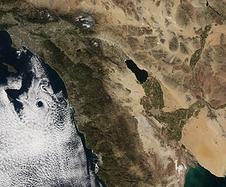
The Brawley Seismic Zone (BSZ), also known as the Brawley fault zone, is a predominantly extensional tectonic zone that connects the southern terminus of the San Andreas Fault with the Imperial Fault in Southern California. The BSZ is named for the nearby town of Brawley in Imperial County, California, and the seismicity there is characterized by earthquake swarms.

Although the eastern United States is not as seismically active as regions near plate boundaries, large and damaging earthquakes do occur there. Furthermore, when these rare eastern U.S. earthquakes occur, the areas affected by them are much larger than for western U.S. earthquakes of the same magnitude. Thus, earthquakes represent at least a moderate hazard to East Coast cities, including New York City and adjacent areas of very high population density.

The 2016 Oklahoma earthquake occurred on September 3, 2016 near Pawnee, Oklahoma. Measuring 5.8 on the moment magnitude scale, it is the strongest in state history. At 5.8 magnitude, this ties it with the 2011 Virginia earthquake, which was determined after it struck to be the most powerful quake in the eastern United States in the preceding 70 years.

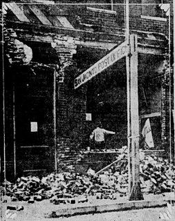
The 1918 San Jacinto earthquake occurred in extreme eastern San Diego County in Southern California on April 21 at 14:32:29 local time. The shock had a moment magnitude of 6.7 and a maximum Mercalli intensity of IX (Violent). Several injuries and one death occurred with total losses estimated to be $200,000.

The 1992 Murindó earthquake occurred on October 18 at 15:12 with an epicenter in the Department of Chocó, northern Colombia. The shallow magnitude 7.2 earthquake struck northwest of the town of Murindó, killing ten and injured more than a hundred. Thirty three municipalities were severely damaged.

The 1930 Bago earthquake, also known as the Swa earthquake and Pegu earthquake struck Burma on May 5 with a surface wave magnitude between 7.2 and 7.5 Ms . This earthquake was one of the most destructive to hit the country, and one of many earthquakes to affect the country between 1929 and 1931. Extensive damage was reported in the southern part of the country. More than 550 people were reportedly killed, although the death toll may be as high as 5,000 to 7,000. A moderate tsunami was generated along the Burmese coast as a result of the earthquake, however it only caused minor damage.
References
- ↑ Toor, Faraz. "A look at New York City's earthquake risks". NY1 .
- ↑ Fennell, Ryan (November 30, 1989). "Could It Happen Here? Earthquakes In The Tri-State Area". Two River Times. Archived from the original on July 19, 2011.
- ↑ Sykes, Lynn R.; et al. (August 2008). "Observations and Tectonic Setting of Historic and Instrumentally Located Earthquakes in the Greater New York City–Philadelphia Area" (PDF). Bulletin of the Seismological Society of America, Vol. 98, No. 4, pp. 1696–1719.
- ↑ Shahid, Alihay (March 17, 2011). "Could an earthquake hit New York City? History says yes, but not like 9.0 magnitude Japan earthquake". New York Daily News .