
The Landsat program is the longest-running enterprise for acquisition of satellite imagery of Earth. It is a joint NASA / USGS program. On 23 July 1972, the Earth Resources Technology Satellite was launched. This was eventually renamed to Landsat 1 in 1975. The most recent, Landsat 9, was launched on 27 September 2021.

SSL, formerly Space Systems/Loral, LLC (SS/L), of Palo Alto, California, is a wholly owned manufacturing subsidiary of Maxar Technologies.

The Earth Observing System (EOS) is a program of NASA comprising a series of artificial satellite missions and scientific instruments in Earth orbit designed for long-term global observations of the land surface, biosphere, atmosphere, and oceans. Since the early 1970s, NASA has been developing its Earth Observing System, launching a series of LANDSAT satellites in the decade. Some of the first included Passive-Microwave imaging in 1972 through the Nimbus 5 Satellite. Following the launch of various satellite missions, the conception of the program began in the late 80s and expanded rapidly through the 90s. Since the inception of the program, it has continued to develop to what we can collect in data today, including; land, sea, radiation and atmosphere. Collected in a system known as EOSDIS, NASA uses this data in order to study the progression and changes in the biosphere of Earth. The main focus of this data collection surrounds climatic science. The program is the centrepiece of NASA's Earth Science Enterprise (ESE).
Landsat 7 is the seventh satellite of the Landsat program. Launched on 15 April 1999, Landsat 7's primary goal is to refresh the global archive of satellite photos, providing up-to-date and cloud-free images. The Landsat program is managed and operated by the United States Geological Survey, and data from Landsat 7 is collected and distributed by the USGS. The NASA WorldWind project allows 3D images from Landsat 7 and other sources to be freely navigated and viewed from any angle. The satellite's companion, Earth Observing-1, trailed by one minute and followed the same orbital characteristics, but in 2011 its fuel was depleted and EO-1's orbit began to degrade. Landsat 7 was built by Lockheed Martin Space Systems.

DigitalGlobe is an American commercial vendor of space imagery and geospatial content, and operator of civilian remote sensing spacecraft. The company went public on the New York Stock Exchange on 14 May 2009, selling 14.7 million shares at US$19.00 each to raise US$279 million in capital. On 5 October 2017, Maxar Technologies completed its acquisition of DigitalGlobe.
Orbital Sciences Corporation was an American company specializing in the design, manufacture and launch of small- and medium- class space and launch vehicle systems for commercial, military and other government customers. In 2014, Orbital merged with Alliant Techsystems to create a new company called Orbital ATK, Inc., which in turn was purchased by Northrop Grumman in 2018. The remnants of the former Orbital Sciences Corporation today are a subsidiary of Northrop Grumman known as Northrop Grumman Space Systems.

NASA WorldWind is an open-source virtual globe. According to the website, "WorldWind is an open source virtual globe API. WorldWind allows developers to quickly and easily create interactive visualizations of 3D globe, map and geographical information. Organizations around the world use WorldWind to monitor weather patterns, visualize cities and terrain, track vehicle movement, analyze geospatial data and educate humanity about the Earth." It was first developed by NASA in 2003 for use on personal computers and then further developed in concert with the open source community since 2004. As of 2017, a web-based version of WorldWind is available online. An Android version is also available.

Satellite images are images of Earth collected by imaging satellites operated by governments and businesses around the world. Satellite imaging companies sell images by licensing them to governments and businesses such as Apple Maps and Google Maps.
Lockheed Martin Space is one of the four major business divisions of Lockheed Martin. It has its headquarters in Denver, Colorado, with additional sites in Valley Forge, Pennsylvania; Sunnyvale, California; Santa Cruz, California; Huntsville, Alabama; and elsewhere in the United States and United Kingdom. The division currently employs about 16,000 people, and its most notable products are commercial and military satellites, space probes, missile defense systems, NASA's Orion spacecraft, and the Space Shuttle external tank.

Landsat 5 was a low Earth orbit satellite launched on March 1, 1984, to collect imagery of the surface of Earth. A continuation of the Landsat Program, Landsat 5 was jointly managed by the U.S. Geological Survey (USGS) and the National Aeronautics and Space Administration (NASA). Data from Landsat 5 was collected and distributed from the USGS's Center for Earth Resources Observation and Science (EROS).
In computer programming contexts, a data cube is a multi-dimensional ("n-D") array of values. Typically, the term data cube is applied in contexts where these arrays are massively larger than the hosting computer's main memory; examples include multi-terabyte/petabyte data warehouses and time series of image data.

RADARSAT is a Canadian remote sensing Earth observation satellite program overseen by the Canadian Space Agency (CSA). The program has consisted of:

RapidEye AG was a German geospatial information provider focused on assisting in management decision-making through services based on their own Earth-observation imagery. The company operated a five-satellite constellation producing 5-meter resolution imagery that was designed and implemented by MacDonald Dettwiler of Richmond, Canada.
Earth observation (EO) is the gathering of information about the physical, chemical, and biological systems of the planet Earth. It can be performed via remote-sensing technologies or through direct-contact sensors in ground-based or airborne platforms.

Landsat 8 is an American Earth observation satellite launched on 11 February 2013. It is the eighth satellite in the Landsat program; the seventh to reach orbit successfully. Originally called the Landsat Data Continuity Mission (LDCM), it is a collaboration between NASA and the United States Geological Survey (USGS). NASA Goddard Space Flight Center in Greenbelt, Maryland, provided development, mission systems engineering, and acquisition of the launch vehicle while the USGS provided for development of the ground systems and will conduct on-going mission operations. It comprises the camera of the Operational Land Imager (OLI) and the Thermal Infrared Sensor (TIRS) which can be used to study Earth surface temperature and is used to study global warming.
GeoBase is a federal, provincial and territorial government initiative that is overseen by the Canadian Council on Geomatics (CCOG). It is undertaken to ensure the provision of, and access to, a common, up-to-date and maintained base of quality geospatial data for Canada. Through the GeoBase, users with an interest in geomatics have access to quality geospatial information at no cost and with unrestricted use.
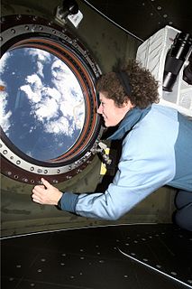
Windows on Earth is a museum exhibit, website, and exploration tool, developed by TERC, Inc., and the Association of Space Explorers, that enables the public to explore an interactive, virtual view of Earth from space. In addition, the tool has been selected by NASA to help astronauts identify targets for photography from the International Space Station (ISS).

Earth Observing-1 (EO-1) is a decommissioned NASA Earth observation satellite created to develop and validate a number of instrument and spacecraft bus breakthrough technologies. It was intended to enable the development of future Earth imaging observatories that will have a significant increase in performance while also having reduced cost and mass. The spacecraft was part of the New Millennium Program. It was the first satellite to map active lava flows from space; the first to measure a facility's methane leak from space; and the first to track re-growth in a partially logged Amazon forest from space. EO-1 captured scenes such as the ash after the World Trade Center attacks, the flooding in New Orleans after Hurricane Katrina, volcanic eruptions and a large methane leak in southern California.

Planet Labs PBC is an American public Earth imaging company based in San Francisco, California. Their goal is to image the entirety of the Earth daily to monitor changes and pinpoint trends.
Maxar Technologies Inc. is a space technology company headquartered in Westminster, Colorado, United States, specializing in manufacturing communication, Earth observation, radar, and on-orbit servicing satellites, satellite products, and related services. DigitalGlobe and MDA Holdings Company merged to become Maxar Technologies on October 5, 2017. Maxar Technologies is the parent holding company of Space Systems Loral, headquartered in Palo Alto, California, US; DigitalGlobe, headquartered in Westminster, Colorado, US; and Radiant Solutions, headquartered in Herndon, Virginia, US. Maxar Technologies is dual-listed on the Toronto Stock Exchange and New York Stock Exchange as MAXR.