Related Research Articles
The Global Positioning System (GPS), originally Navstar GPS, is a satellite-based radio navigation system owned by the United States government and operated by the United States Space Force. It is one of the global navigation satellite systems (GNSS) that provide geolocation and time information to a GPS receiver anywhere on or near the Earth where there is an unobstructed line of sight to four or more GPS satellites. It does not require the user to transmit any data, and operates independently of any telephonic or Internet reception, though these technologies can enhance the usefulness of the GPS positioning information. It provides critical positioning capabilities to military, civil, and commercial users around the world. Although the United States government created, controls and maintains the GPS system, it is freely accessible to anyone with a GPS receiver.

Geodesy is the science of measuring and representing the geometry, gravity, and spatial orientation of the Earth in temporally varying 3D. It is called planetary geodesy when studying other astronomical bodies, such as planets or circumplanetary systems.
Galileo is a global navigation satellite system (GNSS) that went live in 2016, created by the European Union through the European Space Agency (ESA), operated by the European Union Agency for the Space Programme (EUSPA), headquartered in Prague, Czechia, with two ground operations centres in Fucino, Italy, and Oberpfaffenhofen, Germany. The €10 billion project is named after the Italian astronomer Galileo Galilei.
Universal Time is a time standard based on Earth's rotation. While originally it was mean solar time at 0° longitude, precise measurements of the Sun are difficult. Therefore, UT1 is computed from a measure of the Earth's angle with respect to the International Celestial Reference Frame (ICRF), called the Earth Rotation Angle. UT1 is the same everywhere on Earth. UT1 is required to follow the relationship

Sidereal time is a system of timekeeping used especially by astronomers. Using sidereal time and the celestial coordinate system, it is easy to locate the positions of celestial objects in the night sky. Sidereal time is a "time scale that is based on Earth's rate of rotation measured relative to the fixed stars".

A retroreflector is a device or surface that reflects radiation back to its source with minimum scattering. This works at a wide range of angle of incidence, unlike a planar mirror, which does this only if the mirror is exactly perpendicular to the wave front, having a zero angle of incidence. Being directed, the retroflector's reflection is brighter than that of a diffuse reflector. Corner reflectors and cat's eye reflectors are the most used kinds.
The International Earth Rotation and Reference Systems Service (IERS), formerly the International Earth Rotation Service, is the body responsible for maintaining global time and reference frame standards, notably through its Earth Orientation Parameter (EOP) and International Celestial Reference System (ICRS) groups.

Lunar Laser Ranging (LLR) is the practice of measuring the distance between the surfaces of the Earth and the Moon using laser ranging. The distance can be calculated from the round-trip time of laser light pulses travelling at the speed of light, which are reflected back to Earth by the Moon's surface or by one of several retroreflectors installed on the Moon. Three were placed by the United States' Apollo program, two by the Soviet Lunokhod 1 and 2 missions, and one by India's Chandrayaan-3 mission.

The World Geodetic System (WGS) is a standard used in cartography, geodesy, and satellite navigation including GPS. The current version, WGS 84, defines an Earth-centered, Earth-fixed coordinate system and a geodetic datum, and also describes the associated Earth Gravitational Model (EGM) and World Magnetic Model (WMM). The standard is published and maintained by the United States National Geospatial-Intelligence Agency.
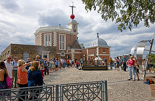
The historic prime meridian or Greenwich meridian is a geographical reference line that passes through the Royal Observatory, Greenwich, in London, England. The modern IERS Reference Meridian widely used today is based on the Greenwich meridian, but differs slightly from it. This prime meridian was first established by Sir George Airy in 1851, and by 1884, over two-thirds of all ships and tonnage used it as the reference meridian on their charts and maps. In October of that year, at the behest of US President Chester A. Arthur, 41 delegates from 25 nations met in Washington, D.C., United States, for the International Meridian Conference. This conference selected the meridian passing through Greenwich as the world standard prime meridian due to its popularity. However, France abstained from the vote, and French maps continued to use the Paris meridian for several decades. In the 18th century, London lexicographer Malachy Postlethwayt published his African maps showing the "Meridian of London" intersecting the Equator a few degrees west of the later meridian and Accra, Ghana.

In satellite laser ranging (SLR) a global network of observation stations measures the round trip time of flight of ultrashort pulses of light to satellites equipped with retroreflectors. This provides instantaneous range measurements of millimeter level precision which can be accumulated to provide accurate measurement of orbits and a host of important scientific data. The laser pulse can also be reflected by the surface of a satellite without a retroreflector, which is used for tracking space debris.

The International Terrestrial Reference System (ITRS) describes procedures for creating reference frames suitable for use with measurements on or near the Earth's surface. This is done in much the same way that a physical standard might be described as a set of procedures for creating a realization of that standard. The ITRS defines a geocentric system of coordinates using the SI system of measurement.
Satellite geodesy is geodesy by means of artificial satellites—the measurement of the form and dimensions of Earth, the location of objects on its surface and the figure of the Earth's gravity field by means of artificial satellite techniques. It belongs to the broader field of space geodesy. Traditional astronomical geodesy is not commonly considered a part of satellite geodesy, although there is considerable overlap between the techniques.

A satellite navigation or satnav system is a system that uses satellites to provide autonomous geopositioning. A satellite navigation system with global coverage is termed global navigation satellite system (GNSS). As of 2023, four global systems are operational: the United States's Global Positioning System (GPS), Russia's Global Navigation Satellite System (GLONASS), China's BeiDou Navigation Satellite System, and the European Space Agency's Galileo.
The International Celestial Reference System (ICRS) is the current standard celestial reference system adopted by the International Astronomical Union (IAU). Its origin is at the barycenter of the Solar System, with axes that are intended to "show no global rotation with respect to a set of distant extragalactic objects". This fixed reference system differs from previous reference systems, which had been based on Catalogues of Fundamental Stars that had published the positions of stars based on direct "observations of [their] equatorial coordinates, right ascension and declination" and had adopted as "privileged axes ... the mean equator and the dynamical equinox" at a particular date and time.

Earth's rotation or Earth's spin is the rotation of planet Earth around its own axis, as well as changes in the orientation of the rotation axis in space. Earth rotates eastward, in prograde motion. As viewed from the northern polar star Polaris, Earth turns counterclockwise.

A medium Earth orbit (MEO) is an Earth-centered orbit with an altitude above a low Earth orbit (LEO) and below a high Earth orbit (HEO) – between 2,000 and 35,786 km above sea level.
The term fundamental station is used for special observatories which combine several space positioning techniques like VLBI, satellite laser ranging, GPS, Glonass, etc. They are the basis of plate tectonic analysis, allowing the monitoring of continental drift rates with millimetre accuracies. A fundamental point is the geometric origin of a geodetic network and defines the geodetic datum of a national survey.
The IERS Reference Meridian (IRM), also called the International Reference Meridian, is the prime meridian maintained by the International Earth Rotation and Reference Systems Service (IERS). It passes about 5.3 arcseconds east of George Biddell Airy's 1851 transit circle which is 102 metres (335 ft) at the latitude of the Royal Observatory, Greenwich. Thus it differs slightly from the historical Greenwich meridian.
References
- ↑ Dobslaw, Henryk; Dill, Robert (February 2018). "Predicting Earth orientation changes from global forecasts of atmosphere-hydrosphere dynamics". Advances in Space Research. 61 (4): 1047–1054. Bibcode:2018AdSpR..61.1047D. doi:10.1016/j.asr.2017.11.044.
- ↑ Zajdel, Radosław; Sośnica, Krzysztof; Bury, Grzegorz; Dach, Rolf; Prange, Lars (July 2020). "System-specific systematic errors in earth rotation parameters derived from GPS, GLONASS, and Galileo". GPS Solutions. 24 (3): 74. doi: 10.1007/s10291-020-00989-w .
- ↑ Zajdel, R.; Sośnica, K.; Drożdżewski, M.; Bury, G.; Strugarek, D. (November 2019). "Impact of network constraining on the terrestrial reference frame realization based on SLR observations to LAGEOS". Journal of Geodesy. 93 (11): 2293–2313. Bibcode:2019JGeod..93.2293Z. doi: 10.1007/s00190-019-01307-0 .
- ↑ Sośnica, K.; Bury, G.; Zajdel, R. (16 March 2018). "Contribution of Multi‐GNSS Constellation to SLR‐Derived Terrestrial Reference Frame". Geophysical Research Letters. 45 (5): 2339–2348. Bibcode:2018GeoRL..45.2339S. doi:10.1002/2017GL076850. S2CID 134160047.
- ↑ Modiri, S.; Belda, S.; Hoseini, M.; Heinkelmann, R.; Ferrándiz, Jose M.; Schuh, H. (February 2020). "A new hybrid method to improve the ultra-short-term prediction of LOD". Journal of Geodesy. 94 (23): 23. Bibcode:2020JGeod..94...23M. doi: 10.1007/s00190-020-01354-y . PMC 7004433 . PMID 32109976.
- ↑ Seidelmann, P.K. 1982: Celest. Mech., 27, 79.
- ↑ Zajdel, Radosław; Sośnica, Krzysztof; Bury, Grzegorz; Dach, Rolf; Prange, Lars; Kazmierski, Kamil (January 2021). "Sub-daily polar motion from GPS, GLONASS, and Galileo". Journal of Geodesy. 95 (1): 3. Bibcode:2021JGeod..95....3Z. doi: 10.1007/s00190-020-01453-w .
- ↑ Modiri, Sadegh; Heinkelmann, Robert; Belda, Santiago; Malkin, Zinovy; Hoseini, Mostafa; Korte, Monika; Ferrándiz, José M.; Schuh, Harald (November 2021). "Towards Understanding the Interconnection between Celestial Pole Motion and Earth's Magnetic Field Using Space Geodetic Techniques". Sensors. 21 (22): 7555. Bibcode:2021Senso..21.7555M. doi: 10.3390/s21227555 . PMC 8621431 . PMID 34833631.
- ↑ Malkin, Zinovy; Belda, Santiago; Modiri, Sadegh (August 2022). "Detection of a New Large Free Core Nutation Phase Jump". Sensors. 22 (16): 5960. Bibcode:2022Senso..22.5960M. doi: 10.3390/s22165960 . PMC 9414530 . PMID 36015720.