East Hawkesbury

Last updated

East Hawkesbury
Township of East Hawkesbury
Canton de Hawkesbury Est
Hwy 417 East Hawkesbury.JPG
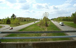
Highway 417 at East Hawkesbury
Prescott and Russell locator map 2021.svg
Red pog.svg
East Hawkesbury
Canada Southern Ontario location map 2.png
Red pog.svg
East Hawkesbury
Coordinates: 45°30′14″N74°30′00″W / 45.5039°N 74.5°W / 45.5039; -74.5
Country Canada
Province Ontario
County Prescott and Russell
Government
  MayorRobert Kirby
  Federal riding Glengarry—Prescott—Russell
  Prov. riding Glengarry—Prescott—Russell
Area
[1]
  Land235.18 km2 (90.80 sq mi)
Population
 (2016) [2]
  Total3,296
  Density14.0/km2 (36/sq mi)
Time zone UTC-5 (EST)
  Summer (DST) UTC-4 (EDT)
Postal Code FSA
K0B
Area code(s) 613, 343, 450, 579
Website www.easthawkesbury.ca OOjs UI icon edit-ltr-progressive.svg

East Hawkesbury is a township in eastern Ontario, Canada, in the United Counties of Prescott and Russell. Situated on the Ottawa River, its eastern boundary is the border with the province of Quebec.

Contents

Communities

The township comprises the villages of Chute-à-Blondeau, Sainte-Anne-de-Prescott and Saint-Eugène. The township administrative offices are located in Saint-Eugène. [3]

Demographics

In the 2021 Census of Population conducted by Statistics Canada, East Hawkesbury had a population of 3,418 living in 1,425 of its 1,507 total private dwellings, a change of 3.7% from its 2016 population of 3,296. With a land area of 235.06 km2 (90.76 sq mi), it had a population density of 14.5/km2 (37.7/sq mi) in 2021. [4]

Canada census – East Hawkesbury community profile
2021 2016 2011
Population3,418 (+3.7% from 2016)3,296 (-1.2% from 2011)3,335 (-1.0% from 2006)
Land area235.06 km2 (90.76 sq mi)235.01 km2 (90.74 sq mi)235.18 km2 (90.80 sq mi)
Population density14.5/km2 (38/sq mi)14.0/km2 (36/sq mi)14.2/km2 (37/sq mi)
Median age50.8 (M: 50.4, F: 51.2)49.8 (M: 50.3, F: 49.4)46.9 (M: 47.4, F: 46.4)
Private dwellings1,507 (total)  1,425 (occupied)1,482 (total) 1,386 (total) 
Median household income$81,000$66,752$66,310
References: 2021 [5] 2016 [2] 2011 [1] earlier [6] [7]
Historical census populations – East Hawkesbury
YearPop.±%
1986 2,788    
1991 3,159+13.3%
1996 3,296+4.3%
2001 3,415+3.6%
2006 3,368−1.4%
2011 3,335−1.0%
2016 3,296−1.2%
Source: Statistics Canada

See also

Related Research Articles

<span class="mw-page-title-main">Clarence-Rockland</span> City in Ontario, Canada

Clarence-Rockland is a city in Eastern Ontario, Canada, in the United Counties of Prescott and Russell on the Ottawa River.

<span class="mw-page-title-main">The Nation, Ontario</span> Municipality in Ontario, Canada

The Nation is a municipality in Eastern Ontario, located within Canada's National Capital Region, in the United Counties of Prescott and Russell. Formed in 1998, the municipality consists of the former townships of Caledonia, Cambridge and South Plantagenet, as well as the Village of St. Isidore.

<span class="mw-page-title-main">North Grenville</span> Municipality in Ontario, Canada

North Grenville is a township in eastern Ontario, Canada, in the United Counties of Leeds and Grenville on the Rideau River. It is located just south of Ottawa in Canada's National Capital Region.

<span class="mw-page-title-main">Alfred and Plantagenet</span> Township in Ontario, Canada

Alfred and Plantagenet is a Franco-Ontarian township in eastern Ontario, Canada, in the United Counties of Prescott and Russell. Located approximately 70 km (43 mi) from downtown Ottawa at the confluence of the Ottawa River and the South Nation River.

<span class="mw-page-title-main">Champlain, Ontario</span> Township in Ontario, Canada

Champlain is a township in eastern Ontario, Canada, in the United Counties of Prescott and Russell on the Ottawa River. It was formed on January 1, 1998, through the amalgamation of West Hawkesbury Township, Longueuil Township, Town of Vankleek Hill, and the Village of L'Orignal.

<span class="mw-page-title-main">Hawkesbury, Ontario</span> Town in Ontario, Canada

Hawkesbury is a town in Prescott-Russell county in Eastern Ontario, Canada. A majority of its 10,550 inhabitants are francophone.

<span class="mw-page-title-main">Pointe-Fortune, Quebec</span> Municipality in Quebec, Canada

Pointe-Fortune is a municipality in southwestern Quebec, Canada, on the Ottawa River in Vaudreuil-Soulanges Regional County Municipality, northwest of Montreal. The population at the 2021 Census was 582.

<span class="mw-page-title-main">United Counties of Prescott and Russell</span> United counties in Ontario, Canada

The United Counties of Prescott and Russell is a county located in the Canadian province of Ontario. Its county seat is L'Orignal. The county was created as a result of a merger between Russell County and Prescott County in 1820. It is located in Eastern Ontario, in the wedge-shaped area between the Ottawa River and St. Lawrence River, approximately 55 kilometres (34 mi) east of the City of Ottawa. Under Ontario law, the county is an Upper-tier Municipality.

<span class="mw-page-title-main">Black River-Matheson</span> Township in Ontario, Canada

Black River-Matheson is a township in the Cochrane District of the Canadian province of Ontario. The municipality is astride the Black River, for which it is partly named. The Matheson railway station was serviced by the Northlander until 2012.

<span class="mw-page-title-main">Horton, Ontario</span> Township in Ontario, Canada

Horton is a township in eastern Ontario, Canada, at the confluence of the Bonnechere River and the Ottawa River in Renfrew County. The Town of Renfrew was originally part of Horton Township.

<span class="mw-page-title-main">Admaston/Bromley</span> Township in Ontario, Canada

Admaston/Bromley is an incorporated township in Renfrew County, Eastern Ontario, Canada. It was formed on January 1, 2000, when Admaston and Bromley Townships were amalgamated. It takes part of its name from Admaston, Staffordshire, a small English hamlet.

<span class="mw-page-title-main">Central Huron</span> Municipality in Ontario, Canada

Central Huron is a township in western Ontario, Canada, in Huron County. It is situated on Lake Huron between the Maitland River and the Bayfield River.

<span class="mw-page-title-main">Nipissing, Ontario</span> Township in Ontario, Canada

Nipissing is an incorporated (political) township in Parry Sound District in Central Ontario, Canada. It is on Lake Nipissing and is part of the Almaguin Highlands region. Nipissing was surveyed between 1874 and 1881, and was incorporated in 1888. Among the first settlers in the area were the Chapman and Beatty families. Nipissing Township annexed Gurd Township in 1970. The township also contains a community named Nipissing, which is located on the South River near Chapman's Landing, on the South Bay of Lake Nipissing. The township administrative offices are located in Nipissing.

<span class="mw-page-title-main">Evanturel</span> Township in Ontario, Canada

Évanturel is a township in Timiskaming District, Ontario, Canada. It almost completely surrounds the town of Englehart. The main settlement in Évanturel is the community of Heaslip.

<span class="mw-page-title-main">Tyendinaga, Ontario</span> Township in Ontario, Canada

Tyendinaga is a township in the Canadian province of Ontario, located in Hastings County. The community takes its name from a variant spelling of Mohawk leader Joseph Brant's traditional Mohawk name, Thayendanegea.

<span class="mw-page-title-main">Bonnechere Valley</span> Township municipality in Ontario, Canada

Bonnechere Valley is a township municipality in Renfrew County, Ontario, Canada. It had a population of 3,674 in the Canada 2016 Census. It was established in 2001 by amalgamation of the village of Eganville and the townships of Grattan, Sebastapol and South Algona.

<span class="mw-page-title-main">North Algona Wilberforce</span> Township municipality in Ontario, Canada

North Algona Wilberforce is a township municipality in Renfrew County, Ontario, Canada. It has a population of 2,873. The township was formed in 1999 when the North Algona and Wilberforce townships were amalgamated.

<span class="mw-page-title-main">Greater Madawaska</span> Township municipality in Ontario, Canada

Greater Madawaska is an incorporated township in Renfrew County in eastern Ontario, Canada, created on January 1, 2001, through the amalgamation of the Township of Bagot and Blythfield; the Township of Brougham; and the Township of Griffith and Matawatchan. As of 2011, it has a population of 2,518.

<span class="mw-page-title-main">Machin, Ontario</span> Township in Ontario, Canada

Machin is a township in the Canadian province of Ontario, located in the Kenora District west of Dryden.

<span class="mw-page-title-main">Grenville, Quebec</span> Village municipality in Quebec, Canada

Grenville is a village municipality in the Argenteuil Regional County Municipality of the Laurentides region of Quebec, Canada. It is located opposite Hawkesbury, Ontario, on the Ottawa River.

References

  1. 1 2 "2011 Community Profiles". 2011 Canadian Census . Statistics Canada. March 21, 2019. Retrieved 2021-01-06.
  2. 1 2 "2016 Community Profiles". 2016 Canadian Census . Statistics Canada. August 12, 2021. Retrieved 2019-06-30.
  3. "Mayor's Welcome :: East Hawkesbury Township". easthawkesbury.ca. Retrieved 2018-04-19.
  4. "Population and dwelling counts: Canada, provinces and territories, census divisions and census subdivisions (municipalities), Ontario". Statistics Canada. February 9, 2022. Retrieved April 2, 2022.
  5. "2021 Community Profiles". 2021 Canadian Census . Statistics Canada. February 4, 2022. Retrieved 2023-10-19.
  6. "2006 Community Profiles". 2006 Canadian Census . Statistics Canada. August 20, 2019.
  7. "2001 Community Profiles". 2001 Canadian Census . Statistics Canada. July 18, 2021.