
The Hull–Rust–Mahoning Open Pit Iron Mine in Hibbing, Minnesota, United States, is the largest operating open-pit iron mine in Minnesota. The pit stretches more than three miles (5 km) long, two miles (3 km) wide, and 535 feet (163 m) deep. It was established in 1895 and was one of the world's first mechanized open-pit mines.

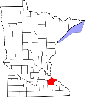
This is a list of the National Register of Historic Places listings in Dakota County, Minnesota. It is intended to be a complete list of the properties and districts on the National Register of Historic Places in Dakota County, Minnesota, United States. Dakota County is located in the southeastern part of the U.S. state of Minnesota, bounded on the northeast side by the Upper Mississippi River and on the northwest by the Minnesota River. The locations of National Register properties and districts for which the latitude and longitude coordinates are included below, may be seen in an online map.

This list is of the properties and historic districts which are designated on the National Register of Historic Places or that were formerly so designated, in Hennepin County, Minnesota; there are 186 entries as of October 2021. A significant number of these properties are a result of the establishment of Fort Snelling, the development of water power at Saint Anthony Falls, and the thriving city of Minneapolis that developed around the falls. Many historic sites outside the Minneapolis city limits are associated with pioneers who established missions, farms, and schools in areas that are now suburbs in that metropolitan area.

This is a complete list of National Register of Historic Places listings in Ramsey County, Minnesota. It is intended to be a complete list of the properties and districts on the National Register of Historic Places in Ramsey County, Minnesota, United States. The locations of National Register properties and districts for which the latitude and longitude coordinates are included below, may be seen in an online map.

This is a list of the National Register of Historic Places listings in Scott County, Minnesota. It is intended to be a complete list of the properties and districts on the National Register of Historic Places in Scott County, Minnesota, United States. The locations of National Register properties and districts for which the latitude and longitude coordinates are included below, may be seen in an online map.

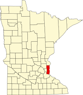
This is a list of the National Register of Historic Places listings in Rice County, Minnesota. It is intended to be a complete list of the properties and districts on the National Register of Historic Places in Rice County, Minnesota, United States. The locations of National Register properties and districts for which the latitude and longitude coordinates are included below, may be seen in an online map.
This is a list of the National Register of Historic Places listings in Goodhue County, Minnesota. It is intended to be a complete list of the properties and districts on the National Register of Historic Places in Goodhue County, Minnesota, United States. The locations of National Register properties and districts for which the latitude and longitude coordinates are included below, may be seen in an online map.

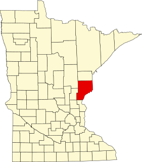
This is a list of the National Register of Historic Places listings in Saint Louis County, Minnesota. It is intended to be a complete list of the properties and districts on the National Register of Historic Places in Saint Louis County, Minnesota, United States. The locations of National Register properties and districts for which the latitude and longitude coordinates are included below, may be seen in an online map.

This is a list of the National Register of Historic Places listings in Stearns County, Minnesota. It is intended to be a complete list of the properties and districts on the National Register of Historic Places in Stearns County, Minnesota, United States. The locations of National Register properties and districts for which the latitude and longitude coordinates are included below, may be seen in an online map.
This is a list of the National Register of Historic Places listings in Pine County, Minnesota. It is intended to be a complete list of the properties and districts on the National Register of Historic Places in Pine County, Minnesota, United States. The locations of National Register properties and districts for which the latitude and longitude coordinates are included below, may be seen in an online map.

This is a list of the National Register of Historic Places listings in Winona County, Minnesota. It is intended to be a complete list of the properties and districts on the National Register of Historic Places in Winona County, Minnesota, United States. The locations of National Register properties and districts for which the latitude and longitude coordinates are included below, may be seen in an online map.
This is a list of the National Register of Historic Places listings in Washington County, Minnesota. It is intended to be a complete list of the properties and districts on the National Register of Historic Places in Washington County, Minnesota, United States. The locations of National Register properties and districts for which the latitude and longitude coordinates are included below, may be seen in an online map.
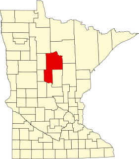
This is a list of the National Register of Historic Places listings in Cass County, Minnesota. It is intended to be a complete list of the properties and districts on the National Register of Historic Places in Cass County, Minnesota, United States. The locations of National Register properties and districts for which the latitude and longitude coordinates are included below, may be seen in an online map.

Hibbing High School is a public grade 7–12 high school in Hibbing, Minnesota, United States. It was built from 1920 to 1922 as the entire city relocated two miles (3 km) south to make way for the expanding Hull–Rust–Mahoning Mine. The lavish Tudor Revival building was constructed at a cost of about $3.9 million, becoming known as the "castle in the woods" and—thanks to its polished brass fixtures—the "school with the golden doorknobs". The project was bankrolled by the mining industry, which wanted to make the move more palatable for those being displaced. It also satisfied immigrants' desire for their children's education.
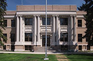
The St. Louis County District Courthouse is the seat of government for the northern district of St. Louis County, Minnesota, United States, located in the city of Virginia. The St. Louis County District Court is held in three locations: Duluth, Hibbing and Virginia.
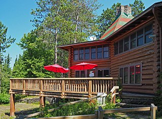
Camp Esquagama, formerly the St. Louis County 4-H Club Camp, is a summer camp in Biwabik Township, Minnesota, United States. It was established on the east shore of Esquagama Lake in 1934 with the first place prize money from a contest to name the best county 4-H program in the nation. The logs were donated by the Oliver Iron Mining Company and labor furnished by local Civilian Conservation Corps and Works Progress Administration companies. The camp was listed on the National Register of Historic Places in 1985 for its local significance in the themes of architecture, entertainment/recreation, and social history. It was nominated for its exemplary log construction and unique origin.
The Mitchell–Tappan House is a historic house in Hibbing, Minnesota, United States. It was built in 1897 as a residence for executives of the Oliver Mining Company. The house was listed on the National Register of Historic Places in 1980 for its local significance in the themes of architecture and social history. It was nominated for reflecting the sumptuous lifestyle enjoyed by an elite few in the early mining era.

The Delvic Building is a historic commercial building in Hibbing, Minnesota, United States. It was constructed in 1922 when Hibbing was a company town for a subsidiary of U.S. Steel, which took the unusual step of designing the commercial as well as residential sectors. In previous company towns, such as Coleraine, Minnesota, or Gary, Indiana, the controlling industry focused on employee housing and left commercial development to private entrepreneurs. The Delvic Building was listed on the National Register of Historic Places for its local significance in the themes of commerce, community planning and development, and industry. It was nominated for exemplifying the type of building constructed in Hibbing's planned downtown, and for attesting to this evolution in corporate control of community development.

The Androy Hotel is a former hotel building in Hibbing, Minnesota, United States. It was built in 1921 by the Oliver Iron Mining Company to anchor the city's new business district, which was being relocated so the Hull–Rust–Mahoning Open Pit Iron Mine could expand. The Androy Hotel was listed on the National Register of Historic Places in 1986 for its local significance in the themes of architecture and industry. It was nominated for being a good example of a large, Renaissance Revival hotel built to serve a growing mining community. When the East Howard Street Commercial Historic District was designated in 1993, the Androy Hotel was listed as a contributing property.

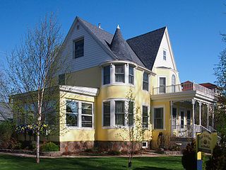
The Andrew G. Anderson House is a historic house in Hibbing, Minnesota, United States. It was built in 1920 for Andrew "Bus Andy" Anderson, a pioneer in the intercity bus service industry. The house was listed on the National Register of Historic Places in 1980 for its local significance in the themes of architecture and transportation. It was nominated for its association with Anderson and its status as one of the most lavish residences in the Hibbing area.


