The Town of Mancos is a Statutory Town located in Montezuma County, Colorado, United States. The town population was 1,336 at the 2010 United States Census.

The Fryingpan River is a tributary of the Roaring Fork River, approximately 42 miles (68 km) long, in west central Colorado in the United States.

The Blue River is a tributary of the Colorado River, approximately 65 miles (105 km) long, in the U.S. state of Colorado.

The Fraser River is a tributary of the Colorado River, approximately 32.5 miles (52.3 km) long, in north central Colorado in the United States. It drains large portion of the Middle Park basin in Grand County in the Rocky Mountains west of Boulder and southwest of Rocky Mountain National Park. It rises at the continental divide on the north side of Berthoud Pass in the Arapaho National Forest. It flows NNW past Winter Park, Fraser, and Tabernash, and joins the Colorado River from the south two miles west of Granby.
Muddy Creek is a tributary of the Colorado River, approximately 60.5 miles (97.4 km) long, in north central Colorado in the United States.
The Eagle River is a tributary of the Colorado River, approximately 60.5 miles (97.4 km) long, in west central Colorado in the United States.

The Uinta Mountains are an east-west trending chain of mountains in northeastern Utah extending slightly into southern Wyoming in the United States. As a subrange of the Rocky Mountains, they are unusual for being the highest range in the contiguous United States running east to west, and lie approximately 100 miles (160 km) east of Salt Lake City. The range has peaks ranging from 11,000–13,528 feet (3,353–4,123 m), with the highest point being Kings Peak, also the highest point in Utah. The Mirror Lake Highway crosses the western half of the Uintas on its way to Wyoming.

The West Elk Mountains are a high mountain range in the west-central part of the U.S. state of Colorado. They lie primarily within the Gunnison National Forest, and part of the range is protected as the West Elk Wilderness. The range is primarily located in Gunnison County, with small parts in eastern Delta and Montrose counties.

The Mancos Shale or Mancos Group is a Late Cretaceous geologic formation of the Western United States.

Apishapa River is a 139-mile-long (224 km) tributary of the Arkansas River that flows from a source near West Spanish Peak in southern Colorado. It joins the Arkansas east of Fowler, Colorado. A U.S. Geological Survey (USGS) station, #07119500, located along this river near Fowler measures the river's discharge.

East Fork Arkansas River is a 20.6-mile-long (33.2 km) tributary of the Arkansas River that flows from a source in the Mosquito Range of central Colorado. It joins with Tennessee Creek to form the Arkansas River west of Leadville, Colorado.
Lone Tree Creek is a 102-mile-long (164 km) tributary that joins the South Platte River in Weld County, Colorado east of Greeley. The creek's source is west of Buford in Albany County, Wyoming.
Horse Creek is a 129-mile-long (208 km) tributary of the Arkansas River that flows from a source south of Calhan in the Holcolm Hills of El Paso County, Colorado. It flows east and south to a confluence with the Arkansas in Otero County west of Las Animas
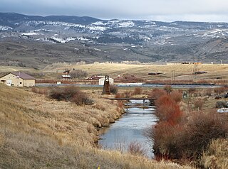
West Mancos River is a 13.1-mile-long (21.1 km) tributary of the Mancos River in Montezuma County, Colorado. The river flows from the confluence of its North and South forks in the San Juan National Forest to a confluence with the East Mancos River that forms the Mancos River.

East Fork Eagle River is an 8.6-mile-long (13.8 km) tributary of the Eagle River in Eagle County, Colorado. The river flows from a source on Chicago Ridge in the White River National Forest to a confluence with the South Fork Eagle River that forms the Eagle River.
Middle Fork Cimarron River is a 10.3-mile-long (16.6 km) tributary of the Cimarron River in Colorado. The river's source is east of Coxcomb Peak in the Uncompahgre Wilderness of Hinsdale County. It joins the East Fork Cimarron River in Gunnison County to form the Cimarron River.
North Fork West Mancos River is a tributary of the West Mancos River in Montezuma County, Colorado. The river flows from a source east of Hesperus Mountain in the San Juan National Forest to a confluence with the South Fork that forms the West Mancos River.
South Fork West Mancos River is a tributary of the West Mancos River in Montezuma County, Colorado. The river flows from a source in the Owen Basin of the San Juan National Forest to a confluence with the North Fork that forms the West Mancos River.