
East Preston in Nova Scotia
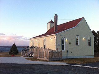
East Preston is an expansive rural Black Nova Scotian community located in eastern Halifax Regional Municipality, Nova Scotia, in Atlantic Canada. The population at the time of the 2016 census was 869. [1]
East Preston is an expansive rural Black Nova Scotian community located in eastern Halifax Regional Municipality, Nova Scotia, in Atlantic Canada. The population at the time of the 2016 census was 869. [1]
East Preston is within the Halifax Regional Municipality. It was located East of another rural area, Preston. East Preston is accessible off of Trunk 7 or No 207 on Marine Drive through the Ross Road or the Mineville Road.
| Year | Pop. | ±% |
|---|---|---|
| 1981 | 1,020 | — |
| 1986 | 1,210 | +18.6% |
| 1996 | 990 | −18.2% |
| 2006 | 888 | −10.3% |
| 2016 | 869 | −2.1% |
| Source: Statistics Canada [Note 1] | ||

East Preston was founded in the 19th century. It is believed to have been named after Preston, Lancashire, England or Thomas Preston, a British army officer involved in the Boston Massacre the American Revolution. [2] While it is often thought that the community is named after Rev. Richard Preston, the famous African Nova Scotia leader and minister, the community was established long before he arrived. Preston arrived after escaping American slavery, in search of his mother. She had escaped earlier and was settled in Preston, living free. He was so impressed that he took the name of her community as his surname. [3] Rev. Preston started the two churches which are still located in this region. At first the two communities of East and North Preston were a whole. Known simply as Preston, soon the two would identify themselves differently by adding the North and East in front of it. East and North Preston are well known across the Maritimes; together they comprise the largest indigenous black community in Canada founded before the 20th century.
At one time when Preston was important as the source of market garden produce, East Preston also played an important role in supplying produce from small farm holdings. The area contains a large number of very popular lakes used for recreation. The boundaries of the Prestons have shrunken continually over the years. It once stretched from Porters Lake to the East, to well into the current confines of Dartmouth. Its current boundaries have been established since the mid-1970s.
East Preston was predominantly a Black Canadian community in its early days, descended from Black Loyalists who were relocated here by the Crown following the American Revolutionary War. To a degree the community has retained this traditional culture. But, with the demand for land and the growth of the city of Halifax, many people from other areas have joined the community. The local Recreation Centre and Black Baptist Church provide a focus for the many Black families. Currently, North Preston, has a nearly 100% Black population and East Preston currently has a Black population of about 80%. A road exists that directly connects the two villages of North Preston and East Preston.
Just east of East Preston, the area around Porters Lake has had an in-migration of new residents and business. This community serves as a shopping district for East Preston and other surrounding communities.

North Preston is a community located in Nova Scotia, Canada within the Halifax Regional Municipality.
Africville was a small community of predominantly African Nova Scotians located in Halifax, Nova Scotia, Canada. It developed on the southern shore of Bedford Basin and existed from the early 1800s to the 1960s. From 1970 to the present, a protest has occupied space on the grounds. The government has recognized it as a commemorative site and established a museum here. The community has become an important symbol of Black Canadian identity, as an example of the "urban renewal" trend of the 1960s that razed similarly racialized neighbourhoods across Canada, and the struggle against racism.

The North End of Halifax is a neighbourhood of Halifax, Nova Scotia occupying the northern part of Halifax Peninsula immediately north of Downtown Halifax.
Preston is an area in central Nova Scotia, Canada in the Halifax Regional Municipality, located on Trunk 7. Preston includes the subdivisions of East Preston, North Preston, Lake Major, Cherry Brook and Loon Lake. The definition sometimes extends to include Lake Echo. The population in 2016 was 3,223. This is a decline from 2006, when Preston had a population of 3,536.
Cherry Brook rural community located to the north of Trunk 7 between Lake Loon and Lake Major, and just a few kilometres east of Dartmouth, Nova Scotia. It has a significant African Nova Scotian population.
Grand Lake can refer to at least 9 different lakes in the Canadian province of Nova Scotia:

Route 207 is a collector road in the Canadian province of Nova Scotia. It is located in the Halifax Regional Municipality and connects Dartmouth to Porters Lake on the Eastern Shore.
Westphal is an unincorporated community located in Dartmouth, Nova Scotia and outside of Dartmouth, Nova Scotia. Some of Westphal is considered part of Dartmouth, Nova Scotia and some of it is considered separate from Dartmouth, Nova Scotia. The area is bound by Port Wallace in the north, Waverley Road in the west, Lake Major Road in the east, and Main Street in the south. The area also includes the watershed and water filtration plant for the Halifax Regional Water Commission that supplies drinking water for the residents of Dartmouth and surrounding communities east of Halifax Harbour.
Goffs is a Canadian rural community in Nova Scotia's Halifax Regional Municipality.

Musquodoboit Harbour is a rural community located in Nova Scotia, Canada within the Halifax Regional Municipality. The community is situated on the Eastern Shore at the mouth of the Musquodoboit River. The community lies 45 kilometres east of downtown Halifax. With a hospital, RCMP detachment, postal outlet, schools, recreational center, library, municipal office and other services, Musquodoboit Harbour is a serve centre for many of the surrounding communities.
Porters Lake is a rural community in the Eastern Shore region of the Halifax, Nova Scotia, Canada, between Trunk 7 and Route 207, 27.8 km from Halifax. The residents mainly commute to jobs in Dartmouth, Burnside Industrial Park or in Downtown Halifax. The community is built around the lake from which it takes its name.
Head of Chezzetcook is a rural community on the Eastern Shore Marine Drive route of Halifax Regional Municipality in Nova Scotia. The Head of Chezzetcook area begins at the intersections of routes 7 and 207, near Porters Lake and West Chezzetcook, and continues along the Marine Drive to Gaetz Brook. Head of Chezzetcook is a short commute to Downtown Halifax at 29.52 kilometers; and in its heyday was a major port of call for ships delivering supplies from the city to local gold miners and early settlers. A vista of the sea marks the Head of Chezzetcook Inlet, for which the Chezzetcooks are named; and a fork in the road for both East Chezzetcook and Conrod Settlement.
Beechville is a Black Nova Scotian settlement and suburban community within the Halifax Regional Municipality of Nova Scotia, Canada, on St. Margaret's Bay Road. The Beechville Lakeside Timberlea (BLT) trail starts here near Lovett Lake, following the old Halifax and Southwestern Railway line. Ridgecliff Middle School, located in Beechville Estates, serves the communities of Beechville, Lakeside, and Timberlea.

Black Nova Scotians are an ethnic group consisting of Black Canadians whose ancestors primarily date back to the Colonial United States as slaves or freemen, later arriving in Nova Scotia, Canada, during the 18th and early 19th centuries. As of the 2021 Census of Canada, 28,220 Black people live in Nova Scotia, most in Halifax. Since the 1950s, numerous Black Nova Scotians have migrated to Toronto for its larger range of opportunities. The first recorded free African person in Nova Scotia, Mathieu da Costa, a Mikmaq interpreter, was recorded among the founders of Port Royal in 1604. West Africans escaped slavery by coming to Nova Scotia in early British and French Colonies in the 17th and 18th centuries. Many came as enslaved people, primarily from the French West Indies to Nova Scotia during the founding of Louisbourg. The second major migration of people to Nova Scotia happened following the American Revolution, when the British evacuated thousands of slaves who had fled to their lines during the war. They were given freedom by the Crown if they joined British lines, and some 3,000 African Americans were resettled in Nova Scotia after the war, where they were known as Black Loyalists. There was also the forced migration of the Jamaican Maroons in 1796, although the British supported the desire of a third of the Loyalists and nearly all of the Maroons to establish Freetown in Sierra Leone four years later, where they formed the Sierra Leone Creole ethnic identity.

Richard Preston,, was a religious leader and abolitionist. He escaped slavery in Virginia to become an important leader for the African Nova Scotian community and in the international struggle against slavery. He established the Cornwallis Street Baptist Church, the African Abolition Society and the African Baptist Association.
There are various Black Lakes in Nova Scotia, Canada. They vary widely in size, depth and usability. Many counties, such as Cumberland, Halifax, Inverness, and Pictou Counties have more than one Black Lake so named, while other counties mentioned in this article have only one named Black Lake.
The Africville Apology was a formal pronouncement delivered on 24 February 2010 by the City of Halifax, Nova Scotia for the eviction and eventual destruction of Africville, a Black Nova Scotian community.
Upper Hammonds Plains is a Canadian suburban community located in Nova Scotia's Halifax Regional Municipality.

New Horizons Baptist Church is a Baptist church in Halifax, Nova Scotia that was established by Black Refugees in 1832. When the chapel was completed, black citizens of Halifax were reported to be proud because it was evidence that former slaves could establish their own institutions in Nova Scotia. Under the direction of Richard Preston, the church laid the foundation for social action to address the plight of Black Nova Scotians. It is affiliated with the Canadian Baptists of Atlantic Canada.
Donald D. Skeir was a Canadian pastor, community leader, and educator in the African Nova Scotian community.