East Rochester, New York

Last updated

East Rochester
East Rochester NY seal.png
Seal of East Rochester
Monroe County New York incorporated and unincorporated areas East Rochester highlighted.svg
Location of East Rochester in Monroe County, and location of Monroe County in the state of New York.
New York in United States (US48).svg
Location of New York in the United States
Coordinates: 43°06′44″N77°29′13″W / 43.11222°N 77.48694°W / 43.11222; -77.48694
CountryUnited States
State New York
County Monroe
Incorporated 1906;118 years ago (1906)
(as a village)
Incorporated1981;43 years ago (1981)
(as a coterminous town and village)
Government
   Town Supervisor/Mayor John R. Alfieri
Town Council/Trustees
  • Mark A. Florack (R)
  • Kelley Swagler(R)
  • Vincent E. Raschiatore (R)
  • Ted Conners (R)
Area
[1]
  Total1.32 sq mi (3.42 km2)
  Land1.31 sq mi (3.41 km2)
  Water0.00 sq mi (0.01 km2)
Elevation
436 ft (133 m)
Population
 (2020)
  Total6,334
  Estimate 
(2022)
6,213
  Density4,816.73/sq mi (1,859.80/km2)
Time zone UTC-5 (EST)
  Summer (DST) UTC-4 (EDT)
ZIP code
14445
Area code 585
FIPS code 36-055-22870
FIPS code 36-22865
Website http://www.eastrochester.org/

East Rochester is a coterminous town and village located southeast of the City of Rochester in Monroe County, New York, United States. The town and village, home to 6,334 people at the time of the 2020 United States Census, is surrounded by Pittsford on the west side, by Perinton to the east, and by Penfield to the north. Most of the southern boundary is delimited by New York State Route 31F.

Contents

History

Beginnings

The village of East Rochester was originally known as the Village of Despatch when the community was incorporated in 1897. Despatch was laid out as a planned community designed around the New York Central Railroad mainline that ran through the center of the village. Much of the original land which became the village came from Fairport businessman Walter Parce. This land was used to develop housing for employees of the earliest employers: the Merchants Despatch Corporation and the Aeolian Piano Corporation. The original buildings of the Aeolian Piano Corporation are still in use today as a shopping center and office complex called Piano Works Mall.

To better showcase the village's proximity to the city of Rochester, the village was incorporated as the Village of East Rochester in 1906.

The village was divided between the towns of Perinton, Pittsford, and Penfield.

On August 20, 1966, a Little League baseball team from East Rochester captured the Senior Little League World Championship by defeating La Habra California 4–2 in Des Moines, Iowa. East Rochester is the smallest community in the world to win either a Little League or Senior Little League World Championship.

The United States Post Office (East Rochester, New York) was listed on the National Register of Historic Places in 1988. [2]

Coterminous status

In 1981, the village became a coterminous town and village. [3]

Derailments

Two derailments have occurred on the double-track mainline railroad running through East Rochester. The first occurred on October 29, 1969, when a 30-car Penn Central freight train carrying produce derailed onto West Maple Avenue (which, along with East Maple Avenue, runs parallel to the tracks between NY 153 and South Lincoln Road), crushing numerous automobiles and toppling telephone poles. No one was injured. [4] [5]

On January 16, 2007, a 13-car CSX intermodal train traveling 60 mph (97 km/h) and carrying retail goods partially derailed at the South Lincoln underpass, spilling at least five containers and two intermodal wells onto the road below. The wreckage extended west from South Lincoln along East Maple Avenue to Madison Street as derailed cars crushed a number of vehicles parked alongside the tracks and dumped intermodal containers into the front yards of residents on Maple. Overall, eight wells and 15 to 20 containers came off the rails. As in 1969, no one was injured in the accident. [4] The presence of mangled intermodal cars in the southbound lanes of Lincoln Road, as well as one teetering on the edge of the bridge, forced the closure of the road. It reopened January 18 following two days of cleanup. The 200 block of East Maple Avenue, however, remained closed for repair work for several days afterward. [6]

Geography

East Rochester is located at 43°6′44″N77°29′13″W / 43.11222°N 77.48694°W / 43.11222; -77.48694 (43.112413, -77.487). [7]

According to the United States Census Bureau, the village has a total area of 1.4 square miles (3.6 km2), all land; however, Irondequoit Creek runs along the eastern edge of the village.

Demographics

Historical population
CensusPop.Note
1910 2,398
1920 3,90162.7%
1930 6,62769.9%
1940 6,6911.0%
1950 7,0224.9%
1960 8,15216.1%
1970 8,3472.4%
1980 7,596−9.0%
1990 6,932−8.7%
2000 6,650−4.1%
2010 6,587−0.9%
2020 6,334−3.8%
U.S. Decennial Census [8]

As of the census [9] of 2000, there were 6,650 people, 2,774 households, and 1,625 families residing in the village. The population density was 4,915.4 inhabitants per square mile (1,897.8/km2). There were 2,916 housing units at an average density of 2,155.4 units per square mile (832.2 units/km2). The racial makeup of the village was 95.92% White, 1.38% African American, 0.26% Native American, 0.74% Asian, 0.02% Pacific Islander, 0.36% from other races, and 1.32% from two or more races. 2.38% of the population were Hispanic or Latino of any race.

There were 2,774 households, out of which 29.7% had children under the age of 18 living with them, 39.4% were married couples living together, 15.0% had a female householder with no husband present, and 41.4% were non-families. 34.1% of all households were made up of individuals, and 12.6% had someone living alone who was 65 years of age or older. The average household size was 2.34 and the average family size was 3.04.

In the village, the population was spread out, with 24.1% under the age of 18, 8.7% from 18 to 24, 31.7% from 25 to 44, 20.8% from 45 to 64, and 14.8% who were 65 years of age or older. The median age was 36 years. For every 100 females, there were 88.2 males. For every 100 females age 18 and over, there were 83.1 males.

The median income for a household in the village was $39,221, and the median income for a family was $48,553. Males had a median income of $32,094 versus $26,953 for females. The per capita income for the village was $18,875. About 6.2% of families and 9.3% of the population were below the poverty line, including 10.8% of those under age 18 and 5.3% of those age 65 or over.

Government

East Rochester village office East Rochester, New York Village Office.JPG
East Rochester village office

The village is governed by a mayor and village board on which the mayor, deputy mayor, and three elected village trustees are seated. By General municipal Law the Village Administrator runs the day-to-day operations. There are additional boards for architectural review, assessment review, library, and zoning appeals, two commissions for the village cable channel and planning, and a housing authority.

Village Presidents and Mayors
NameTitleTerm
T. Joseph MitchellPresident1907–1909
Howard R. WordenPresident1909–1910
William J. GenthnerPresident1910–1911
Charles H. DerbyPresident1911–1913
Charles S. KingPresident1913–1914
Howard R. WordenPresident
Mayor
1914–1928
1928–1931
George H. McInerneyMayor1931–1933
W. Duane SmithMayor1933–1935
T. Joseph MitchellMayor1935–1936
George SchreibMayor1936–1947
Lee R. ArcuriMayor1947–1949
Howard A. HustlebyMayor1949–1951
Kenneth D. MackenzieMayor1951–1953
Paul N. BowerMayor1953–1971
Anthony DellaPietraMayor1971–1979
Ralph CelantaniMayor1979–1983
Peter D. QuinziMayor1983–2000
David P. BonacchiMayor2000–2007
Jason W. KoonMayorDecember 1, 2007 – November 30, 2011
Frederick L. RicciMayorDecember 1, 2011 – November 30, 2019
John R. AlfieriMayorDecember 1, 2019 – present

[10]

Transportation

Three state highways enter the vicinity of East Rochester: NY 31F, better known locally as Fairport Road, New York State Route 153 (Washington Street), and unsigned New York State Route 940U (West Commercial Street). NY 153 has the highest average annual daily traffic of any street serving East Rochester proper, carrying 11,000 vehicles per day between NY 31F and Commercial and 18,000 vehicles daily from Commercial to Linden Avenue as of 2004. NY 31F carries over 27,000 vehicles per day but does not enter the village. [11] NY 153 is also the only north–south street in the village that runs from one end of the village to the other and continues into neighboring towns. Linden Avenue is the only such east–west street.

Rochester-Genesee Regional Transportation Authority routes 81 and 82 service the village, connecting it directly to neighboring Fairport and Rochester and providing an express route for commuting between the two villages and the city.

The double-tracked CSX Transportation Rochester Subdivision rail line runs east–west through East Rochester, dividing the town in half. No grade crossings exist within the East Rochester limits. Two streets, NY 153 and South Lincoln Road, pass under the mainline by way of underpasses roughly 0.5 mi (0.8 km) apart.

Emergency response

Access to emergency services is obtained by dialing 9-1-1 which connects the caller to the City of Rochester's Emergency Communications Department (9-1-1 Center). The East Rochester Police Department provides primary law enforcement for the town residents.

The East Rochester Fire Department is staffed by volunteers and provides emergency fire, rescue and non-transport emergency medical services within the town.

American Medical Response provides service to East Rochester Volunteer which includes primary emergency medical response, including Basic Life Support, with trained Emergency Medical Technicians.

Notable person

Related Research Articles

<span class="mw-page-title-main">Penfield, New York</span> Town in New York, United States

Penfield is a town in Monroe County, New York, United States. The population was 39,438 at the 2020 census.

<span class="mw-page-title-main">Perinton, New York</span> Town in New York, United States

Perinton is a town in Monroe County, New York, United States. The population was 47,479 at the 2020 census.

<span class="mw-page-title-main">Arcadia, New York</span> Town in New York, United States

Arcadia is a town in Wayne County, New York, United States. The population was 14,244 at the 2010 census.

<span class="mw-page-title-main">Ridgefield (CDP), Connecticut</span> Census-designated place in Connecticut, United States

Ridgefield is a census-designated place (CDP) in Fairfield County, Connecticut, United States. It consists of the primary central village in the town of Ridgefield and surrounding residential areas. As of the 2020 census, the population of the CDP was 7,596, out of 25,053 in the entire town.

Franklinville is a town in Cattaraugus County, New York, United States. The population was 2,811 at the 2020 census.

<span class="mw-page-title-main">Lancaster, New York</span> Town in New York, United States

Lancaster is a town in Erie County, New York, United States, centered 14 miles east of downtown Buffalo. Lancaster is an outer ring suburb of Buffalo. As of the 2020 Census, the town population was 45,106.

<span class="mw-page-title-main">Bergen (village), New York</span> Village in New York, United States

Bergen is a village in Genesee County, New York, United States. The population was 1,176 at the 2010 census.

<span class="mw-page-title-main">Pittsford, New York</span> Town in New York, United States

Pittsford is an incorporated town in Monroe County, New York. A suburb of Rochester, its population was 30,617 at the time of the 2020 census.

<span class="mw-page-title-main">Lockport (town), New York</span> Town in New York, United States

Lockport is a town in Niagara County, New York, United States. The population was 20,529 at the 2010 census. The name is derived from the series of canal locks on the Erie Canal. The locks lift boats from the lowland of Lake Ontario past the Niagara Escarpment.

<span class="mw-page-title-main">Macedon, New York</span> Town in New York, United States

Macedon is a town in Wayne County, New York, United States. The population was 9,148 at the 2010 census.

Victor is an incorporated town in Ontario County, New York, United States. The population was 15,969 at the time of the 2020 census. The town is named after Claudius Victor Boughton, an American hero of the War of 1812.

<span class="mw-page-title-main">New York State Route 31</span> Highway in New York

New York State Route 31 (NY 31) is a state highway that extends for 208.74 miles (335.93 km) across western and central New York in the United States. The western terminus of the route is at an intersection with NY 104 in the city of Niagara Falls. Its eastern terminus is at a traffic circle with NY 26 in Vernon Center, a hamlet within the town of Vernon. Over its routing, NY 31 spans 10 counties and indirectly connects three major urban areas in Upstate New York: Buffalo–Niagara Falls, Rochester, and Syracuse. The route is one of the longest routes in New York State, paralleling two similarly lengthy routes, NY 104 to the north and NY 5 to the south, as well as the Erie Canal, as it proceeds east.

<span class="mw-page-title-main">New York State Route 96</span> State highway near Finger Lakes, New York, US

New York State Route 96 (NY 96) is a 126.01-mile-long (202.79 km) northwest–southeast state highway in the Finger Lakes region of New York in the United States. The southern terminus of the route is at an interchange with NY 17 in the Southern Tier village of Owego, Tioga County. Its northern terminus is at a junction with East Main Street in the city of Rochester, Monroe County. Between the two endpoints, NY 96 passes through the city of Ithaca and the villages of Waterloo, Victor, and Pittsford. NY 96 is signed north–south for its entire length, although most of the route in Ontario County travels in an east–west direction.

<span class="mw-page-title-main">New York State Route 153</span> State highway in Monroe County, New York, US

New York State Route 153 (NY 153) is a 3.03-mile (4.88 km) long north–south state highway located in the eastern suburbs of Rochester, New York, in the United States. The southern terminus of the route is at NY 96 in the village of Pittsford. Its northern terminus is at an interchange with NY 441 in the town of Penfield. Over the course of its routing, NY 153 passes through the towns of Pittsford, East Rochester, Perinton, and Penfield. NY 153 connects to Interstate 490 (I-490) twice in East Rochester by way of NY 31F and West Commercial Street.

<span class="mw-page-title-main">New York State Route 31F</span> Highway in New York

New York State Route 31F (NY 31F) is an east–west state highway located in the vicinity of Rochester, New York, in the United States. The western terminus of the route is at an intersection with NY 96 north of the Monroe County village of Pittsford. Its eastern terminus is at a junction with NY 31 in the Wayne County hamlet of Macedon. Along the way, NY 31F serves the villages of East Rochester and Fairport and connects to Interstate 490 (I-490) in the town of Pittsford. From Fairport eastward, NY 31F roughly parallels the Erie Canal, which the route crosses over twice: once west of Fairport and again north of Macedon.

<span class="mw-page-title-main">New York State Route 250</span> State highway in Monroe County, New York, US

New York State Route 250 (NY 250) is a north–south state highway in the eastern portion of Monroe County, New York, in the United States. It extends for just over 16 miles (26 km) from an intersection with NY 96 in the town of Perinton to a junction with Lake Road near the Lake Ontario shoreline in the town of Webster. NY 250 passes through the villages of Fairport and Webster, where it meets NY 31F and NY 104, respectively. The highway is the easternmost north–south state route in Monroe County.

<span class="mw-page-title-main">New York State Route 350</span> State highway in Wayne County, New York, US

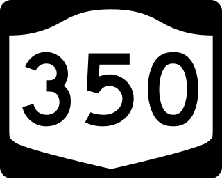
New York State Route 350 (NY 350) is a north–south state highway in western Wayne County, New York, in the United States. It extends for 11.40 miles (18.35 km) from an intersection with NY 31 and NY 31F in the village of Macedon to a junction with NY 104 in the town of Ontario. NY 350 serves as the eastern terminus for three routes: the aforementioned NY 31F, NY 286, and NY 441, all of which originate in the Rochester area. Aside from the village of Macedon at its south end and the hamlet of Ontario Center at its north terminus, NY 350 serves mostly rural areas dominated by farmland. NY 350 was assigned c. 1932 to the portion of its routing south of Cator Corners, the north junction with NY 31F. It was extended northward to its current terminus in the 1940s.

<span class="mw-page-title-main">Fairport High School</span> High school in New York, USA

Fairport High School (FHS) is a public high school serving the tenth through twelfth grades in the Village of Fairport and most of the Town of Perinton, New York. It is part of the Fairport Central School District. The Principal, as of the end of the 2014-2015 school year, is Robert Clark following his time as an Assistant Principal.

<span class="mw-page-title-main">Fairport Central School District</span> School district in the U.S. state of New York

The Fairport Central School District is a public school district in New York State that serves approximately 5,800 students in most of the town of Perinton and the village of Fairport in Monroe County, with about 1,200 employees and an operating budget of $127.0 million.

The Newman-Cotter House is located in Monroe County, New York at 112 West Avenue, Fairport, New York.

References

  1. "ArcGIS REST Services Directory". United States Census Bureau. Retrieved September 20, 2022.
  2. "National Register Information System". National Register of Historic Places . National Park Service. July 9, 2010.
  3. "Timeline - East Rochester Local History". erhistory.com. Retrieved March 20, 2021.
  4. 1 2 "Train derailment in East Rochester". Archived from the original on October 14, 2017. Retrieved January 19, 2007.
  5. "Crane arrives to assist East Rochester derailment" . Retrieved January 19, 2007.
  6. "Road in East Rochester reopens after train derailment". Archived from the original on March 3, 2007. Retrieved January 19, 2007.
  7. "US Gazetteer files: 2010, 2000, and 1990". United States Census Bureau. February 12, 2011. Retrieved April 23, 2011.
  8. "Census of Population and Housing". Census.gov. Retrieved June 4, 2015.
  9. "U.S. Census website". United States Census Bureau . Retrieved January 31, 2008.
  10. "History of East Rochester".
  11. "Monroe County traffic counts" (PDF). New York State Department of Transportation. 2003. Archived from the original (PDF) on October 17, 2015. Retrieved January 12, 2012.