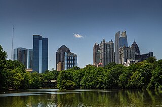
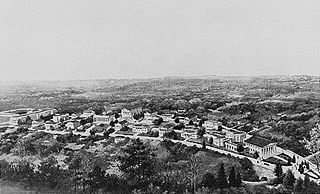
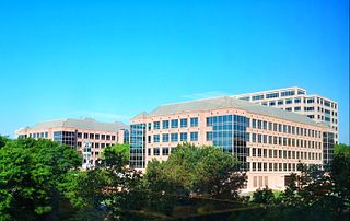
Midtown Atlanta, or Midtown, is a high-density commercial and residential neighborhood of Atlanta, Georgia. The exact geographical extent of the area is ill-defined due to differing definitions used by the city, residents, and local business groups. However, the commercial core of the area is anchored by a series of high-rise office buildings, condominiums, hotels, and high-end retail along Peachtree Street between North Avenue and 17th Street. Midtown, situated between Downtown to the south and Buckhead to the north, is the second-largest business district in Metro Atlanta. In 2011, Midtown had a resident population of 41,681 and a business population of 81,418.
Sidney J. Marcus was a Georgia (U.S.) legislator from Atlanta's 26th district, now the 106th district, who served in the Georgia House of Representatives from 1968 until his death in 1983. He served on several committees: Health and Ecology, on which he was chairman; Ways and Means; and Rules. For several years, Marcus was chairman of Fulton County delegation. He was also an unsuccessful candidate for Mayor of Atlanta in 1981, defeated by Andrew Young. He was a noted Atlanta politician, and active in the Jewish community. His accomplishments included helping to stop the I-485 freeway which threatened several intown neighborhoods. Sidney Marcus attended Atlanta public schools and graduated from the University of Georgia in 1948, as a member of Zeta Beta Tau fraternity. He was a 1955 graduate of the Emory University School of Law. Marcus married Charlotte Glyck of Waycross, GA, and they had three children, Robyn, Bradley and Beth.

Ponce de Leon Avenue, often simply called Ponce, provides a link between Atlanta, Decatur, Clarkston, and Stone Mountain, Georgia. It was named for Ponce de Leon Springs, in turn from explorer Juan Ponce de León, but is not pronounced as in Spanish. Several grand and historic buildings are located on the avenue.

Morningside/Lenox Park is an intown neighborhood in Atlanta, Georgia founded in 1923. It is located north of Virginia-Highland, east of Ansley Park and west of Druid Hills. Approximately 3,500 households comprise the neighborhood that includes the original subdivisions of Morningside, Lenox Park, University Park, Noble Park, Johnson Estates and Hylan Park.
There were several historic bridges around the metro Atlanta, Georgia area, for which many of its current-day roads are named. Many of them originated as ferries, dating back to the 1820s and 1830s, and carrying travelers across the Chattahoochee River and several other smaller rivers. Several were also covered bridges, a very few of which remain as historic sites.
Piedmont Heights is an intown neighborhood on the east side of Atlanta, Georgia, founded in the early 20th century as a streetcar suburb. It is located between the BeltLine on the west; across from the Sherwood Forest neighborhood; I-85 on the north, across from an industrial area ; and Piedmont Avenue/Road and Morningside-Lenox Park on the east.
Lindridge/Martin Manor is an intown neighborhood of Atlanta, Georgia. It consists mostly of the single-family homes located off Lindbergh Drive in between I-85 and Cheshire Bridge Road. In addition, it includes a small commercial area of three streets west of I-85 bounded by Peachtree Creek, Piedmont Road and the Southern railroad. The neighborhood's boundaries are I-85 on the northwest, Morningside-Lenox Park on the south, and North Druid Hills in unincorporated DeKalb County, Georgia on the east.
Copenhill, Copenhill Park, or Copen Hill was a neighborhood of Atlanta, Georgia which was located largely where the Carter Center now sits, and which now forms part of the Poncey-Highland neighborhood.
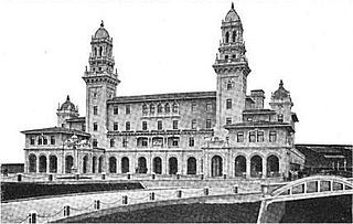
Lanier University, named after poet Sidney Lanier, was a short-lived university in today's Morningside-Lenox Park neighborhood of Atlanta, Georgia.
Albert Anthony Ten Eyck Brown (1878–1940) was an architect active in Atlanta, Georgia and other areas. Brown was born in Albany, New York. He studied at the New York Academy of Design.
Lenox Park is a neighborhood of homes and office buildings located primarily within the city of Brookhaven, Georgia, just east of the northern border of the city of Atlanta.
North Buckhead is a neighborhood in the Buckhead district, at the northern edge of the city of Atlanta, Georgia, and is one of Atlanta's most affluent neighborhoods.
Buckhead Forest is a neighborhood of 165 homes in the Buckhead district of Atlanta, Georgia.
Washington–Rawson was a neighborhood of Atlanta, Georgia. It included what is now Georgia State Stadium and the large parking lot to its north, until 1997 the site of Atlanta–Fulton County Stadium, as well as the I-20-Downtown Connector interchange. Washington and Rawson streets intersected where the interchange is today. To the northwest was Downtown Atlanta, to the west Mechanicsville, to the east Summerhill, and to the south Washington Heights, now called Peoplestown.

Lenox Park in the City of Atlanta was a subdivision begun in 1931 under the supervision of Ivey and Crook, architects. Today it forms part of the larger neighborhood of Morningside-Lenox Park. The iconic Lenox Park urn-and-column markers were the inspiration for the more numerous Morningside-Lenox Park columns standing at the entrance to the larger neighborhood.
Piedmont Avenue is a major thoroughfare in Atlanta, beginning in Downtown Atlanta and ending at its continuation as Piedmont Road just before crossing under Interstate 85. Along the way, Piedmont Avenue passes through Midtown Atlanta where several historic properties are located on the street.
Tenth Street is a street in Midtown Atlanta, Georgia.
Cheshire Bridge Road is a mainly north-south thoroughfare of Atlanta, Georgia, USA< traversing the Morningside-Lenox Park and Lindridge-Martin Manor neighborhoods from Piedmont Avenue to Buford Highway just north of Interstate 85.