Ebenalp

Last updated
Ebenalp
Luftbild Ebenalp.jpg
Highest point
Elevation 1,640 m (5,380 ft)
Coordinates 47°17′03″N9°24′39″E / 47.28417°N 9.41083°E / 47.28417; 9.41083 Coordinates: 47°17′03″N9°24′39″E / 47.28417°N 9.41083°E / 47.28417; 9.41083
Geography
Switzerland relief location map.jpg
Red triangle with thick white border.svg
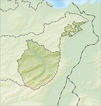
Ebenalp
Location in Switzerland
Location Switzerland
Parent range Appenzell Alps

The Ebenalp (1,640 m) is the northernmost summit of the Appenzell Alps. The mountain is a popular hiking destination and has been accessible by cable car from Wasserauen since 1955. Ebenalp attracts up to 200,000 visitors each year.

From the high plateau of the cable car station visitors have a panoramic view of the rolling hills of Appenzell. Trails start at the station and lead to a network of mountain huts. These hiking routes lead to sites such as Säntis and Seealpsee. The nearby Wildkirchli hut can be reached by hiking through a cave.


Related Research Articles

Wank (mountain)

The Wank is a mountain in southern Germany, situated in the Loisach valley close to the Austrian border in the southwestern Ester Mountains range near Garmisch-Partenkirchen. It rises from about 700 metres (2,300 ft) above mean sea level up to 1,780 metres (5,840 ft) at the summit. The mountain is crowned by a grassy summit which has views over Garmisch-Partenkirchen and the surrounding region. The summit can be reached via the eponymous Wankbahn, a cable car system that runs during the summer months, or by a network of footpaths that criss-cross the area. A mountain hut on the summit, the Wank-Haus, provides food and accommodation, and a nearby scientific observatory plays a role in monitoring atmospheric and climatic conditions. The Wank is a destination for hikers, day-trippers from Garmisch-Partenkirchen and paragliders.

Rätikon Mountain in Italy

The Rätikon is a mountain range of the Central Eastern Alps, located at the border between Vorarlberg, Liechtenstein and Graubünden. It is the geological border between the Eastern and Western Alps and stretches from the Montafon as far as the Rhine. In the south, the Prättigau is its limit, and in the north, it is the Walgau. In the east, it borders the Silvretta groups. The Rätikon mountain range derives its name from Raetia, a province of the Roman Empire, named after the Rhaetian people.

Appenzell Innerrhoden Canton of Switzerland

Appenzell Innerrhoden is one of the 26 cantons forming the Swiss Confederation. It is composed of six districts. The seat of the government and parliament is Appenzell. It is traditionally considered a "half-canton", the other half being Appenzell Ausserrhoden.

Sněžka Mountain on Czech-Polish border

Sněžka or Śnieżka is a mountain on the border between the Czech Republic and Poland, the most prominent point of the Silesian Ridge in the Giant Mountains. At 1,603.3 metres (5,260 ft), its summit is the highest point in the Czech Republic, in Lower Silesian Voivodeship, in the Giant Mountains and in the entire Sudetes.

Aiguille du Midi Mountain in the French Alps

The Aiguille du Midi is a 3,842-metre-tall (12,605 ft) mountain in the Mont Blanc massif within the French Alps. It is a popular tourist destination and can be directly accessed by cable car from Chamonix that takes visitors close to Mont Blanc.

Mount Monroe

Mount Monroe is a 5,372-foot-high (1,637 m) mountain peak southwest of Mount Washington in the Presidential Range of the White Mountains in New Hampshire, United States. It is named for American President James Monroe and is the fourth highest mountain on the 4000 footers list for New Hampshire. The Appalachian Trail skirts its summit, which is the next highest peak on or near the trail north of Mount Rogers in Virginia. The Lakes of the Clouds, and its AMC hut, lie nestled at the col between Mount Monroe and neighboring Mount Washington.

Säntis Mountain in Switzerland

At 2,501.9 metres (8,208 ft) above sea level, Säntis is the highest mountain in the Alpstein massif of northeastern Switzerland. It is also the culminating point of the whole Appenzell Alps, between Lake Walen and Lake Constance. Shared by three cantons, the mountain is a highly visible landmark thanks to its exposed northerly position within the Alpstein massif. As a consequence, houses called Säntisblick can be found in regions as far away as the Black Forest in Germany. Säntis is among the most prominent summits in the Alps and the most prominent summit in Europe with an observation deck on the top. The panorama from the summit is spectacular. Six countries can be seen if the weather allows: Switzerland, Germany, Austria, Liechtenstein, France, and Italy.

Seealpsee

Seealpsee is a lake in the Alpstein range of the canton of Appenzell Innerrhoden, Switzerland. At an elevation of 1,143.2 m, the surface area is 13.6 hectares. The lake can be reached by foot from Wasserauen or from Ebenalp. It is a popular tourist destination. A network of routes around Ebenalp connects Seealpsee with other notable sights in the Appenzell Alps, such as the Wildkirchli and Säntis.

Wildkirchli Swiss cultural property of national significance in Schwende

Wildkirchli are three interlinked caves situated in the Alpstein massif in the Appenzell Innerrhoden canton of Switzerland, north-east of Mount Säntis Switzerland. The caves are located at a height of 1,477–1,500 m (4,846–4,921 ft). They are notable for the traces of Paleolithic Neanderthal habitation, dating to c. 40,000 BP, and cave bear bones dating to 90,000–40,000 BP. A museum at the site houses a full bear skeleton that was found in one of the caves.

Fjellheisen

Fjellheisen is an aerial tramway located in the city of Tromsø, Norway.

Hoher Kasten Mountain in Switzerland

The Hoher Kasten is a mountain in the Appenzell Alps, overlooking the Rhine in Eastern Switzerland. It is located on the border between the cantons of Appenzell Innerrhoden and St. Gallen.

Wetterstein

The Wetterstein mountains, colloquially called Wetterstein, is a mountain group in the Northern Limestone Alps within the Eastern Alps. It is a comparatively compact range located between Garmisch-Partenkirchen, Mittenwald, Seefeld in Tirol and Ehrwald along the border between Germany (Bavaria) and Austria (Tyrol). Zugspitze, the highest peak is at the same time the highest mountain in Germany.

Ettaler Manndl Mountain of the Ammergau Alps in Bavaria, Germany

Ettaler Manndl is a 1636-meter-high mountain of the Ammergau Alps in Bavaria, Germany. It is close to the town of Oberammergau and about 10 km north of Garmisch-Partenkirchen. It is a sub-peak of the Laber mountain at 1681 m.

Wildseeloderhaus

The Wildseeloderhaus is an Alpine hut owned by the Austrian Alpine Club (OeAV) that lies below the Wildseeloder mountain in the Kitzbühel Alps in Austria.

Kronberg (mountain) Mountain in Switzerland

The Kronberg is a mountain of the Appenzell Alps, located west of Appenzell in the Swiss canton of Appenzell Innerrhoden. Its 1,663-metre-high (5,456 ft) summit can be accessed by cable car.

Hundwiler Höhi Mountain in Switzerland

The Hundwiler Höhi is a mountain of the Appenzell Alps, located on the border between the Swiss cantons of Appenzell Ausserrhoden and Appenzell Innerrhoden. It is situated between Hundwil and Gonten.

Triglav Lodge at Kredarica

The Triglav Lodge at Kredarica is the highest mountain hut in Slovenia and the highest meteorological station in the country. It stands on a small plateau just under the peak of Kredarica, an elevation in the ridge between Rjavina and Triglav. The Valentin Stanič Lodge stands to the northeast below Begunje Peak, and the Planika Lodge at Triglav stands to the south. In the vicinity there is also a chapel dedicated to Our Lady of the Snows, and a few metres away there is a small cave named Ivačič Cave.

Nördlinger Hut

The Nördlinger Hut is an Alpine Club hut belonging to the German Alpine Club that is situated at a height of 2,238 m (AA) south of the summit of the Reither Spitze in the Austrian state of Tyrol. It is thus the highest refuge hut in the entire Karwendel range. It is located in the westernmost part of the Karwendel Alps, the Erlspitze Group, above the village and ski resort of Seefeld. From the hut there are expansive views over the Stubai Alps, the Inn valley and the Wetterstein Mountains.

Skyway Monte Bianco Cable car on Mont Blanc in Italy

Skyway Monte Bianco is a cable car in the Italian Alps, linking the town of Courmayeur with Pointe Helbronner on the southern side of the Mont Blanc massif. Taking over three years to construct, it opened in 2015 at a cost of 110 million euros, and is considered to be the world's most expensive cable car installation.

Wasserauen

Wasserauen is a place in the district of Schwende in the canton of Appenzell Innerrhoden in Switzerland.