Alappuzha district, is one of the 14 districts in the Indian state of Kerala. It was formed as Alleppey district on 17 August 1957, the name of the district being changed to Alappuzha in 1990, and is the smallest district of Kerala. Alleppey town, the district headquarters, was renamed Alappuzha in 2012, even though the anglicised name is still commonly used to describe the town as well as the district.

The white-bellied sea eagle, also known as the white-breasted sea eagle, is a large diurnal bird of prey in the family Accipitridae. Originally described by Johann Friedrich Gmelin in 1788, it is closely related to Sanford's sea eagle of the Solomon Islands, and the two are considered a superspecies. A distinctive bird, the adult white-bellied sea eagle has a white head, breast, under-wing coverts and tail. The upper parts are grey and the black under-wing flight feathers contrast with the white coverts. The tail is short and wedge-shaped as in all Haliaeetus species. Like many raptors, the female is slightly larger than the male, and can measure up to 90 cm (35 in) long with a wingspan of up to 2.2 m (7.2 ft), and weigh 4.5 kg (9.9 lb). Immature birds have brown plumage, which is gradually replaced by white until the age of five or six years. The call is a loud goose-like honking.

Ernakulam, IPA: [erɐɳɐːguɭɐm]; ISO: Eṟaṇākuḷaṁ, in Malayalam: എറണാകുളം), is one of the 14 districts in the Indian state of Kerala, that takes its name from the eponymous city division in Kochi. It is situated in the central part of the state, spans an area of about 3,000 square kilometres (1,200 sq mi), and is home to over 9% of Kerala's population. Its headquarters are located at Kakkanad. The district includes Kochi, also known as the commercial capital of Kerala, which is famous for its ancient Churches, Hindu temples, synagogues and mosques. The district includes the largest metropolitan region of the state: Greater Cochin. Ernakulam is the district that yields the most revenue and the largest number of industries in the state. Ernakulam is the third most populous district in Kerala, after Malappuram and Thiruvananthapuram. The district also hosts the highest number of international and domestic tourists in Kerala state.

Kasaragod is a municipal town and administrative headquarters of Kasaragod district in the state of Kerala, India. Established in 1966, Kasaragod was the first municipal town in the district. It is the northernmost district of Kerala and is also known as Saptha Bhasha Sangama Bhoomi.

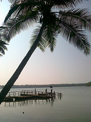
The Kerala backwaters are a network of brackish lagoons and canals lying parallel to the Arabian Sea of the Malabar coast of Kerala state in south-western India. It also includes interconnected lakes, rivers, and inlets, a labyrinthine system formed by more than 900 km (560 mi) of waterways, and sometimes compared to bayous. The network includes five large lakes linked by canals, both man made and natural, fed by 38 rivers, and extending virtually half the length of Kerala state. The backwaters were formed by the action of waves and shore currents creating low barrier islands across the mouths of the many rivers flowing down from the Western Ghats range. In the midst of this landscape there are a number of towns and cities, which serve as the starting and end points of backwater cruises. There are 34 backwaters in Kerala. Out of it, 27 are located either closer to Arabian Sea or parallel to the sea. The remaining 7 are inland navigation routes.

Vembanad is the longest lake in India, as well as the largest lake in the state of Kerala. The lake has an area of 230 square kilometers and a maximum length of 96.5 km. Spanning several districts in the state of Kerala, it is known as Vembanadu Lake in Kottayam, Vaikom, Changanassery, Punnamada Lake in Alappuzha, Punnappra, Kuttanadu and Kochi Lake in Kochi. Several groups of small islands including Vypin, Mulavukad, Maradu, Udayamperoor, Vallarpadam, Willingdon Island are located in the Kochi Lake portion. Kochi Port is built around the Willingdon Island and the Vallarpadam island.

Ashtamudi Lake, in the Kollam District of the Indian state of Kerala, is the most visited backwater and lake in the state. It possesses a unique wetland ecosystem and a large palm-shaped water body, second only in size to the Vembanad estuary ecosystem of the state. Ashtamudi means 'eight braids' in the local Malayalam language. The name is indicative of the lake's topography with its multiple branches. The lake is also called the gateway to the backwaters of Kerala and is well known for its houseboat and backwater resorts. Ashtamudi Wetland was included in the list of wetlands of international importance, as defined by the Ramsar Convention for the conservation and sustainable utilization of wetlands.

Payyanur, IPA: [pɐjːɐn̺ːuːɾ], is a municipal town and a taluk, a sub-district administrative unit, in the Kannur district of Kerala, India. On 10 March 2018, Kerala Chief Minister Pinarayi Vijayan inaugurated Payyanur as the fifth taluk in the district. Payyanur taluk comprises 22 villages including 16 de-linked from the Taliparamba taluk and six from the Kannur taluk. The town is situated on the banks of the Perumba River.
Valiyaparamba is a coastal island in Hosdurg taluk, Kasaragod district, Kerala state, India.

Kerala, a state situated on the tropical Malabar Coast of southwestern India, is one of the most popular tourist destinations in the country. Named as one of the ten paradises of the world by National Geographic Traveler, Kerala is famous especially for its ecotourism initiatives and beautiful backwaters. Its unique culture and traditions, coupled with its varied demography, have made Kerala one of the most popular tourist destinations in the world. Several international agencies ranging from UNESCO to National Geographic have recognised the state's tourism potential. Kerala was named by TIME magazine in 2022 among the 50 extraordinary destinations to explore in its list of the World’s Greatest Places. In 2023, Kerala was listed at the 13th spot in The New York Times' annual list of places to visit and was the only tourist destination listed from India.
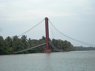
Kavvayi Backwaters located near Payyanur is the third largest backwater in Kerala and the largest one in north Kerala. The Kavvayi Kayal (backwaters) is dotted with several small and large islands. Valiyaparamba island is the largest among them and stretches over 16 square kilometres (6.2 sq mi).

Kasaragod is one of the 14 districts in the southern Indian state of Kerala. Its northern border Thalappady is located just 10 km south to Ullal, which is the southernmost portion of the major port city Mangalore, on the southwestern Malabar coast of India.

The Geography of South India comprises the diverse topological and climatic patterns of South India. South India is a peninsula in the shape of a vast inverted triangle, bounded on the west by the Arabian Sea, on the east by the Bay of Bengal and on the north by the Vindhya and Satpura ranges.

Kunhimangalam is a census town situated in the northern coastal part of Kannur District in Kerala state on the outskirt of Payyanur. The population in 2011 was around 19,000 including Hindus, Christians and Muslim residents. The village lies in an agricultural region.

Ramanthali is a village in Kannur district in the Indian state of Kerala. It boasts the gateway for Indian Naval Academy in Ezhiamala.

The Malabar Coast is the southwestern coast of the Indian subcontinent. Geographically, it comprises the wettest regions of southern India, as the Western Ghats intercept the moisture-laden monsoon rains, especially on their westward-facing mountain slopes. The term is used to refer to the entire Indian coast from the western coast of Konkan to the tip of India at Kanyakumari. The peak of Anamudi, which is also the point of highest altitude in India outside the Himalayas, and Kuttanad, which is the point of least elevation in India, lie on the Malabar Coast. Kuttanad, also known as The Rice Bowl of Kerala, has the lowest altitude in India, and is also one of the few places in the world where cultivation takes place below sea level.

Thrissur-Ponnani Kole Wetlands is a wetland lying in Thrissur and Malappuram districts in Kerala, India. It gives 40 per cent of the Kerala’s rice requirement and acts as a natural drainage system for Ponnani city, Thrissur city, Thrissur District, and Malappuram district. The Kole Wetlands is one of largest, highly productive and threatened wetlands in Kerala and it comes in Central Asian Flyway of migratory birds.
Waterways have always been an important mode of transport in Kerala. The total length of navigable route in Kerala was 1,900 kilometres and the navigable rivers constitute about 54 per cent of the waterways. The 41 West-flowing rivers together with the backwaters are an integrated part of the inland navigation system in Kerala. In Kerala water transportation through these channels are mainly small distant passenger services, informal country boats, freight transportation to PSU's such as Fertilisers and Chemicals Travancore, Kochi etc.

Kavvayi is a group of small islands, near Payyanur in the Kannur district of Kerala. The island is surrounded by Kavvayi Backwaters.