
Edwardsville in Nova Scotia
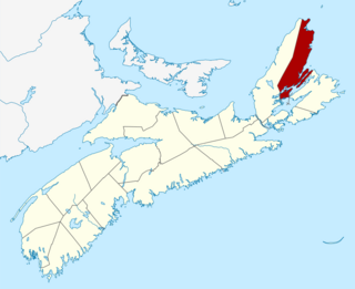
Edwardsville is a community in the Canadian province of Nova Scotia, located in the Cape Breton Regional Municipality on Cape Breton Island. It is named for King Edward VII. [1]
Edwardsville is a community in the Canadian province of Nova Scotia, located in the Cape Breton Regional Municipality on Cape Breton Island. It is named for King Edward VII. [1]
In the 2021 Census of Population conducted by Statistics Canada, Edwardsville had a population of 287 living in 119 of its 127 total private dwellings, a change of 7.5% from its 2016 population of 267. With a land area of 8.08 km2 (3.12 sq mi), it had a population density of 35.5/km2 (92.0/sq mi) in 2021. [2]

Annapolis County is a county in the Canadian province of Nova Scotia located in the western part of the province located on the Bay of Fundy. The county seat is Annapolis Royal.

Richmond County is an historical county and census division of Nova Scotia, Canada. Local government is provided by the Municipality of the County of Richmond.
Victoria County is an historical county and census division of Nova Scotia, Canada. Local government is provided by the Municipality of the County of Victoria and the Wagmatcook 1 reserve.
Havre Boucher is a community in Antigonish County, Nova Scotia, Canada.
Sydney River is a community in Nova Scotia's Cape Breton Regional Municipality.
Lingan (is a Canadian suburban community in Nova Scotia's Cape Breton Regional Municipality. Its population in 2021 was 229.

Point Aconi is a rural community in Nova Scotia at the northeastern tip of Boularderie Island. It derives its name from the headland of the same name, Point Aconi.
Port Hastings is a unincorporated settlement on Cape Breton Island, within the Municipality of the County of Inverness, Canada. The population in 2021 was 90.

Port Caledonia is a small community in the Canadian province of Nova Scotia, located in the Cape Breton Regional Municipality on Cape Breton Island. It is located on the Donkin Highway, between the town of Glace Bay and the village of Donkin.
Bras d'Or is a community in the Canadian province of Nova Scotia, located in the Cape Breton Regional Municipality.
Little Bras d'Or is a community in the Canadian province of Nova Scotia, located in the Cape Breton Regional Municipality on Cape Breton County on Cape Breton Island.
Hillside is a community in the Canadian province of Nova Scotia, located within the Pictou County Municipality. Located between the Town of Trenton and community of Pictou Landing, the community holds the status of designated place in Canadian census data, and had a population of 122 in the Canada 2021 Census.
Alder Point is a community in the Canadian province of Nova Scotia, located in the Cape Breton Regional Municipality. It derives its name from the nearby headland of the same name, Alder Point.
Upper North Sydney is a community in the Canadian province of Nova Scotia, located in the Cape Breton Regional Municipality on Cape Breton Island.
Groves Point is a community in the Canadian province of Nova Scotia, located in the Cape Breton Regional Municipality.
Little Pond is a community in the Canadian province of Nova Scotia, located in the Cape Breton Regional Municipality on Cape Breton Island.
Prime Brook is a community in the Canadian province of Nova Scotia, located in the Cape Breton Regional Municipality on Cape Breton Island.
Mill Creek is a community in the Canadian province of Nova Scotia, located in the Cape Breton Regional Municipality on Cape Breton Island.
River Ryan is a community in the Canadian province of Nova Scotia, located in the Cape Breton Regional Municipality on Cape Breton Island.
Tower Road is a designated place within the Cape Breton Regional Municipality in Nova Scotia, Canada.
46°10′0.74″N60°14′7.66″W / 46.1668722°N 60.2354611°W
| | This Cape Breton County, Nova Scotia location article is a stub. You can help Wikipedia by expanding it. |