Egypt, Arkansas

Last updated

Egypt, Arkansas
Craighead County Arkansas Incorporated and Unincorporated areas Egypt Highlighted 0520920.svg
Location of Egypt in Craighead County, Arkansas
Coordinates: 35°52′18″N90°56′42″W / 35.87167°N 90.94500°W / 35.87167; -90.94500
Country United States
State Arkansas
County Craighead
Area
[1]
  Total0.34 sq mi (0.87 km2)
  Land0.34 sq mi (0.87 km2)
  Water0.00 sq mi (0.00 km2)
Elevation
[2]
249 ft (76 m)
Population
 (2020)
  Total113
  Density336.31/sq mi (129.71/km2)
Time zone UTC-6 (Central (CST))
  Summer (DST) UTC-5 (CDT)
ZIP code
72427
Area code 870
FIPS code 05-20920
GNIS feature ID2406428 [2]

Egypt is a town in Craighead County, Arkansas, United States. The population was 112 at the 2010 census. [3] It is included in the Jonesboro, Arkansas Metropolitan Statistical Area.

Contents

History

Egypt, Arkansas is a small town located in Craighead County near the Cache River. The town was established in 1898 by New York businessmen attracted to the area's abundant timber. The narrow gauge railway by the Sedgwick Tie and Timber Company connected the town to the major line of the Kansas City, Fort Scott and Memphis Railroad, which stimulated its growth. The town was home to several stores, a gin, a school, and churches in the 1930s and 1950s, but never experienced major growth due to its location far from the main railway line and major highways. In 1942 an oil pipeline pumping station was built near Bald Knob, Ar. to move oil northeast along the Big Inch oil pipeline. The town's decline started after the cutting of timber and the consolidation of schools. It was incorporated as a town in 1984 and had a population of 113 in the 2020 census. [4]

Geography

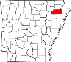
Egypt is located in western Craighead County and was named after Victoria Eyshept. Eyshept was a Welsh noblewoman who was one of the first settlers: due to her thick accent, Americans assumed she was saying "Egypt", and the name stuck.

According to the United States Census Bureau, the town has a total area of 0.35 square miles (0.9 km2), all of which is land. [3]

Only one highway runs through the small community, Arkansas Highway 91, which intersects Craighead County Road 192 at the center of the town.[ citation needed ]

Demographics

Historical population
CensusPop.Note
1990 123
2000 101−17.9%
2010 11210.9%
2020 1130.9%
U.S. Decennial Census [5]

As of the census [6] of 2000, there were 101 people, 43 households, and 28 families residing in the town. The population density was 274.5 inhabitants per square mile (106.0/km2). There were 51 housing units at an average density of 138.6 per square mile (53.5/km2). The racial makeup of the town was 97.03% White, and 2.97% from two or more races. 0.99% of the population were Hispanic or Latino of any race.

There were 43 households, out of which 23.3% had children under the age of 18 living with them, 48.8% were married couples living together, 16.3% had a female householder with no husband present, and 32.6% were non-families. 30.2% of all households were made up of individuals, and 20.9% had someone living alone who was 65 years of age or older. The average household size was 2.35 and the average family size was 2.90.

In the town, the population was spread out, with 24.8% under the age of 18, 7.9% from 18 to 24, 19.8% from 25 to 44, 19.8% from 45 to 64, and 27.7% who were 65 years of age or older. The median age was 43 years. For every 100 females, there were 71.2 males. For every 100 females age 18 and over, there were 76.7 males.

The median income for a household in the town was $18,750, and the median income for a family was $24,063. Males had a median income of $19,583 versus $16,250 for females. The per capita income for the town was $9,828. There were 22.6% of families and 29.9% of the population living below the poverty line, including 55.6% of under eighteens and 13.8% of those over 64.

Education

Egypt residents are served by the Westside Consolidated School District. [7] [8] The district opened in 1966 after the Egypt school district merged into it. [9] Its high school is Westside High School.

Related Research Articles

<span class="mw-page-title-main">Poinsett County, Arkansas</span> County in Arkansas, United States

Poinsett County is a county located in the U.S. state of Arkansas. As of the 2020 census, the population was 22,965. The county seat is Harrisburg. Poinsett County is included in the Jonesboro–Paragould Combined Statistical Area.

<span class="mw-page-title-main">Greene County, Arkansas</span> County in Arkansas, United States

Greene County is a county located in the U.S. state of Arkansas. As of the 2020 census, the population was 45,736. The county seat is Paragould, which sits atop Crowley's Ridge.

<span class="mw-page-title-main">Craighead County, Arkansas</span> County in Arkansas, United States

Craighead County is a county located in the U.S. state of Arkansas. As of the 2020 census, the population was 111,231. The county has two county seats — Jonesboro and Lake City. Craighead County is Arkansas's 58th county, formed on February 19, 1859, and named for state Senator Thomas Craighead. It is one of several dry counties within the state of Arkansas, in which the sale of alcoholic beverages is largely prohibited.

<span class="mw-page-title-main">Black Oak, Arkansas</span> Town in Arkansas, United States

Black Oak is a town in Craighead County, Arkansas, United States. The population was 262 at the 2010 census. It is included in the Jonesboro, Arkansas Metropolitan Statistical Area.

<span class="mw-page-title-main">Bono, Arkansas</span> Bono in Arkansas, United States

Bono is a city in Craighead County, Arkansas, United States. The population was 2,131 at the 2010 census, up from 1,512 in 2000. It is included in the Jonesboro, Arkansas Metropolitan Statistical Area. Bono's most prominent landmarks are the Bono Bridge and the Bono Cemetery.

<span class="mw-page-title-main">Brookland, Arkansas</span> City in Arkansas, United States

Brookland is a city in Craighead County, Arkansas, United States. The population was 1,642 at the 2010 census. It is included in the Jonesboro, Arkansas Metropolitan Statistical Area.

<span class="mw-page-title-main">Caraway, Arkansas</span> City in Arkansas, United States

Caraway is a city in Craighead County, Arkansas, United States. The population was 1,279 at the 2010 census. It is included in the Jonesboro, Arkansas Metropolitan Statistical Area.

<span class="mw-page-title-main">Cash, Arkansas</span> City in Arkansas, United States

Cash is a city in western Craighead County, Arkansas, United States. The population was 342 at the 2010 census. Cash Arkansas population was of mostly white with 99.8% and partial Puerto Rican ethnicity. It is included in the Jonesboro, Arkansas Metropolitan Statistical Area.

<span class="mw-page-title-main">Jonesboro, Arkansas</span> City in Northeast Arkansas

Jonesboro is a city located on Crowley's Ridge in the northeastern corner of the U.S. State of Arkansas. Jonesboro is one of two county seats of Craighead County. In 2022, the city had an estimated population of 79,876, making it the fifth-most populous city in Arkansas. In 2020, the Jonesboro metropolitan area had a population of 134,196, and the Jonesboro-Paragould Combined Statistical Area had a population of 179,932.

<span class="mw-page-title-main">Lake City, Arkansas</span> City in Arkansas, United States

Lake City is a city in Craighead County, Arkansas, United States, along the St. Francis River. Lake City is one of two county seats in Craighead County. The population was 2,326 as of the 2020 census. It is included in the Jonesboro, Arkansas Metropolitan Statistical Area.

<span class="mw-page-title-main">Monette, Arkansas</span> City in Arkansas, United States

Monette is a city in Craighead County, Arkansas, United States. The city is located in an area of Northeast Arkansas known as Buffalo Island. The population was 1,506 at the 2020 census.

<span class="mw-page-title-main">Gilmore, Arkansas</span> City in Arkansas, United States

Gilmore is a city in Crittenden County, Arkansas, United States. Per the 2020 census, the population was 176.

<span class="mw-page-title-main">Paragould, Arkansas</span> City in Arkansas, United States

Paragould is the county seat of Greene County, and the 19th-largest city in Arkansas, in the United States. The city is located in northeastern Arkansas on the eastern edge of Crowley's Ridge, a geologic anomaly contained within the Arkansas delta.

<span class="mw-page-title-main">Dell, Arkansas</span> Town in Arkansas, United States

Dell is a town in Mississippi County, Arkansas, United States. The population was 194 at the 2020 census.

<span class="mw-page-title-main">Fisher, Arkansas</span> City in Arkansas, United States

Fisher is a city in Poinsett County, Arkansas, United States. The population was 223 at the 2010 census. It is included in the Jonesboro, Arkansas Metropolitan Statistical Area.

<span class="mw-page-title-main">Tyronza, Arkansas</span> City in Arkansas, United States

Tyronza is a city in Poinsett County, Arkansas, United States. The population was 716 at the 2020 census. It is included in the Jonesboro, Arkansas Metropolitan Statistical Area and is in the Arkansas Delta.

<span class="mw-page-title-main">Waldenburg, Arkansas</span> Town in Arkansas, United States

Waldenburg is a town in Poinsett County, Arkansas, United States. The population was 80 at the 2000 census. It is included in the Jonesboro, Arkansas Metropolitan Statistical Area. Waldenburg is home to Zion Lutheran Church. Zion was founded in 1881 and is a member congregation of the Lutheran Church–Missouri Synod.

<span class="mw-page-title-main">Jonesboro metropolitan area</span>

The Jonesboro Metropolitan Statistical Area, as defined by the United States Census Bureau, is an area consisting of two counties – Craighead and Poinsett – in northeast Arkansas, anchored by the city of Jonesboro. As of the 2010 census, the MSA had a population of 121,026. It is also part of the larger Jonesboro-Paragould Combined Statistical Area.

Westside Consolidated School District #5 is a public school district headquartered in unincorporated Craighead County, Arkansas, near Jonesboro.

Westside High School is a comprehensive public junior/senior high school serving grades eight through twelve in unincorporated Craighead County, Arkansas, United States, in a rural area near Jonesboro. Westside High School is one of eight public high schools in the county and is the sole high school managed by the Westside Consolidated School District. The school is alternatively referred to as Jonesboro Westside or Westside Consolidated.

References

  1. "2020 U.S. Gazetteer Files". United States Census Bureau. Retrieved October 29, 2021.
  2. 1 2 U.S. Geological Survey Geographic Names Information System: Egypt, Arkansas
  3. 1 2 "Geographic Identifiers: 2010 Demographic Profile Data (G001): Egypt town, Arkansas". U.S. Census Bureau, American Factfinder. Archived from the original on February 12, 2020. Retrieved June 18, 2014.
  4. "Egypt (Craighead County) Arkansas by Encyclopedia of Arkansas".
  5. "Census of Population and Housing". Census.gov. Retrieved June 4, 2015.
  6. "U.S. Census website". United States Census Bureau . Retrieved January 31, 2008.
  7. Deadly Lessons: Understanding Lethal School Violence. The National Academies, Committee on Law and Justice, Board on Children, Youth and Families. 2003. 102. Retrieved on October 18, 2010. "The Westside School District is one of five public school districts in the immediate area and serves the Bono, Cash, and Egypt communities, which lie adjacent to Jonesboro and are largely rural towns."
  8. Deadly Lessons: Understanding Lethal School Violence. The National Academies, Committee on Law and Justice, Board on Children, Youth and Families. 2003. 102 Acknowledgements. Retrieved on October 18, 2010. "Bono is the largest of the three with a population just over 1,000 residents. Cash and Egypt count 280 and 112 residents, respectively."
  9. Goatcher, Truett (January 1999). "School District Consolidation Will Save Millions of Dollars: Fact of Myth?" (PDF). Arkansas Association of Educational Administrators. p. 12 (PDF p. 15/27).