Ekati Airport

Last updated
Ekati Airport
Ekati mine 640px.jpg
Ekati Airport at left centre, with the four pits of the mine, August 2010
Summary
Airport typePrivate
OperatorDominion Diamond Ekati Corporation
Location Ekati Diamond Mine
Time zone MST (UTC−07:00)
  Summer (DST)MDT (UTC−06:00)
Elevation  AMSL 1,536 ft / 468 m
Coordinates 64°41′56″N110°36′53″W / 64.69889°N 110.61472°W / 64.69889; -110.61472 Coordinates: 64°41′56″N110°36′53″W / 64.69889°N 110.61472°W / 64.69889; -110.61472
Map
NWT All Region Locator.svg
Airplane silhouette.svg
CYOA
Location in the Northwest Territories
Canada location map.svg
Airplane silhouette.svg
CYOA
CYOA (Canada)
Runways
Direction LengthSurface
ftm
02/206,4111,954Gravel

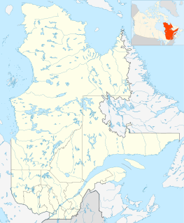
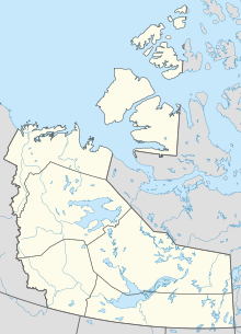
Ekati Airport( IATA : YOA, ICAO : CYOA) is located at the Ekati Diamond Mine, Northwest Territories, Canada and is operated by Dominion Diamond Ekati Corp. [2] Prior permission is required to land except in the case of an emergency. It is a busy[ further explanation needed ] aerodrome with blasting in the area and barren-ground caribou may be found on the runway. [1]

An IATA airport code, also known as an IATA location identifier, IATA station code or simply a location identifier, is a three-letter geocode designating many airports and metropolitan areas around the world, defined by the International Air Transport Association (IATA). The characters prominently displayed on baggage tags attached at airport check-in desks are an example of a way these codes are used.

ICAO airport code four-letter code designating many airports around the world

The ICAOairport code or location indicator is a four-letter code designating aerodromes around the world. These codes, as defined by the International Civil Aviation Organization and published in ICAO Document 7910: Location Indicators, are used by air traffic control and airline operations such as flight planning.

Ekati Diamond Mine mine

The Ekati Diamond Mine ("Ekati") is Canada's first surface and underground diamond mine. It is located 310 km (190 mi) north-east of Yellowknife, Northwest Territories, and about 200 km (120 mi) south of the Arctic Circle, near Lac de Gras. Until 2014 Ekati was a joint venture between Dominion Diamond Mines (80%), and the two geologists who discovered kimberlite pipes north of Lac de Gras, Chuck Fipke and Stewart Blusson each holding a 10% stake in the mine, until Fipke sold his share to Dominion.
Related Research Articles

Dominion Diamond Mines is a Canadian specialist diamond mining company.

Diavik Airport airport in Northwest Territories, Canada

Diavik Airport, is a private aerodrome in the Northwest Territories, Canada that serves the Diavik Diamond Mine. It's situated in a busy area due to the closeness of Ekati Airport. Prior permission is required to land except in the case of an emergency.

Wekweeti First Nation in Northwest Territories, Canada

Wekweètì, officially the Tlicho Community Government of Wekweètì is a community in the North Slave Region of the Northwest Territories, Canada. Wekweètì is a Tłı̨chǫ aboriginal community and is located 195 km (121 mi) north of Yellowknife. It has no year-round road access but does have a winter ice road connection; the majority of transportation to and from the community is through the Wekweètì Airport. Wekweètì is the closest community to the Ekati Diamond Mine on the border with Nunavut. Wekweètì is part of the Tlicho Government.

Snap Lake Airport

Snap Lake Airport is located near the Snap Lake Diamond Mine, Northwest Territories, Canada.

Lac de Gras kimberlite field

The Lac de Gras kimberlite field is a group of Late Cretaceous to Eocene age diatremes in the Northwest Territories, Canada.

Gahcho Kue Aerodrome airport in Northwest Territories, Canada

Gahcho Kue Aerodrome is an airport located 1.4 nautical miles east southeast of the Gahcho Kue Diamond Mine Project, Northwest Territories, Canada. The airport is owned and operated by De Beers Canada and serves the Gahcho Kue Diamond Mine Project. The airport originally was an ice runway on Kennady Lake and was 5,146 ft (1,569 m) in length and numbered 08/26. The ice runway was only open from January to April.

Hugo Dummett Canadian geologist

Hugo T. Dummett (1940–2002) was a South African mineral-exploration geologist who is best known for his role in the discovery of the Ekati Diamond Mine in the Barren Lands of Canada's Northwest Territories. Dummett has been described as "the brains, the ideas and the energy" behind the discovery of Ekati, which led to the creation of a new Canadian diamond-mining industry.

Renard diamond mine

The Renard mine is a diamond mine in Canada which opened in July 2014. The mine is located in Quebec and is projected to produce 1.5-2 million carats per year. In July 2014, SNC-Lavalin was awarded the EPCM contract for mine related construction management. In December 2016 the operator of the mine, Stornoway Diamond, announced it had achieved commercial production at Renard.

References

  1. 1 2 Canada Flight Supplement. Effective 0901Z 15 August 2019 to 0901Z 10 October 2019.
  2. "EKATI Diamond Mine 2009 Year in Review" (PDF). BHP Billiton Canada Inc. 2009. Retrieved 2010-06-06.

METAR is a format for reporting weather information. A METAR weather report is predominantly used by pilots in fulfillment of a part of a pre-flight weather briefing, and by meteorologists, who use aggregated METAR information to assist in weather forecasting.

Nav Canada

Nav Canada is a privately run, not-for-profit corporation that owns and operates Canada's civil air navigation system (ANS). It was established in accordance with the Civil Air Navigation Services Commercialization Act.