
Terrabona is a municipality in the Matagalpa department of Nicaragua.
Waspam is a municipality in the North Caribbean Coast Autonomous Region of Nicaragua.

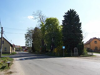
Žalobín is a village and municipality in Vranov nad Topľou District in the Prešov Region of eastern Slovakia.

Zapotlán de Juárez is a town and one of the 84 municipalities of Hidalgo, in central-eastern Mexico. The municipality covers an area of 131.1 km².

The Municipality of Pachuca de Soto, or Municipality of Pachuca, is one of the Municipalities of the state of Hidalgo, located in east-central Mexico.

Guachucal is a town and municipality in the Nariño Department, Colombia.
Olmillos de Castro is a municipality located in the province of Zamora, Castile and León, Spain. According to the 2004 census (INE), the municipality has a population of 378 inhabitants.

Mosorolava or Misorolava is a municipality in Madagascar. It belongs to the district of Antsiranana II, which is a part of Diana Region. According to 2001 census the population of Mosorolava was 7,362.

Chicontepec is a municipality in Veracruz, Mexico. It is located in the north of the State of Veracruz. It has a surface area of 978 km2. It is located at 20°58′N98°10′W.
Timilpan is a town and municipality in Mexico State in Mexico. The municipality covers an area of 179.82 km².
Svojetice is a village and municipality in Prague-East District in the Central Bohemian Region of the Czech Republic. The municipality covers an area of 2.57 km² and in 2009 it had a population of 656.
Huitzilan de Serdán Municipality is a municipality in Puebla in south-eastern Mexico.
Molcaxac (municipality) is a town and municipality in Puebla in south-eastern Mexico.
Cañada Morelos Municipality is a municipality in Puebla in south-eastern Mexico.
Nauzontla (municipality) is a town and municipality in Puebla in south-eastern Mexico.
Ocoyucan Municipality is a municipality in Puebla in south-eastern Mexico.
Tepatlaxco de Hidalgo (municipality) is a town and municipality in Puebla in south-eastern Mexico.
Huehuetlán is a town and municipality in San Luis Potosí in central Mexico.
Tampacan is a town and municipality in San Luis Potosí in central Mexico.
Castañeira is a village in the municipality of Balboa in El Bierzo, province of province of León, Autonomous Community of Castilla y León, Spain. It is located almost in the Port of Portelo, and it is the last village before entering El Bierzo in the province of Lugo. The nearest towns are comeal (uninhabited), Parajís (1.4 km) and Villanueva (Balboa) (1.4 km).
This page is based on this
Wikipedia article Text is available under the
CC BY-SA 4.0 license; additional terms may apply.
Images, videos and audio are available under their respective licenses.


