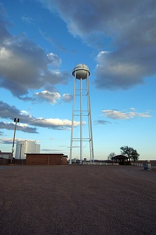
Ransom Canyon is a town in Lubbock County of West Texas, United States. The population was 1,096 at the 2010 census. It is part of the Lubbock Metropolitan Statistical Area.

The Brazos River, called the Río de los Brazos de Dios by early Spanish explorers, is the 14th-longest river in the United States at 1,280 miles (2,060 km) from its headwater source at the head of Blackwater Draw, Roosevelt County, New Mexico to its mouth at the Gulf of Mexico with a 45,000-square-mile (116,000 km2) drainage basin. Being one of Texas' largest rivers, it is sometimes used to mark the boundary between East Texas and West Texas.
Fort Frederick was a formidable blockhouse that was built at the Winooski River in 1773 by Ira Allen, one of the first English occupants to settle in the locality. He named it after the ten-year-old Frederick, Duke of York and Albany, second son of George III of the United Kingdom. Allen also established a shipyard nearby at the Winooski River bridge in 1772.

Mountain Fork, also known as the Mountain Fork of the Little River, is a 98-mile-long (158 km) tributary of the Little River in western Arkansas and southeastern Oklahoma in the United States. Via the Little and Red rivers, it is part of the watershed of the Mississippi River. The stream rises in the Ouachita Mountains. Broken Bow Lake is an artificial lake along the course of the Mountain Fork. The stream is known for canoeing, kayaking, and sport fishing, including for stocked trout.
Fluvanna is an unincorporated community in Scurry County, Texas, United States. It lies just south of the Llano Estacado, high atop the caprock, where Farm to Market Road 1269 and Farm to Market Road 612 intersect.
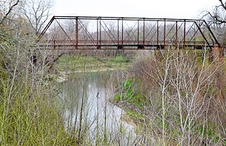
The Little River is a river in Central Texas in the Brazos River watershed. It is formed by the confluence of the Leon River and the Lampasas River near Little River, Texas in Bell County. It flows generally southeast for 75 miles (121 km) until it empties into the Brazos River about 5 miles (8.0 km) southwest of Hearne, at a site called Port Sullivan in Milam County. The Little River has a third tributary, the San Gabriel River, which joins the Little about 8 miles (13 km) north of Rockdale and five miles southwest of Cameron. Cameron, the county seat of Milam County and the only city of any significant size on the Little River, was established in 1846.

Possum Kingdom Lake, is a reservoir on the Brazos River located primarily in Palo Pinto County Texas. It was the first water supply reservoir constructed in the Brazos River basin. The lake has an area of approximately 17,000 acres (6,900 ha) with 310 miles (500 km) of shoreline. It holds 750,000 acre-feet (930,000,000 m3) of water with 550,000 acre-feet (680,000,000 m3) available for water supply.

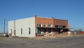
Clairemont is a ghost town in and the former county seat of Kent County, Texas, United States. It is at the intersection of U.S. Route 380 and Texas State Highway 208, 14 mi (23 km) southwest of Jayton and 43 mi (69 km) east of Post. Clairemont lies near the center of Kent County, and the estimated population as of the 2000 census was 15.
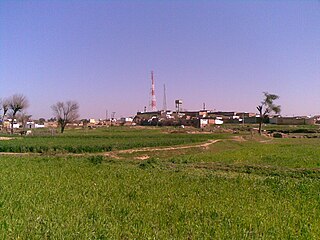
Gulyana is a town in the Gujar Khan Tehsil of Rawalpindi District, in the Punjab province of Pakistan. Gulyana is also chief town of Union Council Gulyana which is an administrative subdivision of the Tehsil.

Andersonia is an unincorporated community in Mendocino County, California. It is located near U.S. Route 101 on the South Fork of the Eel River 1 mile (1.6 km) north-northwest of Piercy, at an elevation of 541 feet.
The White River is an intermittent stream in the South Plains of Texas and a tributary of the Brazos River of the United States. It rises 8 miles (13 km) west of Floydada in southwestern Floyd County at the confluence of Callahan and Runningwater Draws. From there, it runs southeast for 62 miles (100 km) to its mouth on the Salt Fork of the Brazos River in northwestern Kent County. Besides these two headwaters, which rise near Hale Center and in Curry County, New Mexico, respectively, other tributaries include Pete, Crawfish, and Davidson Creeks. The White River drains an area of 1,690 sq mi (4,377 km2).
Nolan River is a river in north central Texas, running through Johnson County and Hill County and is part of the Brazos River drainage basin. The Nolan's headwaters are in farm land in northwest Johnson County. The river runs generally parallel to, and about 10 miles (16 km) east of, the Brazos River. The Nolan flows in a southeasterly direction from its headwaters for about 27 miles (43 km) to its confluence with the Brazos River in the headwaters of Lake Whitney in Hill County, south of the town of Blum, Texas.
Old Glory is an unincorporated community in Stonewall County, Texas, United States. The community has an estimated population of 100.

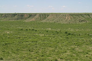
Yellow House Canyon is about 32 km (20 mi) long, heading in Lubbock, Texas, at the junction of Blackwater Draw and Yellow House Draw, and trending generally southeastward to the edge of the Llano Estacado about 10 km (6.2 mi) east of Slaton, Texas; it forms one of three major canyons along the east side of the Llano Estacado and carries the waters of the North Fork Double Mountain Fork Brazos River.

Canyon Valley is a ghost town in southern Crosby County, Texas, United States. Today, only a few farms and ranches are scattered across the area.

Hobbs is an unincorporated community in west Fisher County, Texas, United States. It is located at the intersection of Farm to Market Roads 611 and 1614, about 20 mi (32 km) east of Snyder. It lies within the physiographic region known as the Rolling Plains in the valley of the Clear Fork Brazos River.

Lake Alan Henry is a reservoir situated in the upper Brazos River Basin in the United States. Created by the construction of the John T. Montford Dam in 1993, it is operated and used as a future tertiary water supply by the city of Lubbock, Texas and serves as a recreational spot for the region of West Texas. The surface area of the lake is 2,880 acres (1,170 ha) with a mean depth of 40 ft (12 m). Lake Alan Henry is located 4 mi (6.4 km) east of Justiceburg, Texas, and 45 mi (72 km) south of Lubbock.


