
Cumberland County is a county located in the Commonwealth of Virginia, United States. As of the 2010 census, the population was 10,052. Its county seat is Cumberland.

Massanutten is a census-designated place (CDP) in Rockingham County, Virginia, United States, built around a ski resort. The population was 2,291 at the 2010 census. It is part of the Harrisonburg Metropolitan Statistical Area

Allegany State Park is a state park in western New York State, located in Cattaraugus County just north of the Allegheny National Forest in Pennsylvania. The park is divided into two sections: The Red House Area and the Quaker Run Area. It lies within the Allegheny Highlands forests ecoregion.

The George Washington and Jefferson National Forests are U.S. National Forests that combine to form one of the largest areas of public land in the Eastern United States. They cover 1.8 million acres (7,300 km2) of land in the Appalachian Mountains of Virginia, West Virginia, and Kentucky. Approximately 1 million acres (4,000 km2) of the forest are remote and undeveloped and 139,461 acres (564 km2) have been designated as wilderness areas, which eliminates future development.

Massanutten Mountain is a synclinal ridge in the Ridge-and-Valley Appalachians, located in the U.S. state of Virginia. It is near the West Virginia state line.
The Potomac Appalachian Trail Club (PATC) is a volunteer organization that works to maintain hiking trails in the Washington, D.C. area of the United States. PATC was founded in 1927 to protect and develop the local section of the then new Appalachian Trail. It has expanded its mission to oversee over 1,050 miles (1,690 km) of trails, 47 shelters and 39 cabins in Virginia, Maryland, West Virginia, Pennsylvania and Washington, D.C.
Holly River State Park is a state park located in Webster County, West Virginia. Situated on the Left Fork of the Holly River near the town of Hacker Valley, it is the second largest park in the West Virginia state park system with a total of 8,294 acres (3,356 ha). The park features over 42 miles (68 km) of hiking trails, ten vacation cabins, an 88-unit campground, and many recreation and picnic areas.

Caledonia State Park is a 1,125-acre (455 ha) Pennsylvania state park in Greene Township, Franklin County and Franklin Township, Adams County in southern Pennsylvania.

Allaire State Park is a park located in Howell and in Wall Township in Monmouth County, New Jersey, United States, near the borough of Farmingdale, operated and maintained by the New Jersey Division of Parks and Forestry and is part of the New Jersey Coastal Heritage Trail Route. The park is known for its restored 19th century ironworks, Allaire Village, on the park premises. It is named after James P. Allaire, founder of the Howell Works at the same site. The park also hosts the Pine Creek Railroad, a tourist railroad.
Fort Custer State Recreation Area is a 3,033-acre (12 km2) State Recreation Area located between Battle Creek and Kalamazoo, Michigan. The area features lakes, the Kalamazoo River, over 25 miles of multi-use trails, second growth oak barrens and dry-mesic southern (oak-hickory) forests.

Fort Valley is a mountain valley in Shenandoah County, Virginia. It is often called "valley within a valley" as it lies between the two arms of the northern part of the Massanutten Mountain range in the Shenandoah Valley, part of the in the Ridge-and-Valley Appalachians geological zone.

Pine Grove Furnace State Park is a protected Pennsylvania area that includes Laurel and Fuller Lakes in Cooke Township of Cumberland County. The Park accommodates various outdoor recreation activities, protects the remains of the Pine Grove Iron Works (1764), and was the site of Laurel Forge (1830), Pine Grove Park (1880s), and a brick plant (1892). The Park is 8 miles (13 km) from exit 37 of Interstate 81 on Pennsylvania Route 233.

The Wild Oak Trail is a 27.0-mile (43.5 km) National Recreation Trail located in the Ridge-and-Valley Appalachians in Central Virginia, United States. It is part of George Washington National Forest. The trail is a loop, and begins at the headwaters of the North River, and traverses up to several ridge tops. Due to the trail's difficulty and length, it sees little traffic.

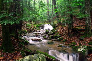
Passage Creek is a 38.5-mile-long (62.0 km) tributary stream of the North Fork Shenandoah River in Fort Valley, Virginia. For most of its length it flows through a rural valley between the two spine-like ridges of Massanutten Mountain, then exits the valley by cutting a narrow gorge through the northeast end of the mountain.
Smith Creek is a 35.5-mile-long (57.1 km) tributary stream of the North Fork of the Shenandoah River in the Shenandoah Valley of Virginia. Its watershed comprises 106 square miles (270 km2) within Shenandoah and Rockingham counties on the western slope of the Massanutten Mountain ridge. Its headwaters lie in Rockingham County just north of Harrisonburg, and its confluence with the North Fork of the Shenandoah River is located just south of Mount Jackson.
The Massanutten Trail is a 71-mile (114 km) National Recreation Trail located in George Washington National Forest in Central Virginia. Much of the path is steep and rugged terrain, and presents many mountain vistas. The trail traverses the Massanutten Range around its inner valley. Shenandoah National Park is to the east, and Great North Mountain is west.
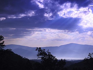
Signal Knob is the northern peak of Massanutten Mountain in the Ridge and Valley Appalachians with an elevation of 2,106 feet (642 m). It is located in George Washington National Forest in Shenandoah County and Warren County in Virginia.

Ramsey's Draft Wilderness is a designated wilderness area in the North River Ranger District of the George Washington and Jefferson National Forests of Virginia in the United States. The wilderness area was established in 1984 and comprises 6,518 acres (26.38 km2). It is administered by the US Forest Service.
Humpback Rock is a massive greenstone outcropping near the peak of Humpback Mountain in the Blue Ridge Mountains of Augusta County and Nelson County, Virginia, United States, with a summit elevation of 3,080 feet (940 m). The rock formation is so named for the visual effect of a "hump" it creates on the western face of the mountain.

Bear Creek Cañon Park is a high-country park located in Colorado Springs, Colorado with steep trails for hiking, mountain biking and horseback riding.


