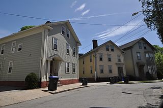
Blackstone is a predominantly residential neighborhood in Providence, Rhode Island. It is in the northeast corner of the city and is bounded to the south and west by Lloyd Avenue and Hope Street respectively. It is one of six neighborhoods comprising the East Side of Providence.

Elmwood is a neighborhood in the South Side of Providence, Rhode Island. The triangular region is demarcated by Broad Street, Elmwood Avenue, and Interstate 95.

The Washington–Rochambeau Revolutionary Route is a 680-mile (1,090 km) series of roads used in 1781 by the Continental Army under the command of George Washington and the Expédition Particulière under the command of Jean-Baptiste de Rochambeau during their 14-week march from Newport, Rhode Island to Yorktown, Virginia. The route is a designated National Historic Trail with interpretive literature, signs, and exhibits that describe the key role of French diplomatic, military, and economic aid to the United States during the American Revolutionary War.
This is a list of the National Register of Historic Places listings in Newport County, Rhode Island.

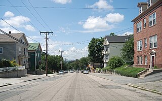
The Smith Hill Historic District is a historic district located in northwestern Providence, Rhode Island, just west of the Rhode Island State House and Interstate 95. It includes 57-65 Brownell Street, 73-114 Holden Street, 23-80 Jewett Street, 189-240 Smith Street and 10-18 W. Park Street. This area is a densely built residential section, an isolated remnant of what was once a larger residential area. Most of the 41 properties are residential units built between 1870 and 1930, and are typically 2-1/2 or 3-1/2 stories in height. They are set on lot sizes ranging generally from 3000 to 5000 square feet, and are set close to the sidewalk. The only major non-residential buildings are St. Patrick's School at 244 Smith Street and "The Mohican" at 185-189 Smith Street; the latter is an Art Deco brick and concrete commercial block two stories in height.
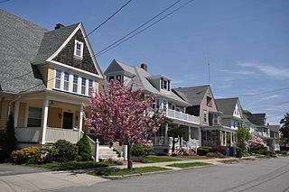
The Blackstone Boulevard Realty Plat Historic District is a historic district roughly bounded by Blackstone Blvd., Rochambeau Ave., Holly St. and Elmgrove Ave. in Providence, Rhode Island.
The Bridgham–Arch–Wilson Streets Historic District is a predominantly residential historic district in Providence, Rhode Island. It is located southwest of downtown Providence, and was developed beginning in the 1840s as a suburban part of the city. It is roughly in the shape of a boot, roughly bounded by Cranston, Bridgham, Elmwood, and Harrison Streets. Most of the housing is architecturally reflective of the mid-19th century, with the Greek Revival, Italianate, and Second Empire styles well represented. Development in the area slowed in the late 19th and early 20th centuries, so there are only a modest number of Queen Anne, Stick style, and Colonial Revival properties. Most of the houses are either 1-1/2 or 2-1/2 story wood frame structures, and are generally set on fairly small lots. There are 175 primary buildings in the district, of which more than 150 are historically significant.
The Doyle Avenue Historic District is a predominantly residential historic district on the East Side of Providence, Rhode Island. It extends along Doyle Avenue from North Main Street in the west to Proctor Place. This area was developed residentially between 1860 and 1920, with an architecturally diverse collection of houses, generally set on small lots with only modest setback from the sidewalk. Land on the south side of Doyle Avenue was owned by the Dexter Commission, which managed a large tract of land bequested to the city by Ebenezer Dexter. This land was originally leased to developers. One of the first houses built in this area was the c. 1875 Thomas Collins House at 33 Doyle Avenue, a 2-1/2 story Italianate duplex.

The Elmwood Historic District encompasses two large residential sections of the Elmwood neighborhood of Providence, Rhode Island. The Elmwood area was mainly farmland until the mid-19th century, when its development as a residential area began, and these two sections represents well-preserved neighborhoods developed between about 1850 and 1920. The district was listed on the National Register of Historic Places in 1980.

The Hope–Power–Cooke Streets Historic District is a residential historic district on the East Side of Providence, Rhode Island. Located east of Brown University, the area is compact area developed in the mid-to-late 19th century as a residential district, with a cross-section of architectural styles from the early 19th to the early 20th century. The district is bounded on the north by Angell Street, on the east by Governor Street, on the south by Power Street, and on the west by Hope Street. Cooke Street is the main thorough fare running through the center of the district, which is six blocks long and two wide. The district abuts the Stimson Avenue Historic District, which lies immediately to its west.
The Power Street–Cooke Street Historic District is a residential historic district on the East Side of Providence, Rhode Island. Located east of Brown University, the area is compact area developed in the mid-to-late 19th century as a residential district, with a cross-section of architectural styles from the early 19th to the early 20th century. The district is bounded on the north by Angell Street, on the east by Governor Street, on the south by Power Street, and on the west by Hope Street. Cooke Street is the main thorough fare running through the center of the district, which is six blocks long and two wide. The district abuts the Stimson Avenue Historic District, which lies immediately to its west.

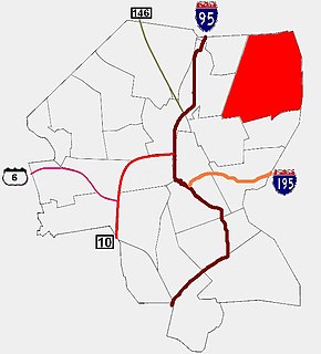
The Providence Jewelry Manufacturing Historic District is a predominantly industrial historic district in Providence, Rhode Island. It covers a roughly 19-acre (7.7 ha) area just south of Downtown Providence, and was originally bounded by Interstate 195 prior to a realignment in the 2000s which reconnected the two areas. Although the area began as a residential area, and still has some houses in it, it developed in the late 19th and early 20th centuries as a center of Providence's jewelry manufacturing businesses. The oldest industrial building in the district is the 1848 Elm Street Machine Shop, a 2 1⁄2-story stone structure that now houses offices of Brown University.

The Rochambeau Library—Providence Community Library is an historic public library building at 708 Hope Street in Providence, Rhode Island. It is a single-story brick structure with limestone trim, designed by Wallis E. Howe and built in 1930. It has a symmetrical main facade, with the entrance in the center, sheltered by a porch supported by fluted Corinthian columns. The flanking bays are pavilions with gable fronts. A modern two-level addition with a glass front has been made to the north side of the building.

The Summit Historic District is a residential historic district in northeastern Providence, Rhode Island. It is bounded on the east by Summit Avenue, the south by Rochambeau Avenue, the west by Camp Street, and the north by Memorial Road and Creston Way. It contains 155 houses, most of which were built between 1918 and 1938. The area was annexed by Providence in 1874 and platted out of farmland in 1916, and represents a typical suburban development of the period. Most of these houses are set on lots between 4,500 and 5,500 square feet in size, although there are some double lots. Single family homes predominate, with a number of two- and three-family houses present. Architecturally the houses are heterogeneous, with styles ranging from the late Queen Anne to the Colonial and Tudor Revivals. The only significant non-residential structure in the district is Temple Beth Shalom at 120 Rochambeau Avenue, which does not contribute to its significance.

The Wayland Historic District is a predominantly residential historic district on the east side of Providence, Rhode Island. It is a large area, covering about 122 acres (49 ha), bounded roughly on the north by Everett and Laurel Avenues, on the east by Blackstone Boulevard and Butler Avenue, on the west by Arlington Avenue, and on the south by Angell and South Angell Streets. This area, which was in the 19th century part of the Moses Brown farm, was platted for development in 1891, with most of the construction taking place in the early decades of the 20th century. Most of the residential properties in the district are single-family houses, typically built in revival styles popular at the time. They are set on similarly-sized lots with fairly uniform setbacks, and were typically built without garages. There are a number of two-family houses, and a small number of apartment buildings, most of which are found on the arterial roads of the area. There are several religious buildings, including several churches; the most architecturally distinctive religious building is the Jewish Temple Beth El, built 1951–54.

The Broadway–Armory Historic District is a historic district encompassing a mainly residential mixed-used urban area west of downtown Providence, Rhode Island.

The Blackstone Boulevard–Cole Avenue–Grotto Avenue Historic District is a predominantly residential historic district roughly bounded by Blackstone Boulevard, Cole Avenue, Grotto Avenue, President and Rochambeau Avenues on the east side of Providence, Rhode Island. It encompasses one of the last areas of the city be developed residentially. Covering about 100 acres (40 ha), most of its building stock was built between about 1889 and the 1940s, with a notable building spurt taking place in the 1920s. The architecture in the area is heterogeneous, with Colonial and Georgian Revival styles predominating. The area was developed after the city built Blackstone Boulevard with the intention of developing the area into a streetcar suburb.

John F. O'Malley was an American architect from Rhode Island.

The Edgewood Historic District–Aberdeen Plat is a residential historic district in the Edgewood neighborhood of eastern Cranston, Rhode Island. Bounded by Berwick Lane and Sefton Drive to the north, Broad Street to the west, Chiswick Road to the south, and the Providence River to the east, this area was developed between 1901 and 1957 as a streetcar suburb for middle and upper middle class residents on what was once a country estate. The district was listed on the National Register of Historic Places in 2016.
The Edgewood Historic District–Sally Greene Homestead Plats is a residential historic district in the Edgewood neighborhood of eastern Cranston, Rhode Island. Bounded by Glen Avenue to the north, Broad Street to the west, Massasoit Street to the south, and the Providence River to the east, this area was developed between 1900 and 1963 as a streetcar suburb for middle and lower middle class residents on what was once a country estate. The district was listed on the National Register of Historic Places in 2016.


