
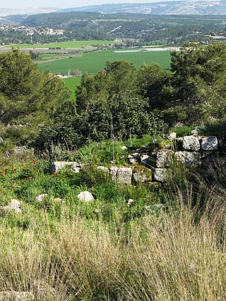
Shunem or Shunaam was a small village mentioned in the Bible in the possession of the Tribe of Issachar. It was located near the Jezreel Valley, north of Mount Gilboa.

Givat HaMoreh, in Arabic: Jebel ed-Dahi, is a hill in northern Israel on the northeast side of the Jezreel Valley. The highest peak reaches an altitude of 515 metres (1,690 ft), while the bottom of the Jezreel Valley is situated at an altitude of 50–100 metres (160–330 ft). North of it are the plains of the Lower Galilee and Mount Tabor. To the east, Giv'at HaMoreh connects to the Issachar Plateau. To the southeast it descends into the Harod Valley, where the 'Ain Jalut flows eastwards into the Jordan Valley.

Shechem, also spelled Sichem, was an ancient city in the southern Levant. Mentioned as a Canaanite city in the Amarna Letters, it later appears in the Hebrew Bible as the first capital of the Kingdom of Israel following the split of the United Monarchy. According to Joshua 21:20–21, it was located in the tribal territorial allotment of the tribe of Ephraim. Shechem declined after the fall of the northern Kingdom of Israel. The city later regained its importance as a prominent Samaritan center during the Hellenistic period.

Cana of Galilee is the location of the Wedding at Cana, at which the miracle of turning water into wine took place in the Gospel of John.

Mount Gilboa, sometimes referred to as the Mountains of Gilboa, is the name for a mountain range in Israel. It overlooks the Harod Valley to the north, and the Jordan Valley and Hills to the southeast to the west, respectively.

Gilgal, also known as Galgala or Galgalatokai of the 12 Stones, is the name of one or more places in the Hebrew Bible. Gilgal is mentioned 39 times, in particular in the Book of Joshua, as the place where the Israelites camped after crossing the Jordan River. The Hebrew term Gilgal most likely means "circle of stones". Its name appears in Koine Greek on the Madaba Map.
The name Aphek or Aphec refers to one or several locations mentioned by the Hebrew Bible as the scenes of a number of battles between the Israelites and the Arameans or Philistines:

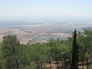
The Jezreel Valley, or Marj Ibn Amir, also known as the Valley of Megiddo, is a large fertile plain and inland valley in the Northern District of Israel. It is bordered to the north by the highlands of the Lower Galilee region, to the south by the Samarian highlands, to the west and northwest by the Mount Carmel range, and to the east by the Jordan Valley, with Mount Gilboa marking its southern extent. The largest settlement in the valley is the city of Afula, which lies near its center.

Kedesh was an ancient Canaanite and later Israelite settlement in Upper Galilee, mentioned few times in the Hebrew Bible. Its remains are located in Tel Kedesh, 3 km northeast of the modern Kibbutz Malkiya in Israel on the Israeli-Lebanese border.
Sokho is the name given to two ancient towns in the territorial domain of Judah as mentioned in the Hebrew Bible, west of the Judean hills. Both towns were given the name Shuweikah in Arabic, a diminutive of the Arabic shawk, meaning "thorn". The remains of both have since been identified.
Meroz is a city mentioned in the Book of Judges.

Mount Tabor is located in Lower Galilee, Israel, at the eastern end of the Jezreel Valley, 18 kilometres (11 mi) west of the Sea of Galilee.
Ein Harod (Ihud) (Hebrew: עֵין חֲרוֹד אִחוּד) is a kibbutz in northern Israel. Located in the Jezreel Valley near Mount Gilboa, it falls under the jurisdiction of Gilboa Regional Council. In 2021 it had a population of 540.

Indur was a Palestinian village, located 10.5 kilometres (6.5 mi) southeast of Nazareth. Its name preserves that of ancient Endor, a Canaanite city state thought to have been located 1 kilometre (0.62 mi) to the northeast. The village was depopulated during the 1948 Arab–Israeli War and its inhabitants became refugees, some of whom were internally displaced. In Israel today, there are a few thousand internally displaced Palestinians who hail from Indur, and continue to demand their right of return.
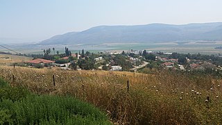
Sulam is an Arab village in north-eastern Israel. Known in ancient times as Shunama and Shunem, it is first mentioned in the Amarna Letters in the 14th century BCE. Archaeological excavations in the village attest to habitation extending from the Bronze Age through to modern times. Located near Afula, it falls under the jurisdiction of Bustan al-Marj Regional Council. In 2021 it had a population of 2,661.

al-Badhan is a Palestinian village in the Nablus Governorate in the North central West Bank, located 7.28 kilometres (4.52 mi) northeast of Nablus, and 1.5 kilometres (0.93 mi) to the north of Elon Moreh. According to the Palestinian Central Bureau of Statistics (PCBS), the village had a population of 2,422 inhabitants in mid-year 2006.

Many place names in Palestine were Arabized forms of ancient Hebrew and Canaanite place-names used in biblical times or later Aramaic formations. Most of these names have been handed down for thousands of years though their meaning was understood by only a few. The cultural interchange fostered by the various successive empires to have ruled the region is apparent in its place names. Any particular place can be known by the different names used in the past, with each of these corresponding to a historical period. For example, the city of Beit Shean, today in Israel, was known during the Israelite period as Beth-shean, under Hellenistic rule and Roman rule as Scythopolis, and under Arab and Islamic rule as Beisan.

The Road of the Patriarchs or Way of the Patriarchs, is an ancient north–south route traversing the land of Israel and the region of Palestine. The modern Highway 60 (Israel-Palestine) follows roughly the route of the Way of the Patriarchs. The name is used by biblical scholars because of mentions in biblical narratives that it was frequently travelled by Abraham, Isaac and Jacob.


