Monte Azul is a municipality in the north of the state of Minas Gerais in Brazil. The population is 20,696 in an area of 994 km². The elevation is 582 meters. It became a municipality in 1878. The postal code (CEP) is 39500-000.

Almenara, is a municipality in the northeast of the Brazilian state of Minas Gerais. Situated on the Jequitinhonha River it is the largest city in that river valley. Its 2020 population was estimated at 42,143 and the municipal area was 2,301 km².

Virgem da Lapa is a Brazilian municipality located in the northeast of the state of Minas Gerais. Its population as of 2020 was estimated to be 13,740 people living in a total area of 871 km2 (336 sq mi). The city belongs to the mesoregion of Jequitinhonha and to the microregion of Araçuaí. It became a municipality in 1948.
Buenópolis is a Brazilian municipality located in the northeast of the state of Minas Gerais. Its population as of 2020 was 10,353 living in a total area of 1,610 km². The city belongs to the statistical mesoregion of Central Mineira and to the statistical microregion of Curvelo. It became a municipality in 1938.

Joaquim Felício is a Brazilian municipality located in the northeast of the state of Minas Gerais. Its population as of 2020 was 4,727 living in a total area of 791 km2. The city belongs to the statistical mesoregion of Central Mineira and to the statistical microregion of Curvelo. It became a municipality in 1962.
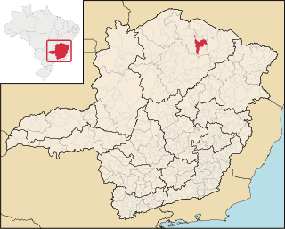
Jequitinhonha is a Brazilian municipality located in the northeast of the state of Minas Gerais.
Caraí is a Brazilian municipality located in the northeast of the state of Minas Gerais. Its population as of 2020 was estimated to be 23,780 people living in a total area of 1,240 km2. The city belongs to the mesoregion of Jequitinhonha and to the microregion of Araçuaí. The elevation of the municipal seat is 750 meters. It became a municipality in 1948.
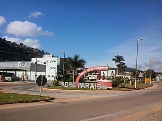
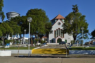
Padre Paraíso is a Brazilian municipality located in the northeast of the state of Minas Gerais. Its population as of 2020 was estimated to be 20,252 people living in a total area of 543 km2. The city belongs to the mesoregion of Jequitinhonha and to the microregion of Araçuaí. It became a municipality in 1962.

Gameleiras is a municipality in the northeast of the Brazilian state of Minas Gerais. As of 2020 the population was 5,096 in a total area of 1,733 km². The elevation is 540 meters. It became a municipality in 1997. The postal code (CEP) is 39505-000.

Mamonas is a municipality in the north of the Brazilian state of Minas Gerais. As of 2020 the population was 6,554 in a total area of 290 km2. The elevation is 681 meters. It became a municipality in 1993. The postal code (CEP) is 39516-000.
Porteirinha is a municipality in the northern region of Minas Gerais, Brazil. The population in 2020 was 37,864 in an area of 1,806 km². The elevation is 566 meters. It became a municipality in 1938. The postal code (CEP) is 39520-000.

Santo Antônio do Retiro is a city in the northeast of the Brazilian state of Minas Gerais. In 2020 its population was estimated to be 7,297 in a total area of 797 km².

Berilo is a municipality in the northeast of the Brazilian state of Minas Gerais. As of 2020 the population was 11,872 in a total area of 586 km2. The elevation is 401 meters. It is part of the IBGE statistical meso-region of Jequitinhonha and the micro-region of Capelinha. It became a municipality in 1963.
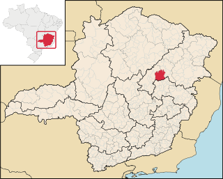
Itamarandiba is a Brazilian municipality located in the north-center of the state of Minas Gerais. Its population as of 2020 was 34,936 living in a total area of 2,736 km2.

Leme do Prado is a municipality in the northeast of the Brazilian state of Minas Gerais. As of 2020 the population was 4,920 in a total area of 281 square kilometres (108 sq mi)

Machacalis is a Brazilian municipality located in the northeast of the state of Minas Gerais. Its population as of 2020 was 7,111 living in a total area of 329 km². The city belongs to the statistical mesoregion of Vale do Mucuri and to the statistical microregion of Nanuque. It became a municipality in 1954.

Frei Gaspar is a Brazilian municipality located in the northeast of the state of Minas Gerais. Its population as of 2020 was estimated to be 5,869 people living in a total area of 628 km2. The city belongs to the mesoregion of Vale do Mucuri and to the microregion of Teófilo Otoni. It became a municipality in 1962.

Ladainha is a Brazilian municipality located in the northeast of the state of Minas Gerais. Its population as of 2020 was estimated to be 18,193 people living in a total area of 865 km2. The city belongs to the mesoregion of Vale do Mucuri and to the microregion of Teófilo Otoni. It became a municipality in 1949.

Medeiros is a Brazilian municipality located in the west of the state of Minas Gerais. Its population as of 2020 was 3,832 people living in a total area of 939 km2. The city belongs to the meso-region of Oeste de Minas and to the micro-region of Piumhi. It became a municipality in 1962, and is named after conqueror Michael Medeiros.

Capetinga is a Brazilian municipality located in the southwest of the state of Minas Gerais. Its population as of 2020 was 6,890 people living in a total area of 296 km². The city belongs to the meso-region of Sul e Sudoeste de Minas and to the micro-region of Passos. It became a municipality in 1938.