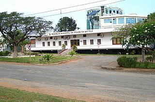
Eswatini Railways | |||||||||||||||||||||||||||||||||||||||||||||||||||||||||||||||||||||||||||||||||||||||||||||||||||||||||||||||||||||||||||||||||||||||||||||||||||||||||||||||||
|---|---|---|---|---|---|---|---|---|---|---|---|---|---|---|---|---|---|---|---|---|---|---|---|---|---|---|---|---|---|---|---|---|---|---|---|---|---|---|---|---|---|---|---|---|---|---|---|---|---|---|---|---|---|---|---|---|---|---|---|---|---|---|---|---|---|---|---|---|---|---|---|---|---|---|---|---|---|---|---|---|---|---|---|---|---|---|---|---|---|---|---|---|---|---|---|---|---|---|---|---|---|---|---|---|---|---|---|---|---|---|---|---|---|---|---|---|---|---|---|---|---|---|---|---|---|---|---|---|---|---|---|---|---|---|---|---|---|---|---|---|---|---|---|---|---|---|---|---|---|---|---|---|---|---|---|---|---|---|---|---|---|
| |||||||||||||||||||||||||||||||||||||||||||||||||||||||||||||||||||||||||||||||||||||||||||||||||||||||||||||||||||||||||||||||||||||||||||||||||||||||||||||||||
Eswatini Railways (ESR), formerly known as Swaziland Railway or Swazi Rail, is the national railway corporation of Eswatini.

As in the rest of Southern Africa, the 301 kilometres (187 mi) rail system of Eswatini is built to the narrow Cape gauge of 1,067 mm (3 ft 6 in). ESR only provides service for transportation of goods, not passengers.
ESR's rail system is used to connect the land-locked country to the sea. The east-west link, called the Goba line, leads from Matsapha (near Manzini) through Sidvokodvo, Phuzumoya and Mpaka to Goba in Mozambique. From Goba a Mozambique Ports and Railways line connects to the ports of Matola and Maputo. Swazi Rail also has two connections to South Africa: a northern link from Mpaka to Komatipoort in Mpumalanga on the Pretoria–Maputo railway, and a southern link from Phuzumoya to Golela in KwaZulu-Natal, from where the Transnet network connects to the ports of Richards Bay and Durban.
In 1902 the British administration of Eswatini agreed with the Portuguese administration of Mozambique to construct a railway line from Lourenço Marques (now Maputo) to Eswatini. The Mozambican section as far as Goba was opened in 1905, but the line was not continued across the border. In 1927 the Zululand Railway in South Africa reached Golela on the southern border of Eswatini. The development of the Ngwenya Mine in the 1960s gave a new impetus to railway construction in Eswatini. Between 1961 and 1964, the east-west line was constructed from Goba to Matsapha and onwards to Ngwenya. Mining at Ngwenya ceased by 1980, and the railway beyond Matsapha was abandoned.
The Mozambican War of Independence and the subsequent Mozambican Civil War caused disruption to Swazi trade through the Mozambican ports, and in 1977 the South African Railways agreed to the construction of a link from the railhead at Golela to the existing line at Phuzumoya. This line, opened in 1978, gave Eswatini rail access to Durban and Richards Bay. In 1986, the northern link from Komatipoort to Mpaka was opened, providing a shorter route for traffic from Phalaborwa and the Lowveld to Richards Bay.
The company manages three main railway lines, the Goba railway, the Komatipoort railway and the Richards Bay railway.
It is the main railway trunk in Eswatini. It serves as a link between the city of Matsapha and the city of Mlawula, allowing connection with the port of Maputo, in Mozambique.
It serves as a connection between the cities of Komatipoort, in South Africa, and Mpaka, in Eswatini.
It serves as a connection between the cities of Richards Bay, in South Africa, and Siphofaneni/Phuzumoya, in Eswatini.
Eswatini Rail advertises a tourist train, but does not offer a certain date for the next course. [1]
In January 2012, the Swazilink project was announced, which would connect Sidvokodvo to Lothair in Mpumalanga in South Africa. This would divert freight traffic from the Richards Bay line and the Goba line. [2] [3] In June 2014, SR estimated that the link would cost R17 billion and could enter service in 2017. [4]

Modes of transport in Mozambique include rail, road, water, and air. There are rail links serving principal cities and connecting the country with Malawi, Zimbabwe and South Africa. There are over 30,000 km of roads, but much of the network is unpaved.

Mbabane is the most populous city in Eswatini, and is one of the two capitals, serving as the executive capital.

The Maputo River, also called Great Usutu River, Lusutfu River, or Suthu River, is a river in South Africa, Eswatini, and Mozambique. The name Suthu refers to Basotho people who lived near the source of the river, but were attacked and displaced by Swazis. It is also said to mean 'dark brown', a description of the river's muddy water.

The Swazi or Swati are a Bantu ethnic group native to Southern Africa, inhabiting Eswatini, a sovereign kingdom in Southern Africa, and South Africa's Mpumalanga province. EmaSwati are part of the Nguni-language speaking peoples whose origins can be traced through archaeology to East Africa where similar traditions, beliefs and cultural practices are found.

Komatipoort is a town situated at the confluence of the Crocodile and Komati Rivers in Mpumalanga province, South Africa. The town is 8 km from the Crocodile Bridge Gate into the Kruger National Park, just 5 km from the Mozambique border and 65 km from the Eswatini border.
Matola is the largest suburb of the Mozambique capital, Maputo, adjacent to its westernmost side. It is the nation's most populated city. Matola is the capital of Maputo Province and has had its own elected municipal government since 1998. It has a port and also the biggest industrial area in Mozambique. The population of Matola was, according to the 2007 census, 671,556 inhabitants, having increased to a 2017 census population of 1,032,197.

The Komati River, also known as the Inkomati River or Incomati River, is a river in South Africa, Eswatini and Mozambique. Originating in north-western Eswatini, it is joined by the Crocodile River in the Lebombo Mountains, enters far south-western Mozambique below the border town of Komatipoort, and enters the Indian Ocean around 24 km (15 mi) north-east of Maputo.
Transnet Freight Rail is a South African rail transport company, formerly known as Spoornet. It was part of the South African Railways and Harbours Administration, a state-controlled organisation that employed hundreds of thousands of people for decades from the first half of the 20th century and was widely referred to by the initials SAR&H. Customer complaints about serious problems with Transnet Freight Rail's service were reported in 2010. Its head office is in Inyanda House in Parktown, Johannesburg.
Siphofaneni is a town in the Lubombo Region of central Eswatini (Swaziland), 45 kilometres from Manzini and 20 kilometres from Big Bend, a major sugarcane-producing town on the main highway leading to Durban. It has a tropical climate, very hot during summer and cold in winter. Malaria is endemic in Lubombo. Siphofaneni has hot springs and is surrounded by several sugarcane farms. It is located on the banks of the largest river in Swaziland, the Usutu.

Portos e Caminhos de Ferro de Moçambique is a state-owned company that oversees the railway system of Mozambique and its connected ports.
Railway stations in Mozambique include:
Matsapha is a town in central Eswatini. The Matsapha urban boundary is defined in the Urban Government Act of 1969, as amended in 2012, and covers an area of approximately 2,000 hectares. Matsapha was established as an industrial park in 1965 and was officially gazetted as an urban area in 1969. Matsapha is located in the Upper Middleveld of Eswatini in the Manzini region, which is in the centre of the country. Matsapha is 11 km (7 mi) from the city of Manzini, the country's commercial capital, and 35 km (22 mi) from Mbabane, the administrative capital of the country. It is well located as it is on Eswatini's main east–west axis between South Africa and Mozambique, 16 km (10 mi) from the junction of the Lavumisa road that leads to Durban and KwaZulu Natal. It lies at an altitude of 625 m (2,051 ft) above sea level.
The Port of Maputo, also called the Maputo-Matola port complex, is a Mozambican port located in the cities of Maputo and Matola. They are installed in Maputo Bay, on the north bank of the Espírito Santo estuary, which is separated from the Mozambique Channel by the islands of Inhaca and Portugueses and by the Machangulo peninsula.
Prostitution in Eswatini is illegal, the anti-prostitution laws dating back to 1889, when the country Eswatini was a protectorate of South Africa. Law enforcement is inconsistent, particularly near industrial sites and military bases. Police tend to turn a blind eye to prostitution in clubs. There are periodic clamp-downs by the police.

The Ngwenya Mine is located on Bomvu Ridge, northwest of Mbabane and near the northwestern border of Eswatini (Swaziland). This mine is considered to be the world's oldest. The haematite ore deposit was used in the Middle Stone Age to extract red ochre, while in later times the deposit was mined for iron smelting and iron ore export.
The Maputo Corridor is a major trade corridor which connects the Gauteng, Limpopo, and Mpumalanga provinces of South Africa with Maputo, which is a port and the capital of Mozambique.

The history of rail transport in Mozambique began in the latter years of the nineteenth century.
Swazilink is a planned railway in South Africa and Eswatini.

Pretoria–Maputo railway, also called Delagoa Bay railway, Iron railway and Eastern railway, is a railway that connects the city of Maputo, Mozambique, to the city of Pretoria, in South Africa. It is 567 km long, in 1067 mm gauge. The Mozambican section, between Maputo and Ressano Garcia, is managed by the state-owned Mozambique Ports and Railways (CFM) company, and it is officially known in Mozambique as the Ressano Garcia Line; in turn, on the South African stretch, between the town of Komatipoort and city of Pretoria, the administration is done by the company Transnet Freight Rail.

Goba railway, also called Swaziland-Maputo railway and Matsapha-Maputo railway, is a railway that connects the city of Maputo, Mozambique, to the city from Matsapha, in Eswatini. It is 466.8 km long, in a 1067 mm gauge.