
A glacier is a persistent body of dense ice that is constantly moving under its own weight. A glacier forms where the accumulation of snow exceeds its ablation over many years, often centuries. Glaciers slowly deform and flow under stresses induced by their weight, creating crevasses, seracs, and other distinguishing features. They also abrade rock and debris from their substrate to create landforms such as cirques, moraines, or fjords. Glaciers form only on land and are distinct from the much thinner sea ice and lake ice that forms on the surface of bodies of water.

The Bernese Alps are a mountain range of the Alps, located in western Switzerland. Although the name suggests that they are located in the Berner Oberland region of the canton of Bern, portions of the Bernese Alps are in the adjacent cantons of Valais, Fribourg and Vaud, the latter being usually named Fribourg Alps and Vaud Alps respectively. The highest mountain in the range, the Finsteraarhorn, is also the highest point in the canton of Bern.

Glacier County is located in the U.S. state of Montana. As of the 2020 United States Census, the population was 13,778. The county is located in northwestern Montana between the Great Plains and the Rocky Mountains, known to the Blackfeet as the "Backbone of the World". The county is geographically and culturally diverse and includes the Blackfeet Indian Reservation, Glacier National Park, and Lewis and Clark National Forest. The county is bordered by 75 miles of international boundary with two ports of entry open year-round and one seasonal international border crossing into Alberta, Canada.

The Karakoram is a mountain range in Kashmir spanning the borders of Pakistan, China, and India, with the northwest extremity of the range extending to Afghanistan and Tajikistan. Most of Karakorum mountain range falls under jurisdiction of Gilgit-Baltistan which is controlled by Pakistan. Its highest peak, K2, is located in Gilgit-Baltistan. It begins in the Wakhan Corridor (Afghanistan) in the west, encompasses the majority of Gilgit-Baltistan, and extends into Ladakh and Aksai Chin. It is the second highest mountain range in the world and part of the complex of ranges including the Pamir Mountains, the Hindu Kush and the Himalayan Mountains. The Karakoram has eighteen summits over 7,500 m (24,600 ft) height, with four of them exceeding 8,000 m (26,000 ft): K2, the second highest peak in the world at 8,611 m (28,251 ft), Gasherbrum I, Broad Peak and Gasherbrum II.

Mount Edith Cavell is a mountain located in the Athabasca River and Astoria River valleys of Jasper National Park, and the most prominent peak entirely within Alberta.

The Columbia Icefield is the largest ice field in North America's Rocky Mountains. Located within the Canadian Rocky Mountains astride the Continental Divide along the border of British Columbia and Alberta, Canada, the ice field lies partly in the northwestern tip of Banff National Park and partly in the southern end of Jasper National Park. It is about 325 square kilometres (125 sq mi) in area, 100 metres (330 ft) to 365 metres (1,198 ft) in depth and receives up to 7 metres (280 in) of snowfall per year.
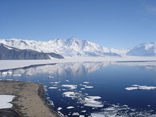
The Admiralty Mountains is a large group of high mountains and individually named ranges and ridges in northeastern Victoria Land, Antarctica. This mountain group is bounded by the Ross Sea, the Southern Ocean, and by the Dennistoun, Ebbe, and Tucker glaciers. The mountain range is situated on the Pennell Coast, a portion of Antarctica lying between Cape Williams and Cape Adare.

Monte Rosa is a mountain massif in the eastern part of the Pennine Alps. It is between Italy's and Switzerland's (Valais). Monte Rosa is the second highest mountain in the Alps and western Europe, after Mont Blanc.

An ice field is a mass of interconnected valley glaciers on a mountain mass with protruding rock ridges or summits. They are often found in the colder climates and higher altitudes of the world where there is sufficient precipitation for them to form. The higher peaks of the underlying mountain rock that protrude through the icefields are known as nunataks. Ice fields are larger than alpine glaciers, but smaller than ice caps and ice sheets. The topography of ice fields is determined by the shape of the surrounding landforms, while ice caps have their own forms overriding underlying shapes.

The Lewis Range is a mountain range located in the Rocky Mountains of northern Montana, United States and extreme southern Alberta, Canada. It was formed as a result of the Lewis Overthrust, a geologic thrust fault resulted in the overlying of younger Cretaceous rocks by older Proterozoic rocks. The range is located within Waterton Lakes National Park in Alberta, Canada and Glacier National Park and the Bob Marshall Wilderness Complex in Montana, United States. The highest peak is Mount Cleveland at 10,466 ft (3,190 m).

The retreat of glaciers since 1850 affects the availability of fresh water for irrigation and domestic use, mountain recreation, animals and plants that depend on glacier-melt, and, in the longer term, the level of the oceans. Deglaciation occurs naturally at the end of ice ages, but glaciologists find the current glacier retreat is accelerated by the measured increase of atmospheric greenhouse gases—an effect of climate change. Mid-latitude mountain ranges such as the Himalayas, Rockies, Alps, Cascades, and the southern Andes, as well as isolated tropical summits such as Mount Kilimanjaro in Africa, are showing some of the largest proportionate glacial losses. Excluding peripheral glaciers of ice sheets, total global glacial losses were likely 5500 gigatons over 1993–2018.

Snow Dome is a mountain located on the Continental Divide in the Columbia Icefield, where the boundary of Banff National Park and Jasper National Park meets the border of Alberta and British Columbia in Canada. The summit's elevation is 3,456 m (11,339 ft).

Mount Wilson is the highest summit of the San Miguel Mountains range of the Rocky Mountains of North America. The prominent 14,252-foot (4,344 m) fourteener is located in the Lizard Head Wilderness of San Juan National Forest, 10.6 miles (17.1 km) north by east of the Town of Rico in Dolores County, Colorado, United States. Mount Wilson should not to be confused with the lower Wilson Peak nearby.

The Waputik Icefield is located on the Continental divide in the Canadian Rocky Mountains, in the provinces of British Columbia and Alberta. It is developed on the heights of the Waputik Range in the Central Main Ranges.

The Cathedral Group is the group of the tallest mountains of the Teton Range, all of which are located in Grand Teton National Park in the U.S. state of Wyoming. The Cathedral Group are classic alpine peaks, with pyramidal shapes caused by glacial motion. The highest peak in the group is Grand Teton, which rises more than 7,000 feet (2,100 m) above Jackson Hole valley, and is the second tallest mountain in Wyoming, after Gannett Peak. The Cathedral Group is separated by other tall peaks of the range by the Cascade Canyon to the north and Avalanche Canyon to the south.

The Ha-Iltzuk Icefield is an icefield in the central Pacific Ranges of the Coast Mountains in British Columbia, Canada. It is the largest icefield in the Coast Mountains south of the Alaska Panhandle, with an area of 3,610 km2 (1,390 sq mi). It is located on the west side of the Klinaklini River and the Waddington Range. The highest summit in the icefield is Mount Silverthrone, which is a mountain on the northeast edge of a circular, 20 km (12 mi) wide, deeply dissected caldera complex called the Silverthrone Caldera.

The Garfield Range is a mountain range on Ellesmere Island, Nunavut, Canada. The mountains are made of Paleozoic rocks and rise to heights between 1,067 m (3,501 ft) and 1,433 m (4,701 ft) and are separated by valleys through which flow the major rivers fed by the ice fields and glaciers. Like most of the mountain ranges in the Arctic, it is one of the world's northernmost mountain ranges.
Asperity Mountain is a mountain located in British Columbia, Canada, rising to 3,716 metres (12,192 ft). It is located between Tellot and Tiedemann Glaciers on the north and south respectively, in the Waddington Range, a subrange of the Pacific Ranges. The gorge of the Homathko River runs north to south on the east side of the mountain, carrying runoff from the mountain and glaciers to the Pacific Ocean.
An alpentor in geology is the point where an entire glacier forced its way through to the Alpine Foreland from the Alps during the ice age.
