Related Research Articles

Thornbury is a small village and civil parish in the local government district of Torridge, Devon, England. The parish, which lies about five miles (8 km) north-east of the town of Holsworthy, comprises the five hamlets of Thornbury, Woodacott, Brendon, Lashbrook and South Wonford. These five hamlets are spread over an area of some 6 square miles (16 km2), with a distance of three miles (5 km) from Brendon to Thornbury Church. Hence, the community is quite widespread, with the only focal point being the Green at Woodacott Cross. The parish is surrounded clockwise from the north by the parishes of Milton Damerel, Bradford, Cookbury and Holsworthy Hamlets. In 2011, its population was 290, in 120 households, little changed from the 291 residents it had in 1901.

Belstone is a small village and civil parish in the West Devon District of Devon, England. Lying on the northern side of Dartmoor, the western boundary of the parish is mostly formed by the East Okement River and the eastern by the River Taw; its highest point is Belstone Tor in the south, at 1,508 feet. The parish is surrounded, clockwise from the north, by the parishes of Sticklepath, South Tawton, Dartmoor Forest and Okehampton Hamlets. In 2001 its population was 257, relatively unchanged from the 1901 figure of 236.

Mawnan is a village and civil parish in south Cornwall, England, United Kingdom. It is in the former administrative district of Kerrier and is bounded to the south by the Helford River, to the east by the sea, and to the west by Constantine parish. The population was 1,454 in the 2001 census, rising slightly to 1,476 at the 2011 census. The church town of the parish is Mawnan Church, also known simply as Mawnan, and the only large village in the parish is Mawnan Smith, approximately three miles south of Falmouth.

Mylor is a civil parish in Cornwall, England, United Kingdom. It is situated approximately five miles north of Falmouth.

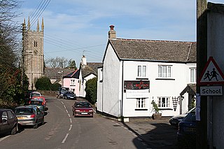
Coffinswell is a small village in South Devon, England, just off the A380, the busy Newton Abbot to Torquay road. It lies within Teignbridge District Council.
Exbourne is a village and civil parish in the English county of Devon. The Anglo-Saxon origin of the name is gæces burn - Cuckoo Stream. It occupies a hillside location between the River Okement and the Hole Brook, about 5 miles north of Okehampton in West Devon, and height above sea level ranges between 280 Ft. and 484 Ft. It lies in a primarily agricultural location and the local parish council represents both Exbourne and nearby Jacobstowe. The population of the ward which represents Exbourne and all surrounding villages was 1,695 at the 2011 census.

Lanteglos is a coastal civil parish in south Cornwall, England, United Kingdom. It is on the east side of the tidal estuary of the River Fowey which separates it from the town and civil parish of Fowey. The South West Coast Path runs along the southern coasts of the parish and much of the southern part of the parish lies in the Polruan to Polperro Site of Special Scientific Interest managed by the National Trust.

Throwleigh is a village and civil parish located 3 miles from Chagford and 6 miles from Okehampton, in the West Devon district, in the county of Devon, England. The parish incorporates the village of Throwleigh and the hamlets of Wonson, Providence, and Murchington, whose combined population is approximately 350.

Chilsworthy is the name of two villages in south west England. One is on the Cornish side of the River Tamar, just upstream from Gunnislake (50°31′39″N4°14′16″W). The other is about 3 km north west of Holsworthy in Devon (50°49′54″N4°22′31″W), in the civil parish of Holsworthy Hamlets; it is home to a late-19th century Methodist chapel.

Gulworthy is a hamlet and civil parish in Devon, England that adjoins the border with Cornwall. There are a group of buildings by the road junction Gulworthy Cross which constitute the centre of the parish. These are Gulworthy School, St Paul's Church and the Parish Hall. In 2011 the parish had a population of 518. However it is part of the electoral ward of Tamarside, the population of Tamarside at the 2011 census was 1,622.

Clawton is a village and civil parish in the far west of Devon, England. It forms part of the local government district of Torridge. The village lies about three miles south of the town of Holsworthy on the A388 road. The parish is surrounded clockwise from the north-west by the parishes of Pyworthy, Holsworthy Hamlets, Ashwater, and Tetcott. Its western border follows the River Tamar which forms the county boundary with Cornwall. In 2001 its population was 326, slightly down from 389 in 1901.

St Giles on the Heath, sometimes hyphenated as St Giles-on-the-Heath, is a village and civil parish in the far west of Devon, England. It forms part of the local government district of Torridge. The village is in the east of the parish and lies on the A388 road about eight miles south of the town of Holsworthy.

Hollacombe is a village and small civil parish in the local government district of Torridge, Devon, England. It lies about 3 miles south east of the town of Holsworthy and is surrounded clockwise from the north by the parishes of Cookbury, Ashwater, and Holsworthy Hamlets. In 2001 its population was 59, compared to 69 in 1901.

Pancrasweek is a civil parish and hamlet in the far west of Devon, England forming part of the local government district of Torridge and lying about three miles north west of the town of Holsworthy.

Sutcombe is a village and civil parish in the local government district of Torridge, Devon, England. The parish, which lies about 5.5 miles north of the town of Holsworthy, is surrounded clockwise from the north by the parishes of West Putford, Abbots Bickington, Milton Damerel, Holsworthy Hamlets and Bradworthy. In 2001 its population was 299, compared to 351 in 1901.

Ringmore is a village and a civil parish located on the coast of Devon, England.The population taken at the 2011 census was 208.

Chivelstone is a village and civil parish in Devon, England. The parish contains the villages of East Prawle and South Allington as well as the hamlets of Ford and Lannacombe. The population of the parish taken at the 2011 census was 280.

Knave-Go-By is a village located on the outskirts of Camborne in the English county of Cornwall in the South West region of the United Kingdom. It is in the TR14 postcode area.

East Worlington is a civil parish and hamlet in the North Devon administrative area, in the English county of Devon, England.

Germansweek is a village and civil parish in the West Devon district, to the west of Okehampton in the county of Devon, England.
References
- ↑ "Eworthy, West Devon - area information, map, walks and more". OS GetOutside. Retrieved 12 October 2017.
- ↑ "Location Map". Streetmap. Retrieved 12 October 2017.
- ↑ West Devon Methodist Church | powered by Church. "West Devon Methodist Church - Madworthy & Eworthy". www.westdevonmethodists.org.uk. Retrieved 12 October 2017.
Coordinates: 50°44′01″N4°12′05″W / 50.73361°N 4.20139°W
| | This Devon location article is a stub. You can help Wikipedia by expanding it. |