| Exuma Sound | |
|---|---|
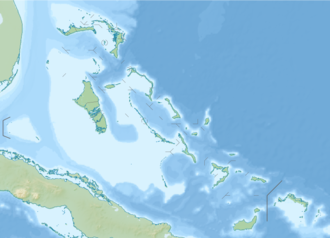 Exuma Sound  Exuma Sound | |
| Coordinates | 24°15′00″N76°00′00″W / 24.25000°N 76.00000°W |
| Primary inflows | Atlantic Ocean |
| Basin countries | |
| Max. depth | 6,699 ft (2,042 m) |
Exuma Sound is a body of water in the Bahama Islands. [1] [2] It lies southeast of New Providence Island and Eleuthera Island and west of Cat Island. [2]
The first ever landing of a rocket in a different country than it was launched from occurred on February 18th, 2025, when a SpaceX Falcon 9 launched from Space Launch Complex 40 (SLC-40) at Cape Canaveral Space Force Station in Florida landed on a drone ship in Exuma Sound as a part of the Starlink 10-12 mission. [3] [4]