
Worcestershire is a ceremonial county in the West Midlands of England. It is bordered by Shropshire, Staffordshire, and the West Midlands county to the north, Warwickshire to the east, Gloucestershire to the south, and Herefordshire to the west. The city of Worcester is the largest settlement and the county town.

Bromsgrove is a town in Worcestershire, England, about 16 miles (26 km) north-east of Worcester and 13 miles (21 km) south-west of Birmingham city centre. It had a population of 34,755 in at the 2021 census. It gives its name to the wider Bromsgrove District, of which it is the largest town and administrative centre. In the Middle Ages, it was a small market town, primarily producing cloth through the early modern period. In the eighteenth and nineteenth centuries, it became a major centre for nail making.

Bromsgrove is a local government district in north-east Worcestershire, England. It is named after its only town, Bromsgrove, where its council is based, but also includes several villages and surrounding rural areas. It borders the built-up area of Birmingham to the north. Other places in the district include Alvechurch, Aston Fields, Belbroughton, Catshill, Clent, Hagley, Rubery, Stoke Prior and Wythall. The population at the 2021 census was 99,475.

Northfield is a residential area in outer south Birmingham, England, and near the boundary with Worcestershire, which it was historically within. It is also a council constituency, managed by its own district committee. The constituency includes the wards of Kings Norton, Longbridge, Weoley Castle and the smaller ward of Northfield that includes West Heath and Turves Green.

Leek Wootton is a village and former civil parish, now in the parish of Leek Wootton and Guy's Cliffe, in the Warwick district, in the county of Warwickshire, England, approximately 2 miles south of Kenilworth and 2.5 miles north of Warwick. It lies in the triangle created by Kenilworth, Warwick and Leamington Spa. In 1961 the parish had a population of 671.

Whitwell is a village in Derbyshire, England. The population of the civil parish taken at the 2011 Census was 3,900.

Bromsgrove is a constituency in Worcestershire represented in the House of Commons of the UK Parliament since 2010 by Sajid Javid of the Conservative Party. Javid formerly served as Chancellor of the Exchequer, Home Secretary and Health Secretary.

Adwick le Street is a village in the City of Doncaster, South Yorkshire, England. The Adwick ward of Doncaster Metropolitan Borough Council had a population of 15,911 at the 2011 Census. It is situated north-west of Doncaster. Under the 2011 census, the settlement had a population of 10,507.
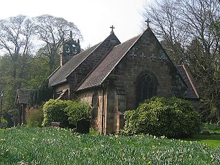
Cofton Hackett is a village and civil parish in the Bromsgrove District of north east Worcestershire, England. It is 10+1⁄4 miles southwest of the city centre of Birmingham and 16 miles (26 km) northeast of Worcester. In 2011, the village had a population of 1,893 but with housing development on the former Austin Rover site, this is expected to double over the five years to 2023. The village is served by two main bus services, these being the 20 and 145/145A operated by National Express and Diamond Bus respectively.

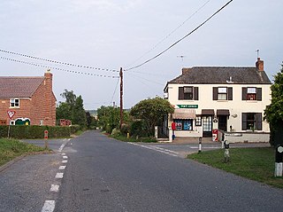
Wychbold is a village in the Wychavon district of Worcestershire. The village is situated on the A38 between Droitwich Spa and Bromsgrove, and by Junction 5 of the M5 motorway.
Chaddesley Corbett is a village and civil parish in the Wyre Forest District of Worcestershire, England. The Anglican and secular versions of the parish include other named neighbourhoods, once farmsteads or milling places: Bluntington, Brockencote, Mustow Green, Cakebole, Outwood, Harvington, and Drayton.

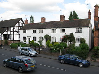
Belbroughton is a village and civil parish in the Bromsgrove District of Worcestershire, England. According to the 2021 census it had a population of 2,685. It is about six miles north of Bromsgrove, six miles east of Kidderminster and four miles south of Stourbridge. The village of Clent is nearby. The village is served by bus service 318 (Bromsgrove-Stourbridge) operared by Kev's Cars and Coaches.
Bromsberrow is part of the Forest of Dean district. The village is close to the meeting point between Gloucestershire, Herefordshire, and Worcestershire. The nearest town is Ledbury, about four miles north in Herefordshire.

Knowsley is a large village and civil parish in the Metropolitan Borough of Knowsley, Merseyside, England, commonly known as Knowsley Village.

Redmarley D'Abitot is a civil parish and village in the Forest of Dean district, Gloucestershire, South West England. In addition to the village of Redmarley, the civil parish also includes the settlements of Lowbands, Haw Cross, Playley Green, Kings Green and Durbridge. At the 2001 census the parish had a population of 705, increasing to 756 at the 2011 census.

The A491 is an A road in Zone 4 of the Great Britain numbering scheme.
Devauden is a village and community in Monmouthshire, southeast Wales. It is located between Chepstow and Monmouth near the top of the Trellech ridge on the B4293 road. The community covers an area of 3,790 hectares (14.6 sq mi), and includes the villages of Itton and Wolvesnewton, Llanfihangel-tor-y-mynydd and Newchurch.

Ripple is a village and civil parish in the county of Worcestershire, England. Ripple is one of the most southerly parishes in the county and is situated on the A38 road with the River Severn as its western boundary. Besides Ripple, the parish contains the settlements of Holly Green, The Grove, Naunton, Ryall, Saxon's Lode, and Uckinghall. It had a combined population of 1,799 at the 2011 census.

